

Strong storms get an earlier start Tuesday

Weather Forecast: June 23, 2020
FOX 35 meteorologist Kristin Giannas has your Central Florida forecast.
ORLANDO, Fla. - Damaging wind gusts, torrential downpours, and frequent lightning are likely on Tuesday, as strong storms get an earlier start.
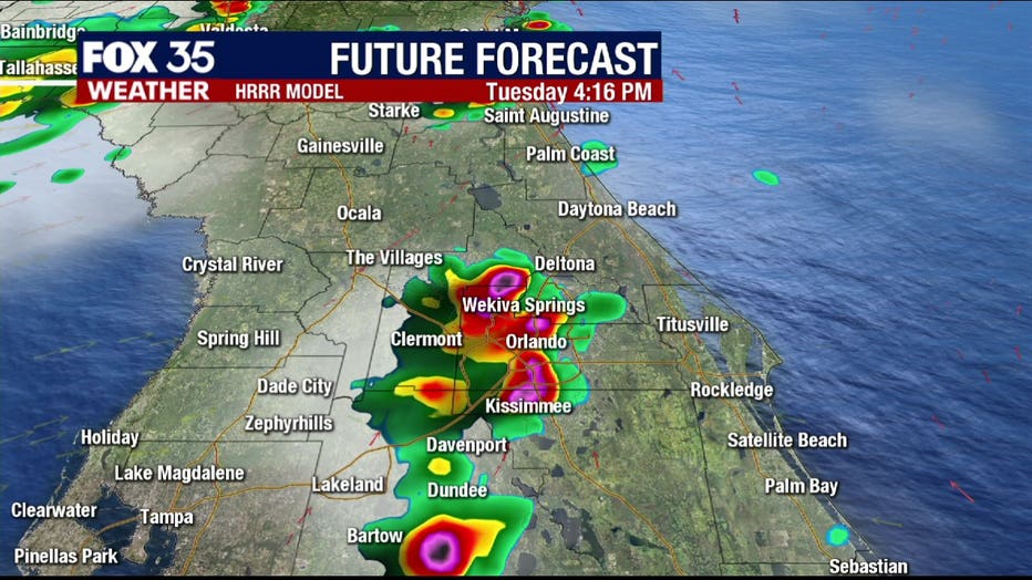
Expect scattered showers and lightning storms to develop across the interior, mainly after 2:00 p.m.
The storms will push to the south and east of the I-4 corridor by early evening.
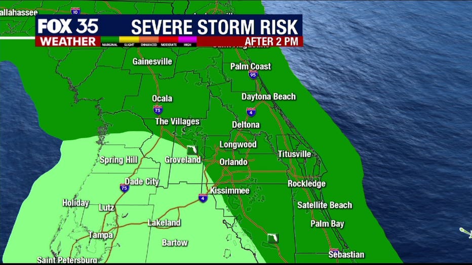
The Storm Prediction Center has put North and East Central Florida under a "marginal risk" for severe thunderstorms.
Afternoon highs will reach the low-to-mid 90s, with winds out of the southwest at 5-10 mph.
Tonight, temperatures will fall to the low-and-mid 70s, with a 20% chance for lingering showers and storms after sunset.
Be sure to have the FOX 35 Weather App downloaded and ready to receive breaking weather alerts to keep you and your family safe during the storms.