

Steamy temperatures continue with rain likely this weekend

Weather Forecast: May 26, 2021
FOX 35 Storm Team Meteorologist Allison Gargaro has the latest on the weather in Central Florida.
Orlando, FL - Well, what's new? Not much when it comes to Florida weather!
Might this be changing over the coming days though? Fingers are crossed for some beneficial rainfall that could arrive by this weekend, but in the meantime, it's really hot and very dry!
The latest satellite scans reveal only a slight increase in moisture locally into Wednesday evening but not enough to produce even a sprinkle.
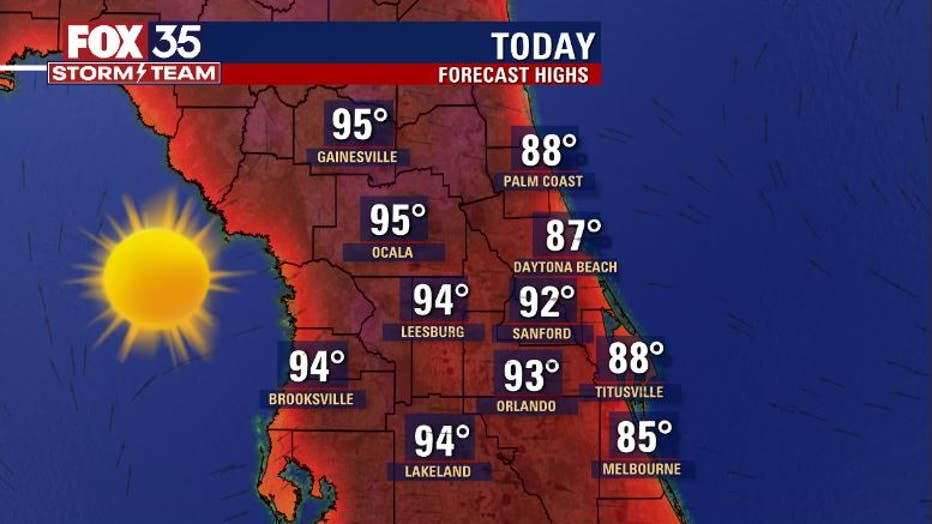
High temps on Wednesday will trend very warm especially as you move inland away from the coastal counties and the Atlantic Ocean.
WEATHER ALERTS: Download the FOX 35 Storm Team Weather app for live radar, severe weather alerts, and daily forecast reports on your phone
You can expect a beautiful, mostly dry day on Thursday with highs once again heading for the 80s and 90s. The hottest temperatures will be found out in Marion, and Alachua counties. The seabreeze storms will start to kick up soon.
It's a good idea to wear quality sunscreen to protect your skin and be sure to hydrate during the day. Sunshine will produce a UV INDEX FACTOR around 11 this afternoon, this is in the EXTREME range! Offshore winds are also creating turbulent surf.
As for the Memorial Day holiday weekend forecast and the potential for some beneficial rainfall, current forecast models are indicating an approaching front and a draw of moisture coming up out of the tropics.
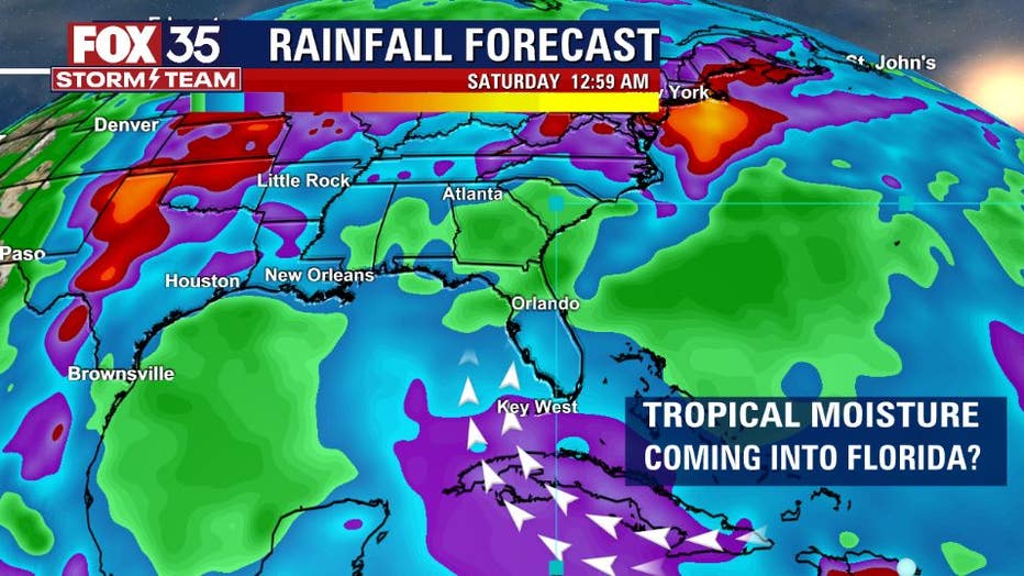
The front will drive rain chances first by Sunday. As the front dissolves on top of the state, Atlantic high pressure will transport moisture into Florida out of the Atlantic and Caribbean. This will set the stage for an increase in rain chances on Sunday at 40%, Monday and Tuesday chances are near 50%. Something to certainly keep an eye on as the rainy season lurks just around the corner.
Watch FOX 35 News for the latest weather updates.