Storms bring severe weather to parts of Central Florida, scattered showers and cooler temperatures to follow

Weather Report: April 15
FOX 35 meteorologist Jayme King gives you the latest on the weather in Central Florida.
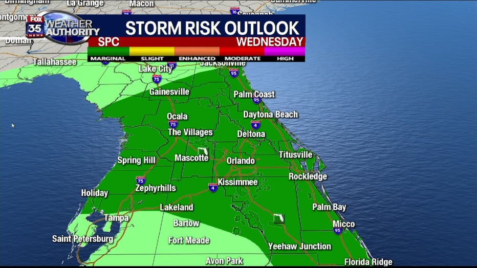
ORLANDO, Fla. - A storm system moving across the northern parts of Central Florida has brought a severe weather risk to the region, activating a FOX 35 Severe Weather Day.
Much of the more intense weather is centered around the Marion County area, specifically between Ocala to Belleview. Heavy rain is dumping down there, with lightning and thunderstorms possible.

The risk for any severe weather is expected to pass and simmer down as it moves south. The latter portion of the afternoon and the evening only have a 'marginal risk' for severe weather and by 10 p.m., much of this will have faded away. The main threats look to be damaging winds inside some of the stronger storms that could roll through, FOX 35 meteorologist Jayme King says. Other than that, expect scattered showers.
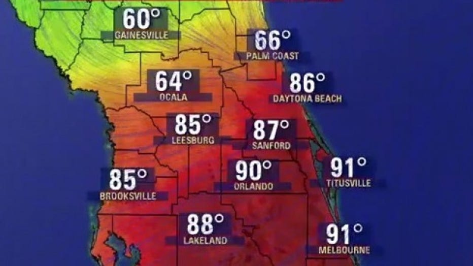
With the moving storms comes a cold front, bringing cooler temperatures to our area. You can already see the difference within Central Florida, as temperatures near Gainesville are in the 60s and temperatures near Orlando is in the 90s.
Thursday is expected to be a cooler, breezy day as the cold front moves through the state.