Orlando weather: How the Daytona 500 will be impacted by rain

Orlando Weather Forecast: February 17, 2024
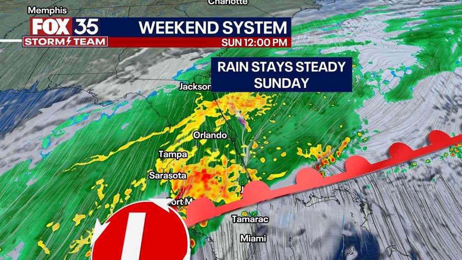
More widespread rain is expected Saturday night as rain continues and temperatures hold steady.
TODAY'S HIGH: 65
TONIGHT'S LOW: 56
PM UPDATE: Light rain/mist will continue into this evening and become even more widespread and heavy into tonight. Overnight will be plenty cool thanks to the rain and north winds in place. Lows will fall well into the 50s so it will be an uncomfortable start to Sunday.
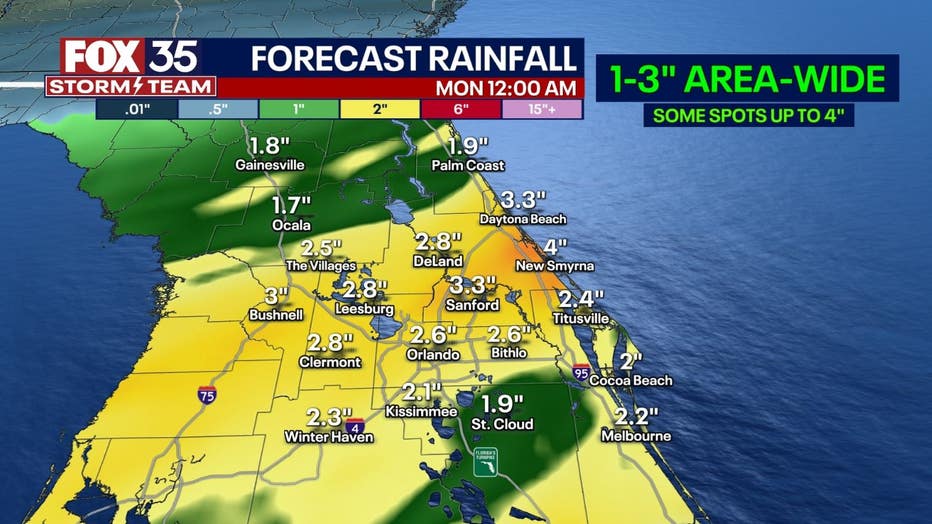
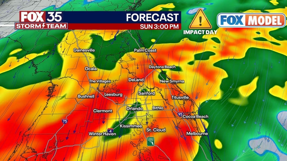
SUNDAY: No big changes expected for tomorrow with nearly a 100% of rain across the entirety of Central Florida. As the stalled front keeps to our south and a low pressure system passes by, rain will become moderate to heavy at times Sunday morning into the early afternoon. Winds will be breezy out of the north helping to keep highs in the upper 50s to low 60s again. Later into the day appears to be when rain will begin becoming light and more scattered again. By Sunday evening, drizzly weather will likely return.
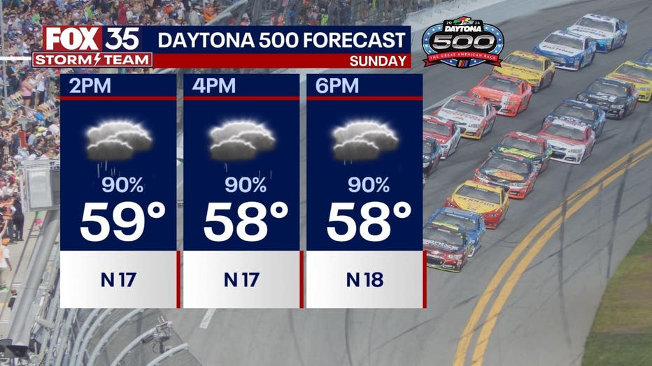
DAYTONA 500 FORECAST: No major changes for Sunday's forecast. It will be a very wet day with a significant delay at minimum expected for the race. Rain should become lighter and more scattered by Sunday evening (after 7 pm), but will it be dry enough for the race to happen? That remains iffy at best odds. Off and on showers may continue overnight into Monday morning, but should slowly depart by the afternoon. It seems more likely for NASCAR to take advantage of the better weather Monday, but we shall see. Either way, expect cool weather both days with a breezy north wind keeping temperatures near 60 at the warmest. Continue to check back with us for more updates this weekend!
LOOKING AHEAD: Behind the departing system, a cool north wind will keep highs in the upper 50s to low 60s on Monday with decreasing rain chances and clouds. The rest of the week will see improving weather with lots of sunshine and pleasant afternoons. Highs will return to the 70s by Wednesday with no rain in the forecast until Friday.