

Hurricane forecasters track 2 systems in tropical Atlantic

Meteorologist Allison Gargaro breaks down upcoming storms in Central Florida and activity in the tropics
FOX 35 Storm Team Meteorologist Allison Gargaro has your forecast.
ORLANDO, Fla. - All eyes are on the tropics this weekend as we track several low-pressure systems moving across the tropical Atlantic.
There are two areas in particular with a 40 percent chance for development within the next five days.
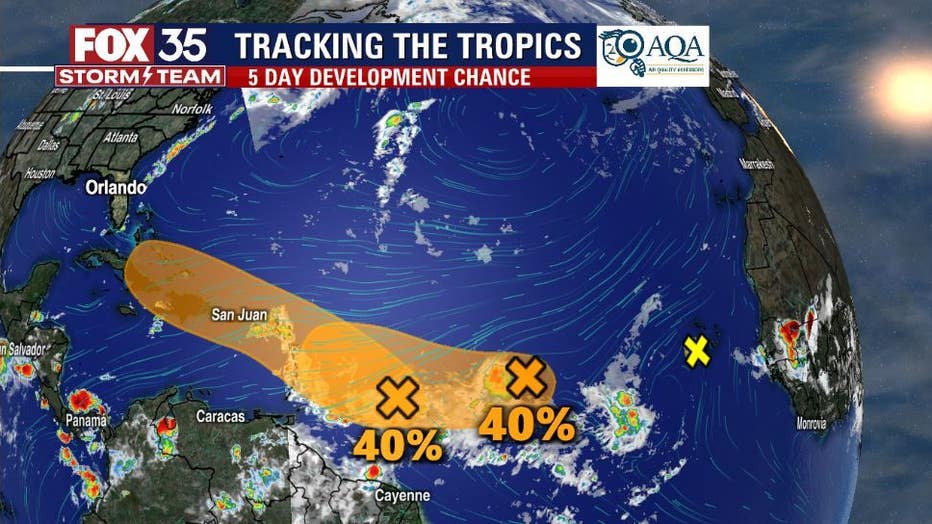
The system furthest west is entering favorable conditions for further development this week. The disturbance is forecast to reach the Lesser Antilles late Monday and then move across the eastern Caribbean Sea by the middle of the week.
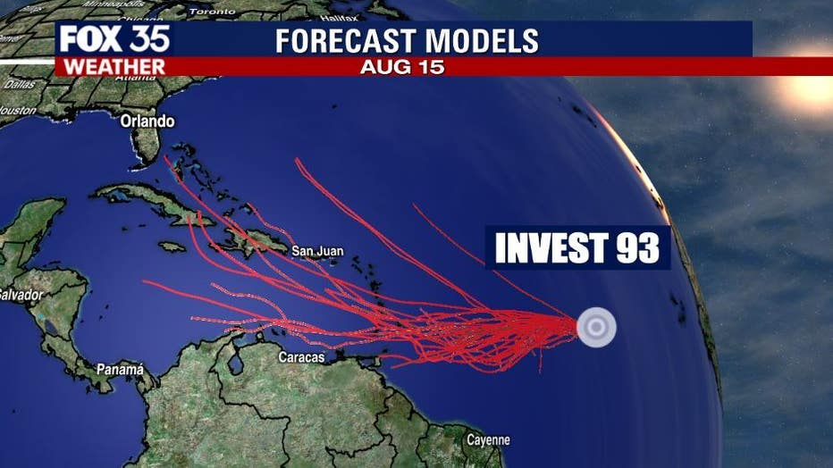
The second system we are watching in the middle tropical Atlantic is known as Invest 93L. Our futurecast models have this system slowly moving southwest over the next few days. The National Hurricane Center says environmental conditions will become favorable for gradual development, meaning this could become a tropical depression within a few days.
TRACK THE TROPICS: Visit the FOX 35 Storm Team Hurricane Center for the latest tropical weather outlook and more
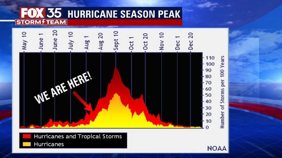
The peak of hurricane season is still a few weeks away, so you can expect even more storms to develop in the near future.
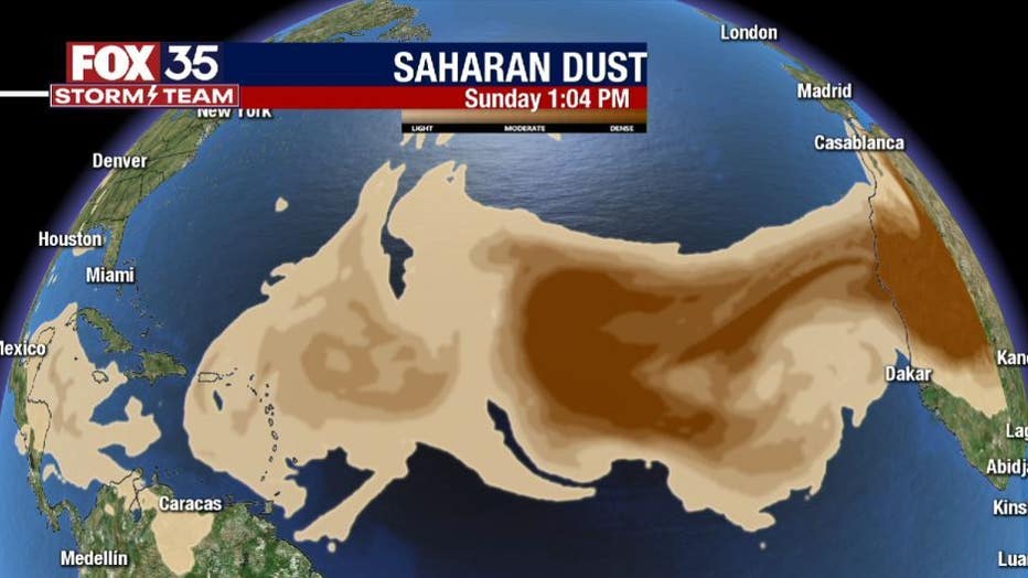
Saharan dust is still visible across the Atlantic this week, but the coverage is not as high as earlier in the summer.
Depend on the FOX35 Storm Team to bring you the latest updates on the tropics.