

FOX 35 Weather Impact Day: Heat advisories issued across Central Florida

Orlando AM Weather Forecast: July 19, 2025
The heat is on! Meteorologist T.J. Springer talks how hot it'll feel in Central Florida and has details on when we'll see more widespread rain returning to the region.
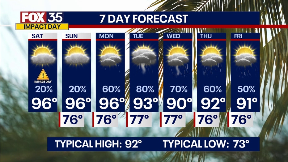
ORLANDO, Fla. - The heat is on once again and that is why the FOX 35 Storm Team has designated Saturday a Weather Impact Day.
What will the weather look like today?
What To Expect:
Advisories have been issued across Central Florida for extreme heat. Every county in the FOX 35/FOX 51 viewing area will be impacted.
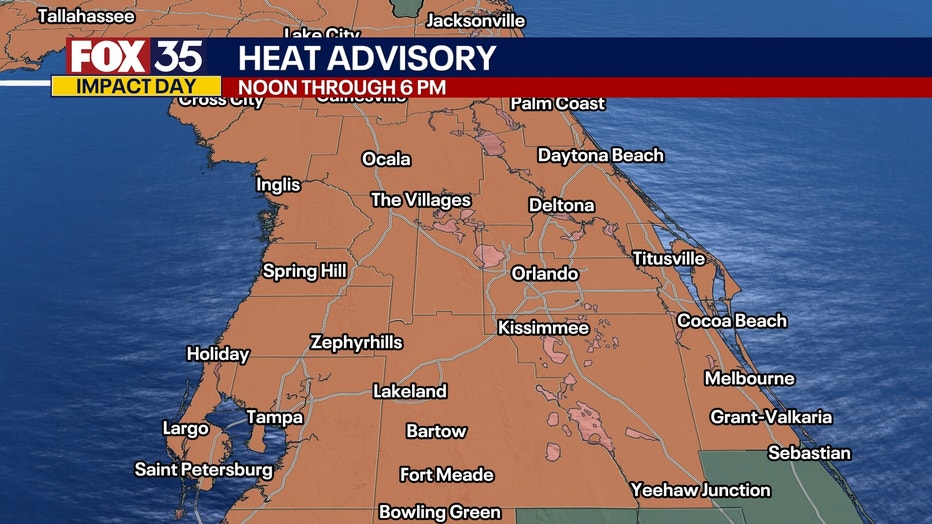
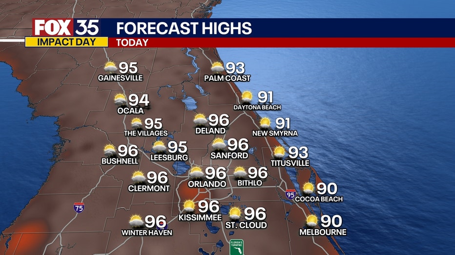
Highs look to top out in the mid-90s. The heat and humidity combo will be a tough one to combat, especially if you have outdoor plans. Stay hydrated and try not to overexert yourself this afternoon. A ridge of high pressure is in control and that's one of the big reasons why the heat is our big story.
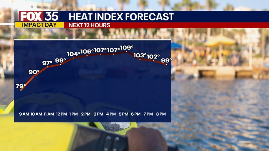
The higher dew points will make it feel close to 110 degrees, with the warmest part of the day peaking between 2 p.m. and 6 p.m.
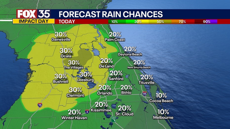
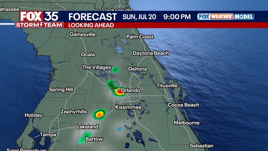
An isolated storm or two is possible as the sea breezes interact, but with this ridge overhead, it'll be hard to get too much to develop. Most of the activity will likely form over the western portions of our viewing areas and fade by the evening.
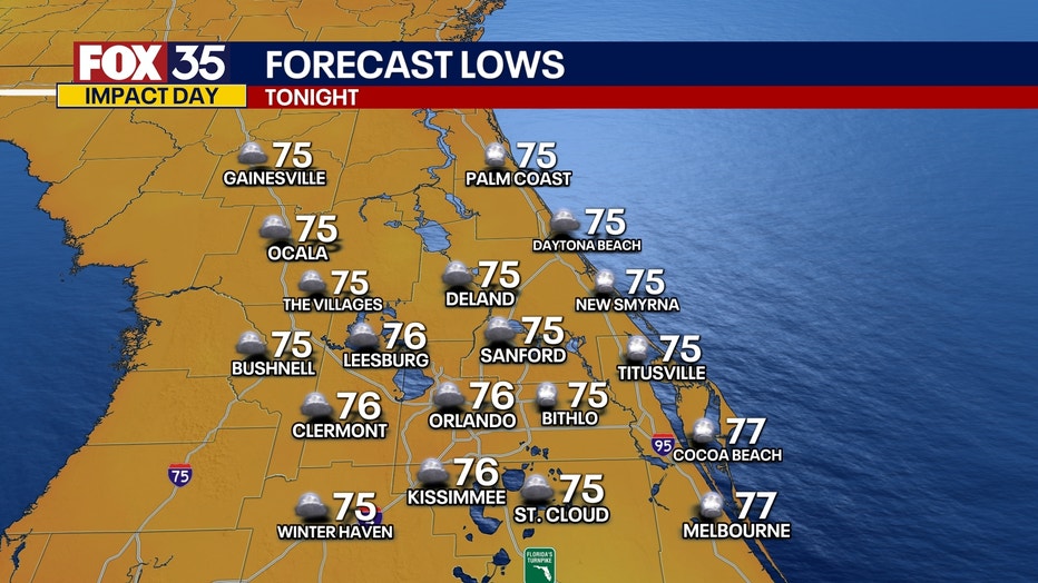
Overnight lows will dip back into the middle and upper 70s.
What will the weather look like on Sunday?
What To Expect:
We do it all over again on Sunday as highs rebound back into the mid-90s. Dew points in the middle to upper 70s will make it feel more like the upper 100s, which would likely mean we see another round of Heat Advisories issued.
This ridge will continue to dominate our weather pattern, keeping things mainly dry and steamy. A stray storm or two is possible during the heating of the day, but they'll fade away into the evening as we lose the daytime-driven instability.
We'll see partly cloudy conditions overnight with lows dipping back into the mid-70s for most locales.
Tracking the Tropics
Looking ahead:
The heat sticks around to kick off the workweek, but this area of high pressure starts to shift back to the west, allowing our weather pattern to become a little cooler and more unsettled. In fact, the same area of tropical moisture that used to be Invest-93L looks to round the ridge of move back toward Florida. Chances of showers and storms rise on Monday, but they still look to be scattered in nature.
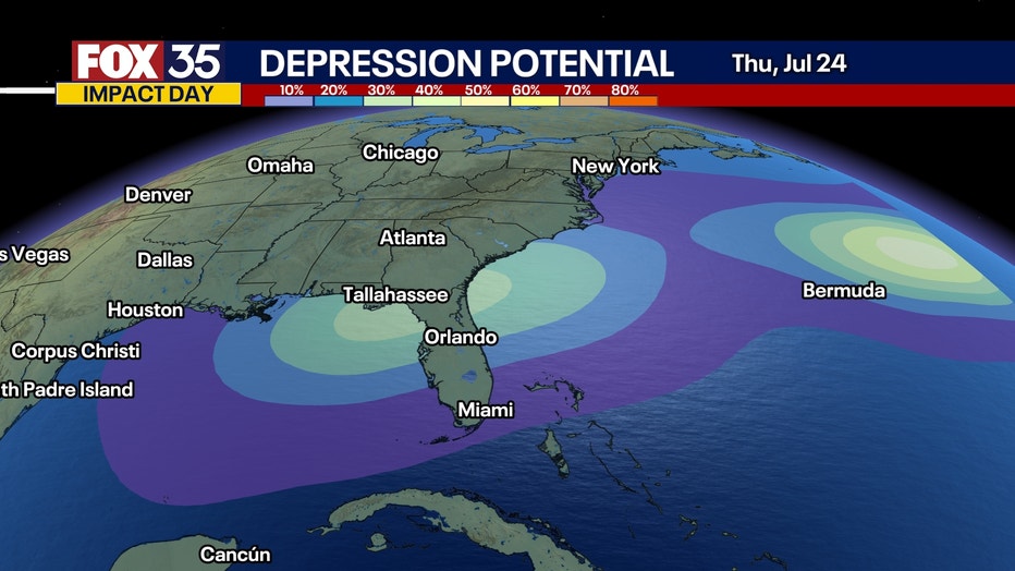
This area of low pressure then looks to bring more widespread rain to the region from Tuesday into midweek. With all the moisture in the air, flooding could be a concern, which is something we'll be watching closely.
Another thing we'll be monitoring is if this low could reorganize into a depression as it works closer to the Gulf. Rain chances stay elevated through the late week with afternoon readings a little cooler, topping out near 90.
We're also watching an area of showers and storms with a tropical wave in the Atlantic. This disturbance has a 20% chance of development over the next 7 days.
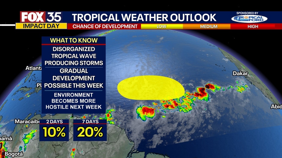
It looks likely to encounter a more hostile environment later next week that should limit any sort of major development. Stay tuned!
Orlando 7-Day Weather Forecast
FOX 35 Storm Tracker Radar and Live Weather Cameras
Track live when storms move across your area using the FOX 35 Storm Tracker Radar below. You can also watch as heavy rain moves across Central Florida on our Live Weather Cameras' page here.

More radar maps from FOX 35 Storm Tracker Radar
- Brevard County
- Flagler County
- Lake County
- Marion County
- Osceola County
- Orange County
- Polk County
- Seminole County
- Sumter County
- Volusia County
- U.S./National Radar
The Source: This story was written based off information shared by the FOX 35 Storm Team on July 19, 2025.