

Ending April with a bang; more storms on the way
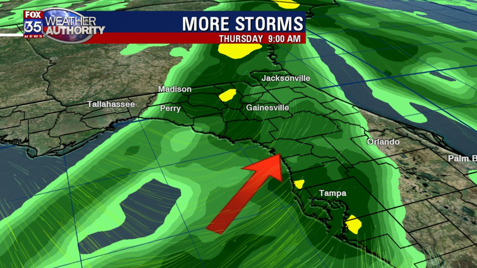
ORLANDO, Fla. - It will be a stormy end to the month of April, with showers and storms moving over Central Florida on Thursday.
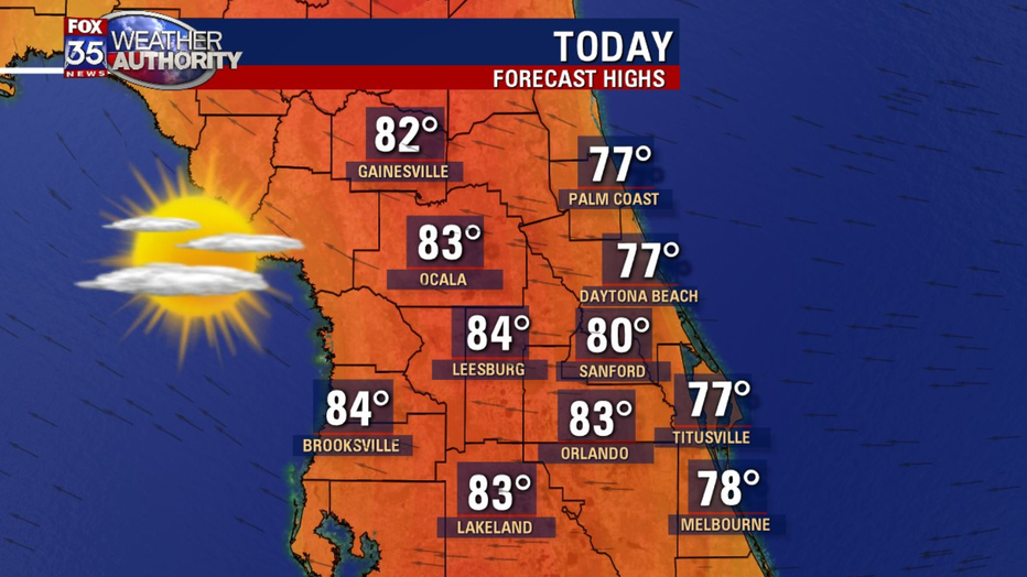
Until then, expect mostly sunny skies and dry conditions.
After a cool start on Tuesday, temperatures will climb to the low 80s inland, with solid upper-70s along the coast.
As high pressure moves over the state and towards the Atlantic Ocean, winds will become easterly.
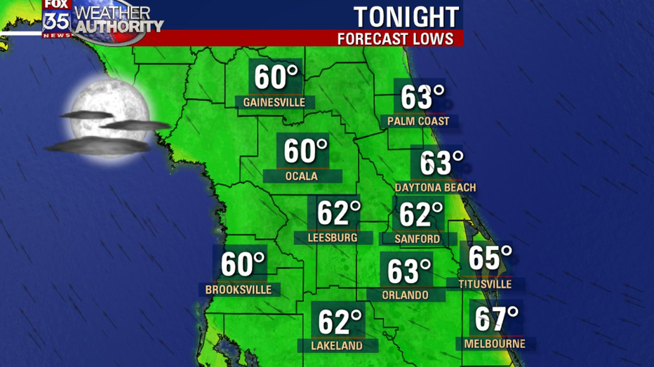
The heat and humidity will be on the rise Wednesday, with more of a southerly component to our winds.
A fast-moving cold front will slide over the panhandle on Wednesday, making it to Orlando by Thursday morning, according to the latest model guidance.
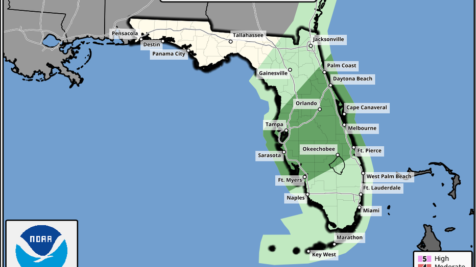
The Storm Prediction Center has Central Florida under a marginal risk of severe thunderstorms.
Moderate instability and a moist atmosphere may increase intensity of storms by mid-morning/early afternoon.
Isolated strong/gusty winds are the main threat, with storms weakening and moving offshore by Thursday night.
Be sure to have the FOX 35 Weather App downloaded to be the first to know when storms are headed for your area.