

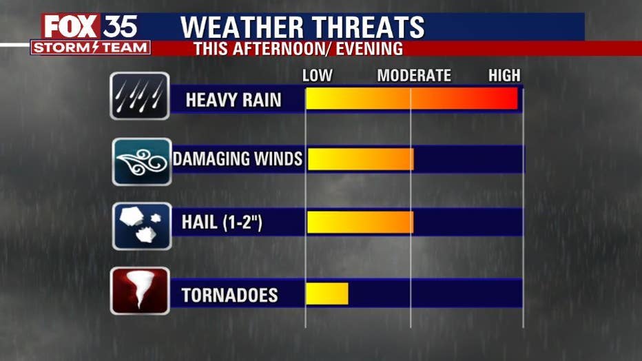
Damaging winds, hail, heavy rain and flooding "likely" this afternoon

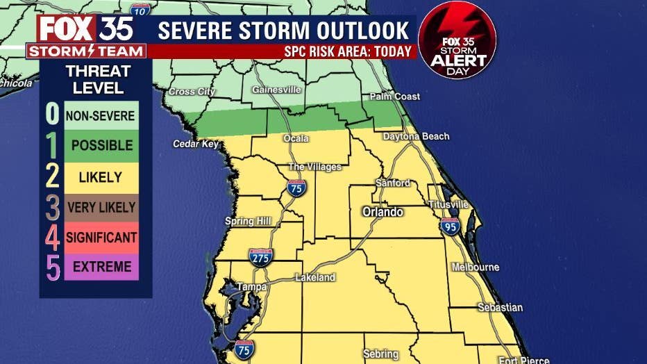
Storm Alert Day for Saturday
FOX 35 Storm Team Meteorologist Allison Gargaro on Storm Alert Day that has been declared for Saturday afternoon and evening.
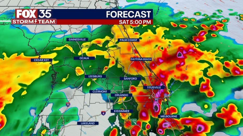
ORLANDO, Fla. - Today is a FOX 35 Storm Alert Day. Strong to severe storms are likely across east central Florida this afternoon and evening.
DOWNLOAD: FOX 35 NEWS APP | FOX 35 STORM TEAM WEATHER APP
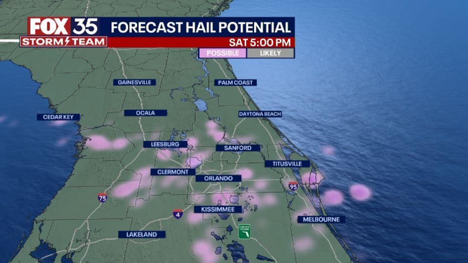
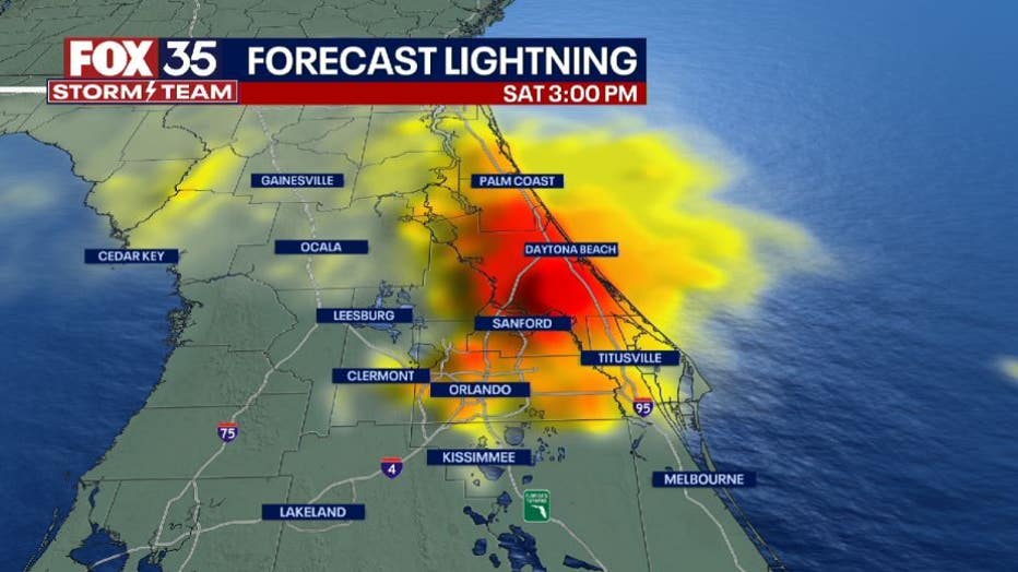
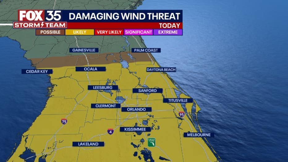
There is a "Likely" (2/5) risk for damaging wind gusts 55+ mph, 1-2" hail, heavy rain, flooding, frequent lighting and isolated tornadoes.
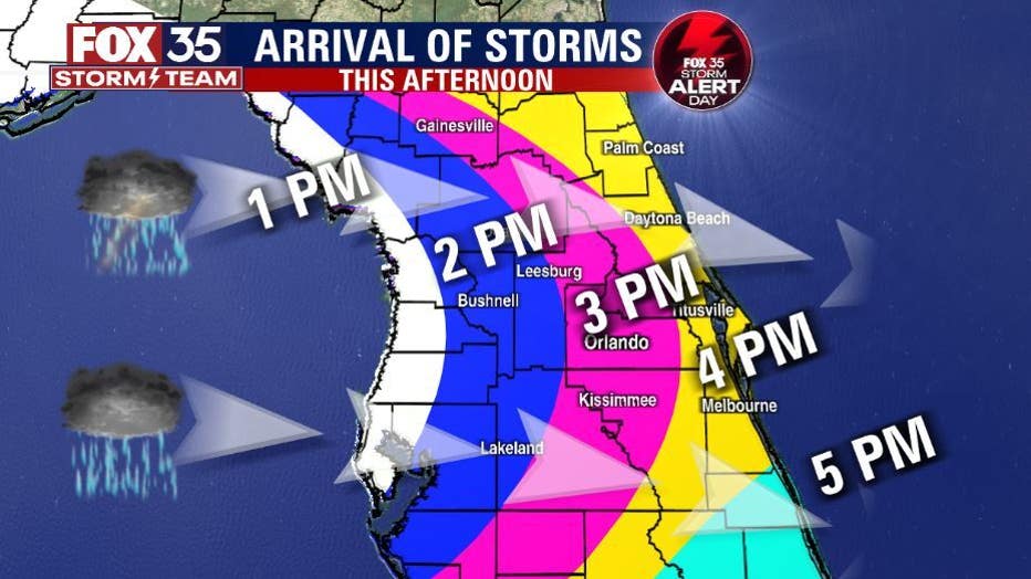
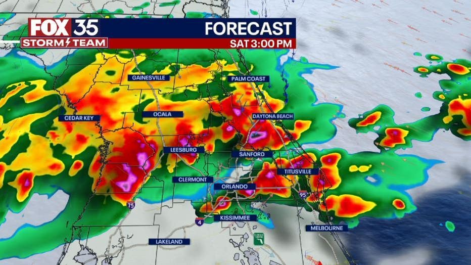
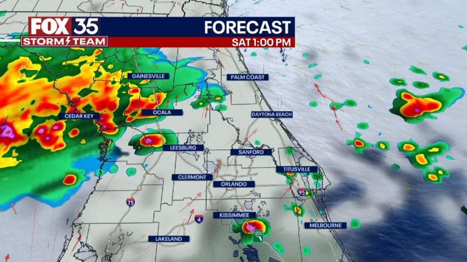
The storms will move into the west side of the Florida peninsula just after noon, then arrive in Lake and Volusia Counties by 3 p.m. and into Orange, Seminole, Brevard, Osceola and Volusia Counties by 5 p.m. As the departing storm energy pushes into the Atlantic by mid-evening, only a few showers will linger in it's wake with quiet skies overnight.
Depend on the FOX 35 STORM TEAM for updates and new information as it becomes available!
Don't forget to download the FOX 35 Storm Team weather app to use the interactive radar.
Orlando Weather: Storm alerts, live interactive radar, forecast, and more
Click here for the latest Central Florida news, Florida stories, and local headlines.