

Central Florida forecast: Severe storms possible midweek before things calm down

Weather Forecast: July 25, 2022
Orlando and Central Florida will see an active weather pattern over the next two days before things calm down. Storms will gusty winds and small hail are possible on Tuesday and Wednesday afternoons.
WHAT IS THE WEATHER FORECAST FOR TODAY AROUND ORLANDO?
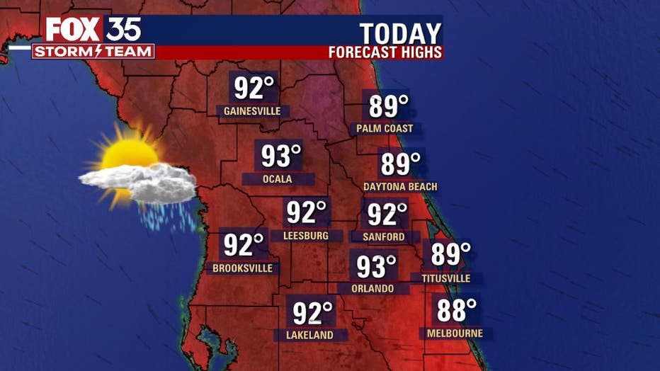
Today's forecast high: 93 degrees
Tonight's forecast low: 76 degrees
Main weather concerns:
The heat is on for what looks like a typical July day in Central Florida. Highs hit in the low-mid 90s inland, closer to 90 along the beaches. Rain chances remain around 30% along the coastal counties, higher as you head steadily inland. The highest rain chances will be found over the deep interior towards the Gulf of Mexico by the end of the day. Heavy rain and lightning remain the main threats.
WHAT IS THE WEATHER FORECAST FOR WALT DISNEY WORLD, UNIVERSAL, AND SEAWORLD?
Not much change at the theme parks for Tuesday. Trending hot and humid with a rise in showers and lightning storms mainly after 2 p.m.
WHAT IS THE WEATHER FORECAST FOR THE BEACHES IN CENTRAL FLORIDA?
If you've got beach plans, keep an eye to the sky for scattered showers and possibly a lightning storm or 2. Rain opportunities will present both AM and PM. While coverage looks low, there's still a chance!
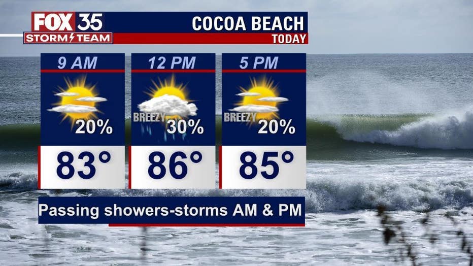
Skies will feature a sun-cloud blend, with a high hit near 90 degrees or so. Rip current threat remains moderate both during mid-morning and again during the late afternoon. Surf is in the 1-3' range as an increase in Southeast swell occurs
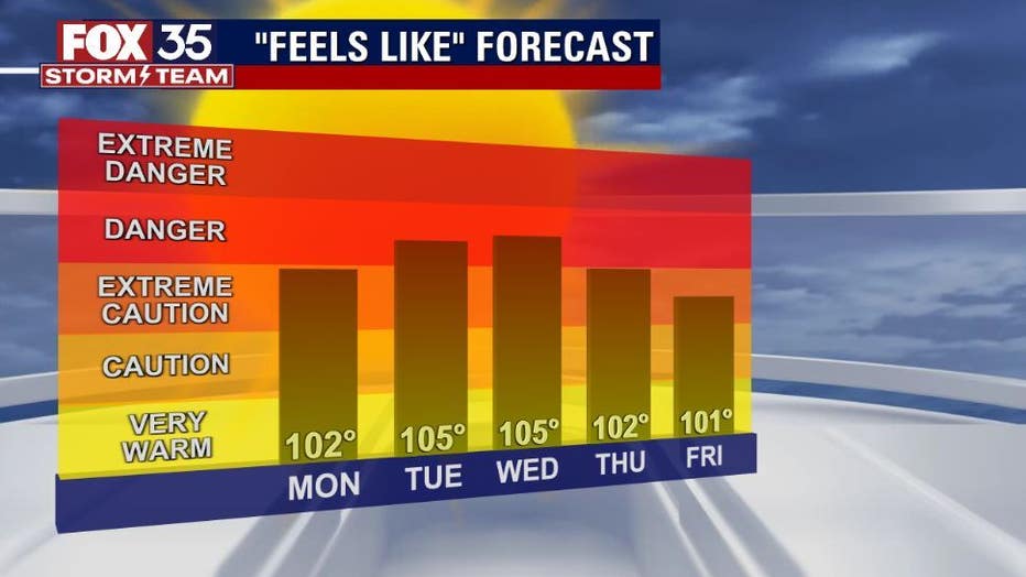
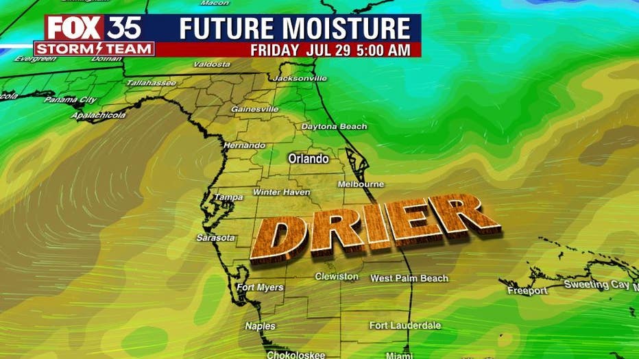
LOOKING AHEAD: Rain chances will peak this week on Tuesday and Wednesday. After that, drier air dominates heading into the weekend.
The tropics are still sleeping, and tropical storm formation is not expected for the next 5 days.