

Orlando storms possible from system that prompted tornado watches in Florida Panhandle

Weather Forecast: April 5, 2022
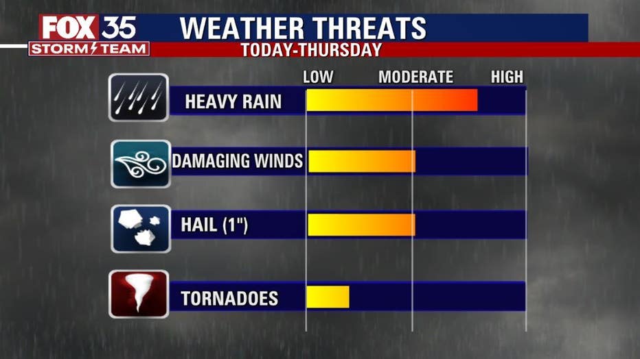
Severe weather for Orlando and Central Florida is a possibility on Wednesday and Thursday afternoons, which is why we have declared them FOX 35 Weather Impact Days. Rain chances are greater for Thursday as a cold front moves over the region.
ORLANDO, Fla. - Tuesday marks a 3-day run of FOX 35 Weather Impact Days.
Central Florida remains in a "LEVEL-1 POSSIBLE" risk mode for severe weather on Tuesday afternoon and early evening with an emphasis on strong storm formation closer to Interstate 95 and the Atlantic beachfront communities. There are NO SEVERE WEATHER WATCHES IN EFFECT for our area currently.
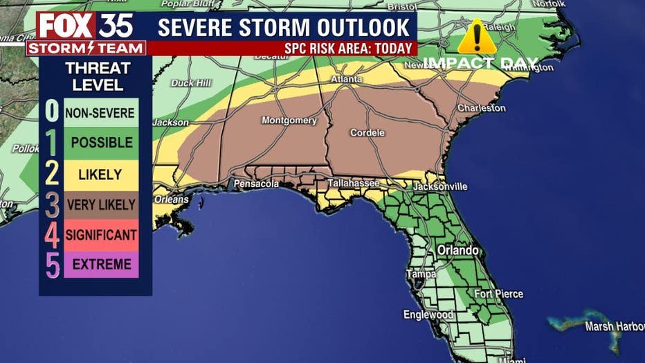
In Central Florida, the most active areas through Wednesday will be closer to the coastal counties and the I-95 corridor. On Thursday, the storm risk spreads out across the Peninsula as a cold front will finally drive south through Central Florida.
DOWNLOAD: FOX 35 NEWS APP | FOX 35 STORM TEAM WEATHER APP
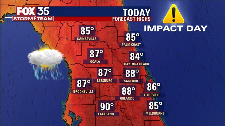
HIGH IN ORLANDO
It will be hot and steamy across Central Florida with highs in the upper 80s to around 90-degrees. A high of 88 is expected in Orlando.
WILL IT RAIN AT THE DISNEY OR UNIVERSAL TODAY?
The highest storm risk is after 12 p.m. on Tuesday. By 5 p.m., there's a 40% risk of storms in the theme park area.
WHEN WILL IT BE COLD IN ORLANDO?
Temperatures will drop into the 50s this weekend in Central Florida. Saturday wake-up temps will be around 55 and Sunday will be even colder at 50-degrees.
Stay with the FOX 35 STORM TEAM for the very latest as we're always watching, always tracking.