

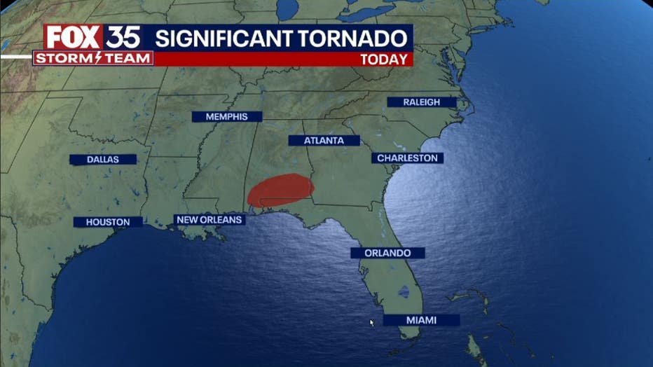
Severe storms with 'significant' tornadoes possible in Florida Panhandle
ORLANDO, Fla. - The FOX 35 Storm Team is tracking some pretty mean weather across the southern states on Friday.
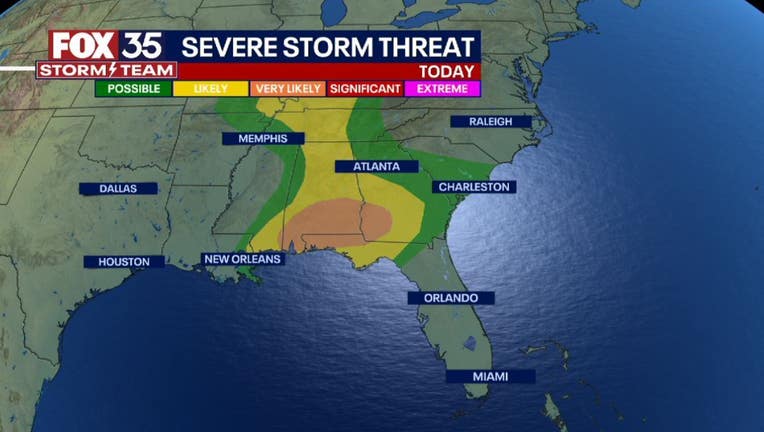
A slow moving cold front is combining forces with rising moisture levels and lots of energy. This means the risk of severe weather will be rising for the first part of the coming weekend. Today's risk resides over the Gulf South, from southern Alabama, the western Panhandle of Florida and Southwest Georgia. Damaging winds and the possibility of "significant tornadoes" appear to be the primary threats.
You can track the radar below:
A "significant tornado" ranges from an EF-2 to EF-5 on the Enhanced Fujita Scale. Torrential downpours and substantial lightning will also be in the mix. A Tornado Watch is also in effect until 3 p.m. for the areas of concern.
DOWNLOAD: FOX 35 NEWS APP | FOX 35 STORM TEAM WEATHER APP
Later tonight, storms will continue to move east across Georgia and portions of the Florida Panhandle/I-10 Corridor. On Saturday, a "LEVEL 2" or "LIKELY" risk of storms is forecast for the Florida-Georgia border and a "LEVEL 1" or "POSSIBLE" risk for areas South into north Florida.
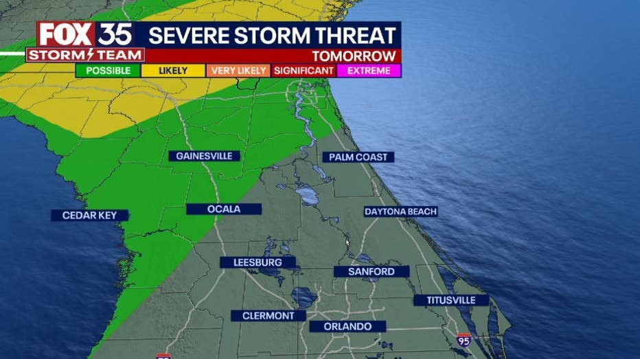
Threats tomorrow will include damaging winds and a few isolated tornadoes mainly in the "LIKELY" risk zones.
On Sunday, the severe risk will ease as the front finally pushes down the Florida Peninsula. Sunday is also the first day of Spring and beautiful weather, along with some comfortable warmth will return to the region. "