

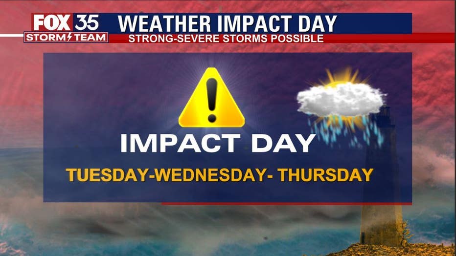
Storms make a comeback in Central Florida mid-week

Weather Forecast: April 4, 2022
FOX 35 Storm Team Meteorologist Brittany Lockley has the latest on the weather in Central Florida.
ORLANDO, Fla. - After a rather wet weekend, complete with a few rounds of severe thunderstorms, Central Florida enjoyed a pretty quiet Monday, with a few spotty showers.
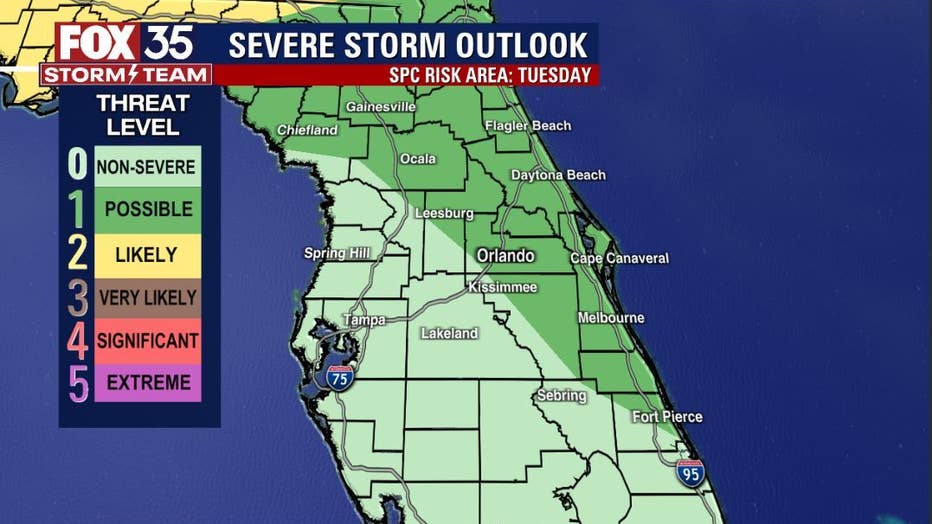
Additional weather energy moves in Tuesday with rain chances coming up a bit. The highest storm risk will be closer to the coastal counties and primarily after 4 p.m. A few strong storms will be possible during this time.
While the severe risk will be the highest well north of Central Florida on Tuesday, a good chunk of the viewing area is outlined with a "LEVEL-1 POSSIBLE" for stronger storms.
DOWNLOAD: FOX 35 NEWS APP | FOX 35 STORM TEAM WEATHER APP
The FOX 35 STORM TEAM has issued WEATHER IMPACT DAYS to address the possibility of a greater severe weather risk on Tuesday, Wednesday and Thursday.
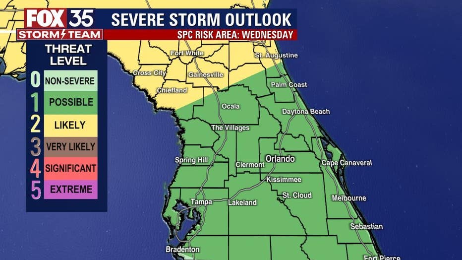
Damaging wind gusts, heavy rain, and lots of lightning could accompany some stronger storms.
Orlando Weather: Storm alerts, live interactive radar, forecast, and more
Click here for the latest Central Florida news, Florida stories, and local headlines.