

Orlando weather: Rain possible to start the week as drier air moves into Central Florida
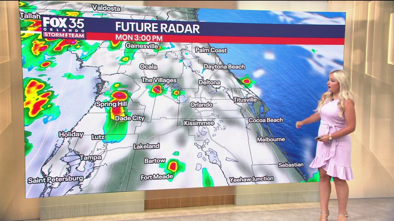
Orlando AM Weather Forecast: Scattered downpours to start the week
The workweek begins with scattered downpours in the afternoon. Temperatures will reach the low 90s, making for a hot and humid day. FOX 35 Storm Team meteorologist Jessica Dobson takes a look at the forecast.
ORLANDO, Fla. - Hit-or-miss downpours are on the table as we kick off the workweek, with Tropical Depression 2 spinning just to our northwest.
It will gradually work away from us over the next couple of days. Just like our weekend, Monday won't be a washout, with the bulk of the moisture falling during the afternoon and evening.
A drier trend then develops as we progress through the rest of the workweek.
Tropical Depression 2 to become Tropical Storm Bertha
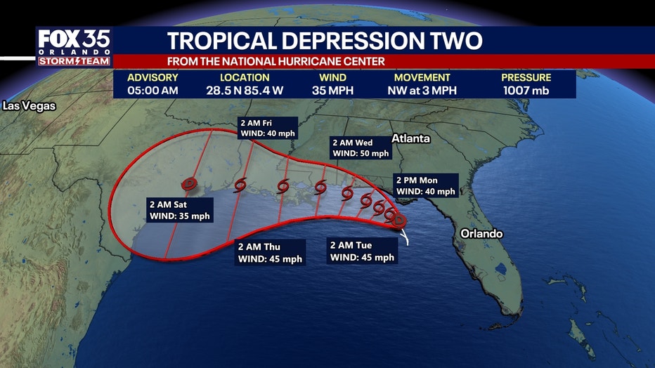
Tropical Depression 2 is churning in the Gulf and is expected to organize further in the hours ahead.
As we progress through the next 24 hours, this system will likely become Tropical Storm Bertha as it works its way west-northwest.
As it moves westbound, it encounters less shear and this should make for strengthening as it moves over the warm water. With that shear, Bertha will likely be lobsided in nature, with the heaviest rain falling offshore.
Tropical Storm watches and warnings have been issued for parts of the Gulf, including the Florida Panhandle. If you have travel plans to the Panhandle, as well as the Gulf Coast in general, you'll definitely want to monitor the latest forecast.
Tropical downpours expected
As this area of low pressure continues to develop in the Gulf, we'll be on the outer periphery of the heavier tropical moisture. That doesn't mean we can't get some tropical rain though, as more moisture streams into the state.
This system, with the help of the upper-level flow, will start to shift to the northwest, taking the heavier rain along with it.
Hit-or-miss tropical downpours and storms are still on the table, mainly this afternoon into the evening. A couple of storms could turn stronger with gusty wind along with heavy rain.
Drier conditions rest of the week as temperatures climb
Drier air will continue to wrap around this developing area of low pressure in the Gulf through the first half of next week. This will start to cut down on rain chances.
In fact, we'll likely see drier than normal conditions middle to late week.
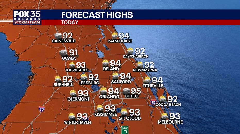
Chances dip to around 20% Wednesday and that trend continues into Friday. With that drier air in play, temps will be topping out in the middle 90s for the most part as we approach midweek.
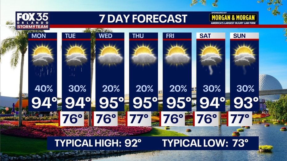
By Thursday and Friday, highs look to climb into the middle to potentially upper 90s in some isolated spots, which is above average for this time of year. Feels like temps with the humidity look to get back into the middle to upper 100s.
The Source: The information in this story was provided by the FOX 35 Storm Team.