

Orlando weather: Strong storms Thursday, cooler weekend after cold front

Orlando Weather Forecast PM: May 28th, 2025
FOX 35 Storm Team Meteorologist Noah Bergren is tracking some showers tonight but a much higher chance for storms Thursday.
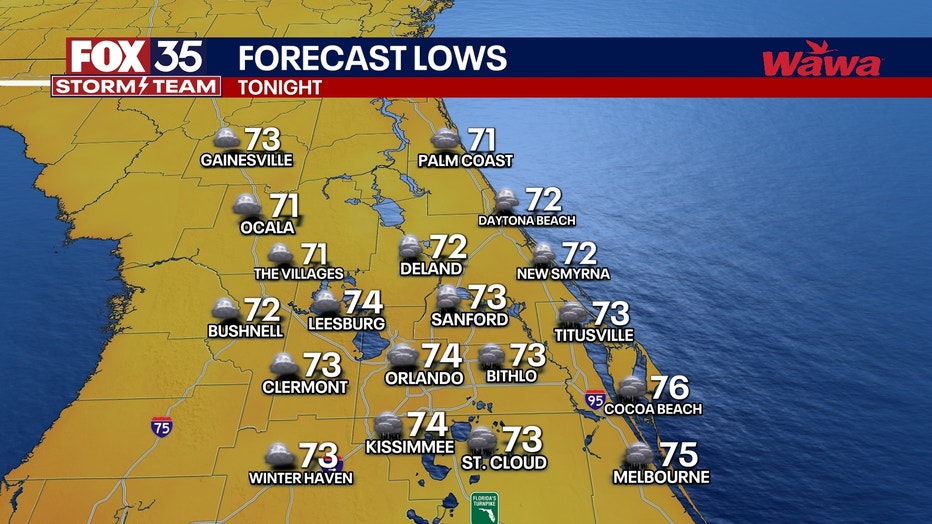
What will the weather look like tonight?
What to expect:
ORLANDO, Fla. - A few thunderstorms early this evening. Do not think it will be as widespread as Tuesday evening's storms. Lightning, gusty winds, downpours, small hail mainly focused on the Atlantic Beaches.
What will the weather look like Thursday?
Timeline:
Much bigger coverage of storms with several strong storms likely, and a few severe storms possible. Torrential rains, vivid lightning, and a few pockets of large hail or 50-60 MPH wind gusts are possible in the mid-afternoon through the mid-evening.
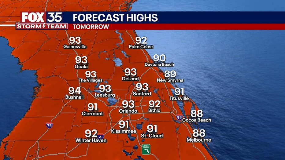
Highs in the low to mid 90s with a heat index near 100 degrees before the thunderstorms start to pop off.
What will the weather look like for remainder of the week?
Looking ahead:
Friday evening into early Saturday morning, a cold front will approach Florida from the north. While a few isolated t-storms are possible Friday afternoon, the best chance for rain will be overnight Friday night into very early Saturday morning.
A line of showers and strong storms is possible Saturday morning between 2AM and 9AM. There is a small chance for a brief tornado or damaging wind gust with storms in that Saturday morning timeframe.
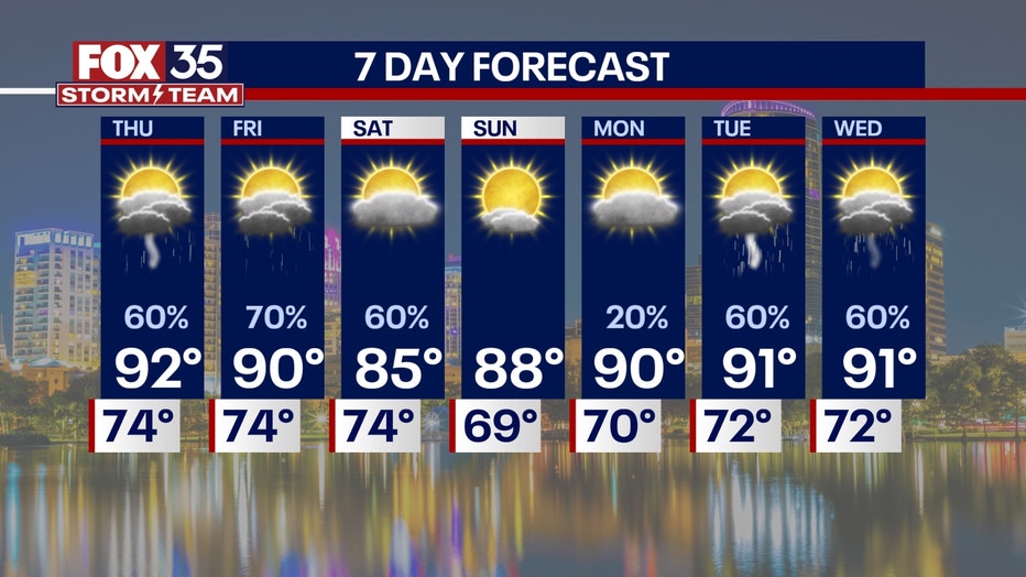
Once the line clears south, the sky will rapidly clear, humidity plummets, and turn totally sunny for midday Saturday and the rest of the day.
It will be a stellar Saturday afternoon and evening. Sunday will also be dry with no rain and sunshine behind this rare late May cold front.
Hurricane season begins June 1st, which is Sunday, and for now -- the Atlantic remains quiet for at least the next 7days.
Orlando 7-Day Weather Forecast

FOX 35 Storm Tracker Radar
Track live when storms move across your area using the FOX 35 Storm Tracker Radar below.

More radar maps from FOX 35 Storm Tracker Radar
- Brevard County
- Flagler County
- Lake County
- Marion County
- Osceola County
- Orange County
- Polk County
- Seminole County
- Sumter County
- Volusia County
- U.S./National Radar
STAY CONNECTED WITH FOX 35 ORLANDO:
- Download the FOX Local app for breaking news alerts, the latest news headlines
- Download the FOX 35 Storm Team Weather app for weather alerts & radar
- Sign up for FOX 35's daily newsletter for the latest morning headlines
- FOX Local: Stream FOX 35 newscasts, FOX 35 News+, Central Florida Eats on your smart TV
The Source: This story was written based on information shared by the FOX 35 Storm Team on May 28, 2025.