

Orlando weather: Intense heat expected to persist with light relief from scattered showers

Orlando PM Weather Forecast: July 31. 2025
The heat continues to be our big weather story! Meteorologist T.J. Springer lets us know when we start to see some changes and when our rain chances start to increase.
ORLANDO, Fla. - Although the Florida heat wave is continuing to beat down in full force, the Central Florida area will see some relief with increased rain chances this afternoon and heading into the weekend.
Here's a look at what to expect from the weather tonight, tomorrow and headed into the weekend.
What will the weather look like tonight?
What To Expect:
Scattered afternoon showers and thunderstorms will continue to pop up as the day continues.
The main threats for the rest of the evening include frequent lightning, heavy rain and gusty winds.
Storms should significantly quiet down by 9 p.m., but we could still see lingering spotty showers until midnight.
Temperatures will stay warm with muggy conditions through the overnight with lows in the upper-70s.
What will the weather look like for the rest of the week?
What's next:
The heat is still on, but not as intense as we saw at the beginning of the week.
Temperatures will remain in the low-and-mid-90s this weekend and next week, but chances of rain will be on the rise, providing a little relief from the heat. A front will come in from the north and amp up our rain chances on Sunday.
This front will stall off to the north and act as a roadblock to the moisture that this front will push into Central Florida. Our chances of rain will be on the rise and stay soggy into next week. This will put Central Florida back into the widespread afternoon and evening rain and thunderstorms.
Temperatures will stay in the mid-and low-90s for most of next week.
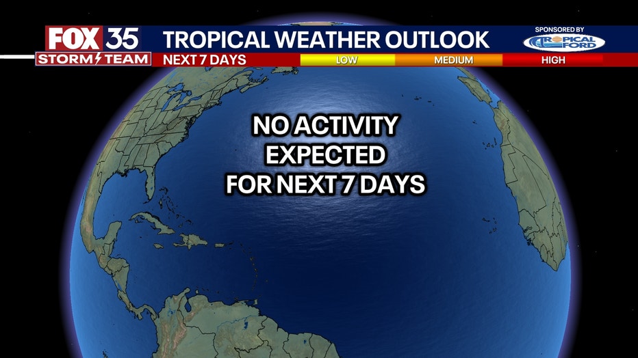
Tracking the tropics
Dig deeper:
The Atlantic basin remains quiet for now. No areas of official development are outlooked by the National Hurricane Center (NHC) over the next seven days.
August is normally when we see the Atlantic tropics start to wake up. So, it is not unusual to see tropical activity start to pick up. On average, we see our first hurricane within the first two weeks of August, around Aug. 11.
The NHC looks at the potential for tropical activity within the next seven days, and the Climate Prediction Center (CPC) looks two and three weeks out for the potential for Tropical Activity.
The CPC is predicting the possibility of tropical activity in the Gulf and along the East Coast within the next two weeks. The CPC is taking into account the sea surface temperature, and the thinning Saharan dust. There will also be a lot more moisture in the atmosphere within the next two weeks that could possibly turn into a tropical system.
As of now, there is only a 20-40% chance of development. However, A LOT can change in two weeks, so use the time now that it is quiet to get prepared for the rest of the season.
The Source: This story was written based on information shared by the FOX 35 Storm Team on July 31, 2025.