TIMELINE: Evening storms could bring Orlando, Central Florida flooding, frequent lightning

Orlando Weather PM Forecast: August 7, 2025
FOX 35 Storm Team Meteorologist Laurel Blanchard takes a look at our rain chances for the rest of the workweek and the weekend.
ORLANDO, Fla. - Storms are expected to continue into Thursday evening across Florida, with widespread activity through 10 p.m. then the rain will begin to taper off.
What will the weather look like tonight?
What to expect:
Rain and storms will clear out overnight, but not before another round of potentially intense weather. Temperatures will drop noticeably with lows dipping into the mid-70s.

The National Weather Service says high moisture levels in the atmosphere are contributing to torrential downpours and an increased risk of flash flooding. Gusty winds and frequent lightning are also expected, and some storms could become strong or even severe.
Hour-by-hour rain forecast
Timeline:
Any lingering showers and storms will gradually fade around midnight to 1am.

What are the potential storm threats?
These showers and storms will dump a lot of rain over a short period of time, so flooding and flash flooding will be possible. Gusty winds and frequent, prolific lightning can be expected along with heavy rain.

CLICK TO DOWNLOAD THE FOX LOCAL APP
What will the weather look like on Friday?
What to expect:
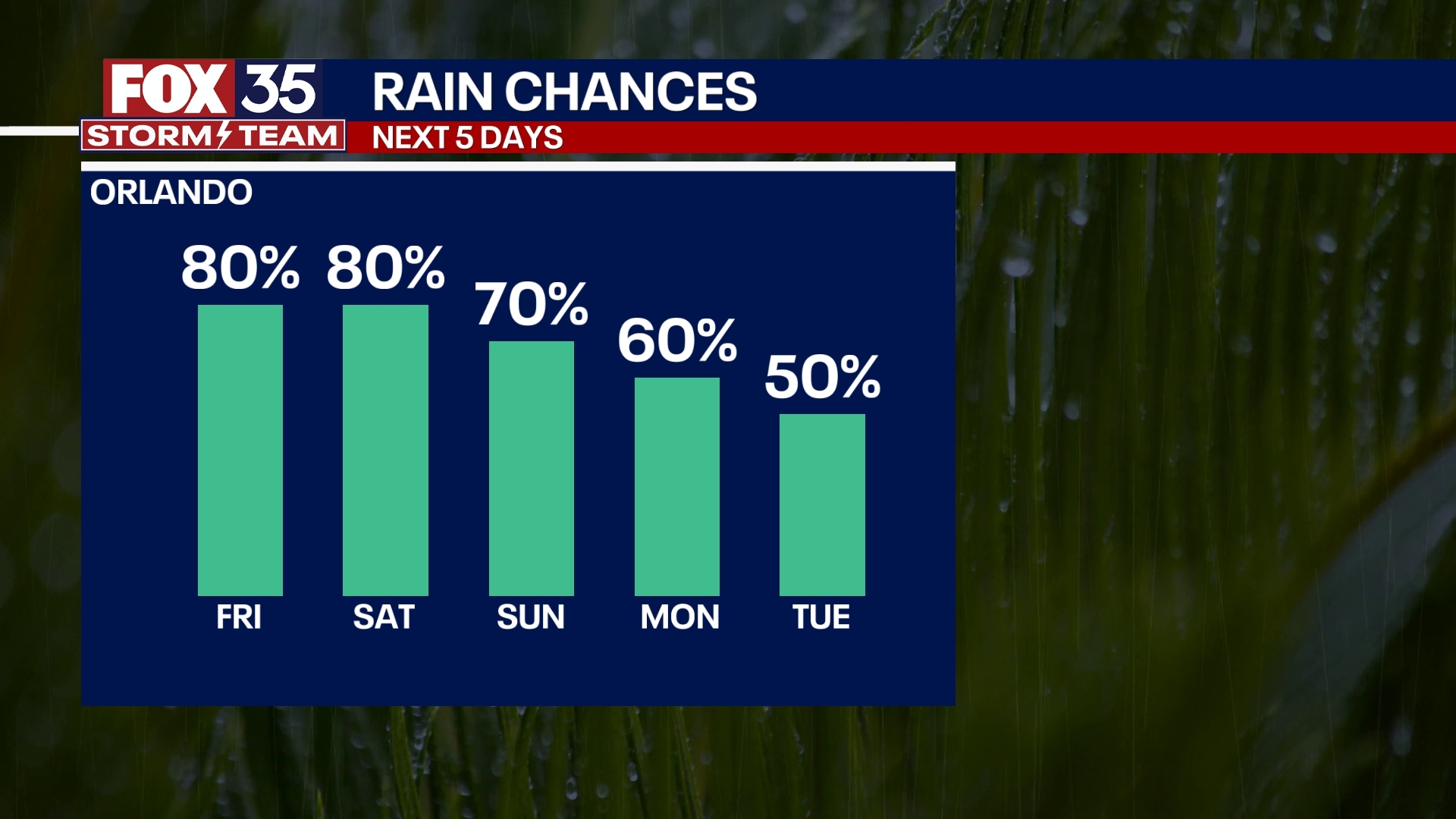
Rain chances remain elevated through the end of the workweek. A surge of tropical moisture across Florida will keep conditions unsettled, with widespread heavy rainfall expected on Friday afternoon and evening.
While the mornings are expected to be mostly dry but cloudy, daily highs should stay near 90 degrees due to persistent cloud cover.

What will the weather look like this weekend?
Looking ahead:
As we move into the weekend, high chances of heavy afternoon rain and storms will persist. An isolated strong storm or two can't be ruled out, with gusty winds, heavy rain, and frequent lightning, once again, being the main threats.
A slight reprieve from the heat also arrives this weekend, with highs around the low 90s.

Next week, a more typical pattern sets up. This means more sea-breeze-driven scattered showers and storms will be likely. With slightly lower chances of rain, temperatures will heat back up into the mid-90s by midweek.
SIGN-UP FOR FOX 35'S BREAKING NEWS, DAILY NEWS NEWSLETTERS
Tracking the Tropics
Post-Tropical Dexter has lost its tropical characteristics and poses no threat to the U.S. mainland. However, the system is expected to produce large ocean swells and increase the risk of rip currents along Florida's Atlantic coast through the weekend.
The National Hurricane Center has identified two other systems being monitored for tropical development:

Off the Southeastern U.S.: A broad area of disorganized thunderstorms off the southeastern coastline has shown some signs of circulation but remains in cooler waters. The system has a 20% chance of development over the next seven days. It’s forecast to drift northward while continuing to enhance local rain and rip current threats.
Central Tropical Atlantic: A tropical wave in the eastern Atlantic, designated as Invest 96L, has a 60% chance of developing over the next week and a 10% chance in the next 48 hours. Conditions are becoming more favorable for gradual development, and a tropical depression could form late this weekend or early next week as the system tracks northwest.
Forecasters are also monitoring another tropical wave expected to emerge off the west coast of Africa as early as Thursday night.
The Source: This story was written based on information shared by the FOX 35 Storm Team on August 7, 2025.

