Orlando weather forecast: Here's a look at storm arrival times on Wednesday

Weather Forecast: August 24, 2022
Storms are expected to linger into the evening on Wednesday but should die off after 10 p.m. Thursday will be a repeat but rain increase significantly. Lightning will also be a threat.
ORLANDO, Fla. - ORLANDO WEATHER: Tonight's low: 76 degrees | Tomorrow's high: 94 degrees | 60% chance of p.m. storms
MAIN WEATHER CONCERNS: Storms are expected to linger into the evening on Wednesday but should die off after 10 p.m. Thursday will be a repeat but rain increase significantly. Lightning will also be a threat. Another round of storms is expected Thursday, mainly after 2-3pm. Concerns are like previous days...heavy rain and lots of lightning. The beaches see the lowest coverage at 40% or less, inland areas remain higher at 60%+. Rain will ease up late evening with skies turning partly cloudy overnight.
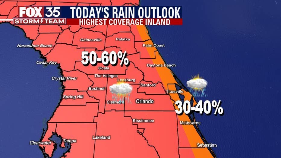
BEACHES:
There will be a 40% chance for afternoon showers/storms at the beaches primarily after 11am as the Atlantic seabreeze fires up. Surf is beat, around a foot in a small dribble of Southeast trade swell.
Moderate risk for rip currents. Lightning will be a possible danger should storms drift back towards the coast in the late afternoon and early evening.
Remember, when thunder roars, go indoors.
THEME PARKS:
Hot and humid conditions with numerous afternoon storms. Plan for rain delays on fireworks and outdoor activities. Best chance for rain between 2pm-8pm. Heavy rain and lightning will be likely.
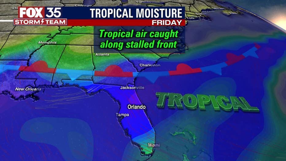
EXTENDED OUTLOOK:
Rain chances will go up to 80% by the end of the week with flooding rain possible. Depend on the FOX 35 Storm Team and download the FOX 35 Storm Team App!
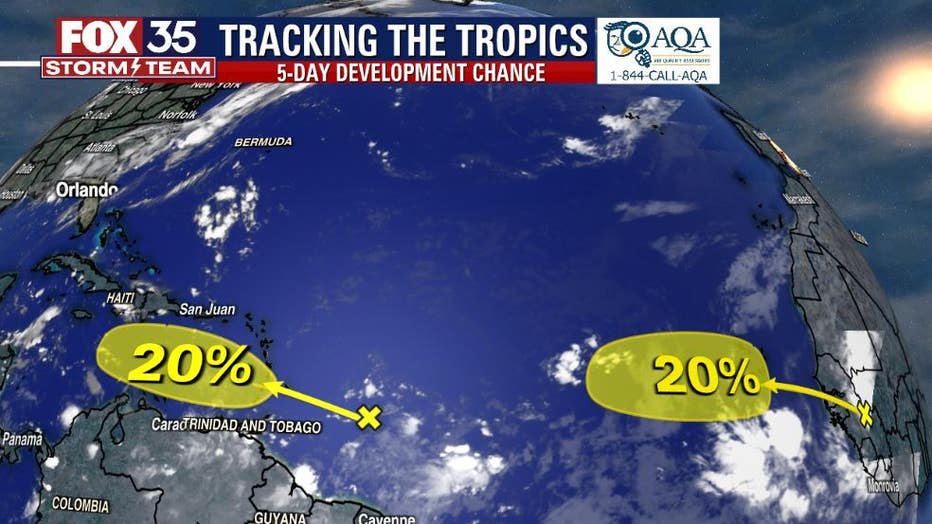
TROPICS:
NHC is currently watching TWO tropical waves for a 20% chance for development (each). No threat to FL yet, but some long range models remind us to keep our guard up as we approach the peak of the hurricane season. Track the tropics in real-time on the FOX 35 STORM TEAM WEATHER APP.