Orlando weather forecast: Showers could linger into over night hours in some areas

Weather Forecast: August 19, 2022
Orlando and Central Florida will see the potential for severe weather in the early to mid-evening hours.
ORLANDO, Fla. - WEATHER FORECAST FOR ORLANDO:
Tonight’s low: 77 degrees | Tomorrow's high: 94 degrees | Rain Saturday: 40% chance for p.m. storms
Main weather concerns: Lightning storms with torrential rain moving into Orlando by 6 p.m. and peaking around 8 p.m. Rain should end by 11 p.m. Expect frequent, dangerous lightning, and one or two could be severe with gusty winds over 60mph. Storms will track east and have no trouble reaching the beaches. 2 to 4 inches of rain is possible so watch for flooding in poor drainage areas.
Beaches: There will be a 30% chance for afternoon storms at the beaches tomorrow. Waves 2-3 feet with a moderate risk for rip currents. Slight chance of lightning will be a danger between 1 p.m. -8 p.m. Winds southwesterly offshore in the morning, shifting to a sea breeze southeast, onshore wind at 15mph.
Extended outlook: Remaining very muggy with isolated storms this weekend followed by numerous storms next week. Depend on the FOX 35 Storm Team and download the FOX 35 Storm Team App!

Lightning safety tips: Here are the worst places to be during a lightning storm
Three people, including a mother and her child, were struck by lightning in Winter Springs Thursday afternoon. FOX 35 Storm Team Meteorologist Brooks Garner has some tips on what you should and should not do when a lightning storm is approaching.
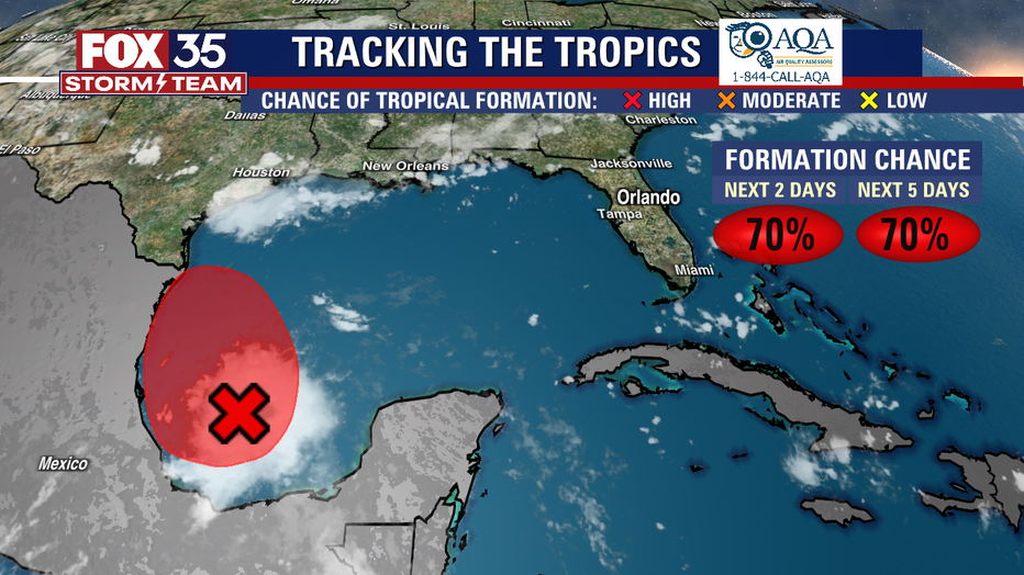
Tracking the tropics:
A tropical wave in the western Caribbean Sea off Belize is expected to drift northwest toward the Bay of Campeche and could become a tropical depression today or tomorrow. There's a high (70%) chance of that happening. No threats to Florida as the circulation would likely drift into Mexico or Texas. The next name on the list is Danielle.