

Orlando weather: Blast of cold air to leave Floridians shivering in the 30s this weekend

Weather forecast: Jan. 13, 2023
Now that showers associated with a cold front have moved out of the state, we can expect temperatures to plunge. Lows this weekend will drop into the 30s while highs will barely break the mid-50s in most areas.
ORLANDO, Fla. - Tonight's low: 39 degrees | Tomorrow's high: 52 degrees | Rain: None
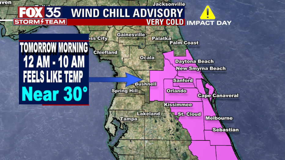
Main weather concerns: A cold front is sweeping across the Florida peninsula this morning. Behind it are freezing temperatures for northern parts of our viewing area. Wake-up temperatures on Saturday will be in the widespread 30s. There is a wind Chill Advisory in effect from midnight to 10 a.m. Saturday in Orange, Seminole, Volusia, Lake, Osceola, and Brevard Counties. Feels-like temperatures overnight will be near 30 degrees.
While we don't experience a true freeze, sky conditions and temps will be just right to develop some scattered frost for areas away from the immediate coast. Bundle up and check on your outdoor pets and plants.

Strong cold front to leave Floridians shivering this weekend
FOX 35 Storm Team Chief Meteorologist Jayme King has the forecast.
BEACHES:
Expect mixed skies and much cooler temperatures. Surf will be in the 2-foot range with a moderate rip current risk. High tide is around at 11:45 a.m.
THEME PARKS:
Not the best start to the day at the theme parks, so bring a jacket.
OUTLOOK:
Colder air and gusty northwest winds will fill in quickly behind a cold front. Friday night, temps fall off, bottoming out in the 30s and 40s across the viewing area by Saturday morning.
A Wind Chill Advisory in our eastern counties remains in effect from midnight to 10 a.m. Saturday with feels-like temperatures near 30 degrees. Temps stay down all weekend with highs on Saturday only in the 50s despite full sunshine. Saturday night into Sunday morning, lows fall into the 30s.