

New tropical depression forms near Florida, expected to strengthen as it moves west into Gulf

Tracking the Tropics: September 11, 2020
We are tracking a tropical depression that is expected to move across South Florida over the weekend before entering the Gulf of Mexico, where it is expected to strengthen.
ORLANDO, Fla. - FOX 35 is currently watching several systems in the Atlantic, including a newly-formed tropical depression that is expected to cross over Florida this weekend.
"It is uncertain whether the large burst of convection over the center will continue and cause the depression to become a tropical storm before reaching Florida," the National Hurricane Center said in an update on Friday. "It is possible that tropical storm conditions could still occur along the southeast Florida coast late tonight, and a tropical storm watch has been issued."
This system is expected to produce locally heavy rainfall over portions of the Bahamas, South Florida, and the Florida Keys during the next couple of days. After the system reaches the eastern Gulf of Mexico, it is expected to strengthen due to expected light wind shear and very warm water.
Heavy rainfall is expected to produce isolated flash flooding over portions of central and southern Florida and the system is forecast to strengthen to near hurricane intensity by early next week as it moves across the northeastern Gulf of Mexico.
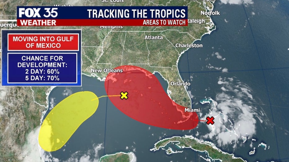
Tropical storms Rene and Paulette continue to swirl in the Atlantic. Paulette is expected to become a Category 2 hurricane this weekend.
Rene is moving toward the west-northwest. A decrease in forward speed is forecast Sunday and Sunday night.
TRACK THE TROPICS: Visit the FOX 35 Orlando Hurricane Center for the latest in the tropics, including daily updates, live radar, and severe weather alerts
Both Rene and Paulette are no threat to land.
A tropical wave is located a few hundred miles south-southeast of the Cabo Verde Islands that could become our next named storm of the 2020 Atlantic Hurricane season. Forecasters give it a 90-percent chance of developing. If it does, it would be named Sally.
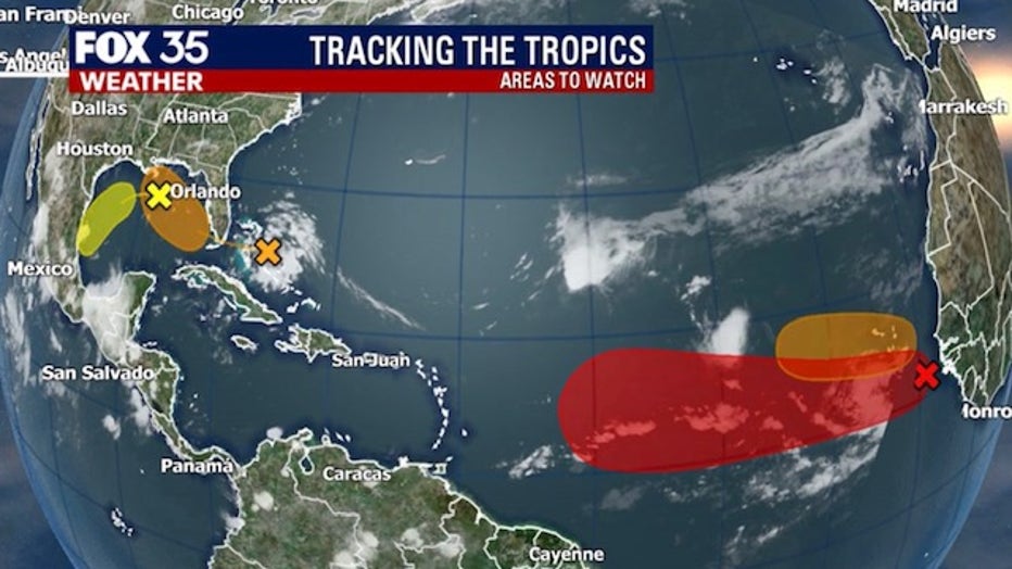
Another tropical wave is forecast to emerge off the west coast of Africa this weekend and has a 40-percent chance of developing as it moves westward.
We're also watching another trough of low pressure that has developed over the north-central Gulf of Mexico and is producing a few disorganized showers and thunderstorms. Chances of development remain low at 30-percent.
STAY PREPARED: Get all you need to know about the 2020 Atlantic hurricane season with the FOX 35 Orlando Hurricane Guide
The 2020 Atlantic Hurricane Season runs until Nov. 30.
Out of the 21 names on the list for the 2020 Atlantic Hurricane season, there are only 4 left.
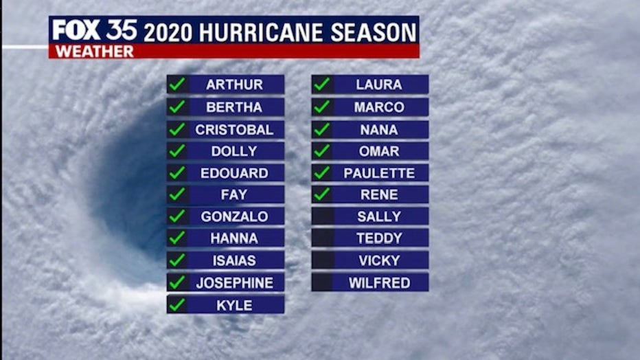
Forecasters have predicted that this season will have more activity than normal. For example, NOAA predicted an above-average season, with 13 to 19 named storms. Six to 10 of those would become hurricanes and three to six of those are forecasted to become major hurricanes (Category 3 or higher).
In comparison, the 2019 Atlantic Hurricane season had 18 named storms, matching 1969 for the fourth most-lively season in the past 150 years.
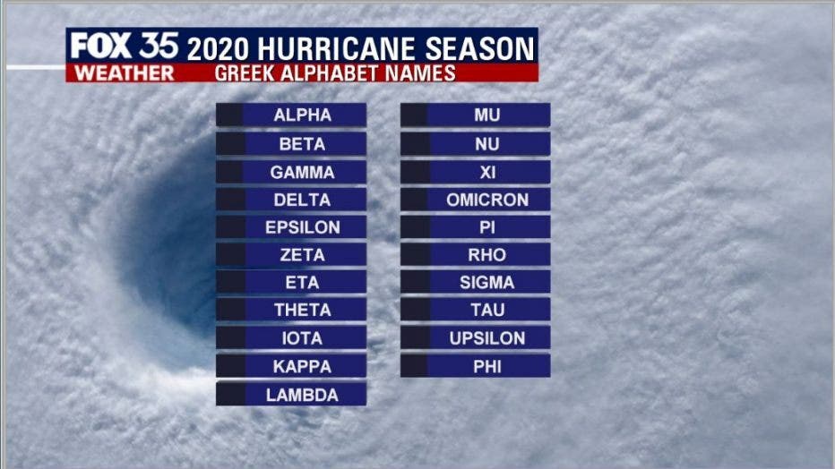
RELATED: Greek Alphabet will be used if hurricane names run out
If a tropical storm or hurricane develops after "Wilfred," (the last name of the season), the letters of the Greek alphabet will be used.
Watch FOX 35 News for the latest updates.