

Massive Saharan dust cloud on its way to Florida

Why Saharan dust is good for Florida during hurricane season
FOX 35 Storm Team Chief Meteorologist Jayme King tells us when Saharan dust will arrive in Florida and how it helps out during hurricane season.
ORLANDO, Fla. - It's back!
The Saharan Air Layer, or "SAL," looks like Atlantic high pressure and its associated clock-wise flow of air will serve as the vehicle to bring the dust closer to home and soon!
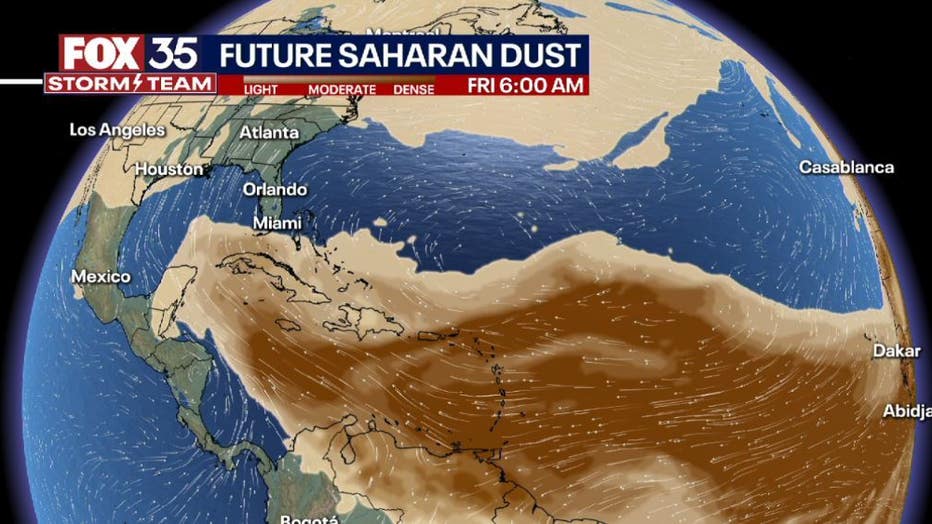
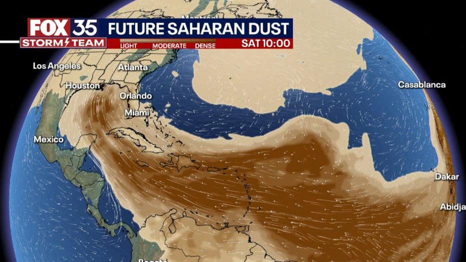
The FOX 35 STORM TEAM is tracking the dust veil with current forecast models showing the dust entering the southern Gulf by this weekend. From there, the dust advances into the Gulf south and much of Florida.
DOWNLOAD: FOX 35 NEWS APP | FOX 35 STORM TEAM WEATHER APP
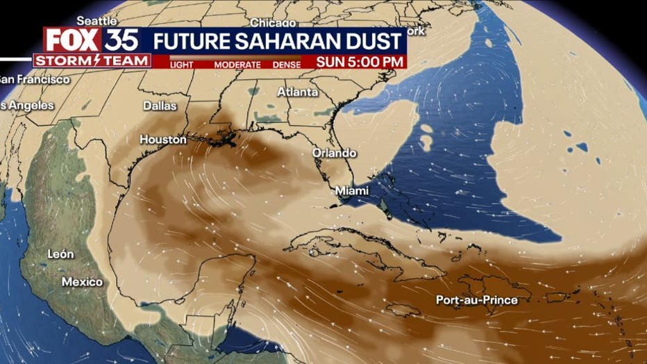
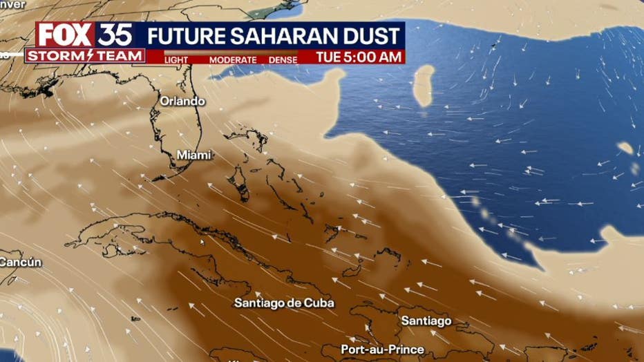
As high pressure remains the dominate feature on the map through early next week, another ramp up in dusty air is possible. Models by next Tuesday shows a rather dense veil moving through the islands and possibly overspreading all of Florida.
MORE NEWS: Mosquitoes prefer biting people wearing these colors, study says
The Saharan air layer comes in handy during the hurricane season, specifically in quelling the atmosphere and keeping tropical development at bay. The 2022 Atlantic hurricane season begins on June 1 and runs through Nov. 30.
Saharan dust is also notorious for creating some of the most beautiful sunrises and sunsets as light bounces off the dust particles, tapping all of the color spectrum.
Stay with the FOX 35 Storm Team and our dust tracking efforts all summer long!