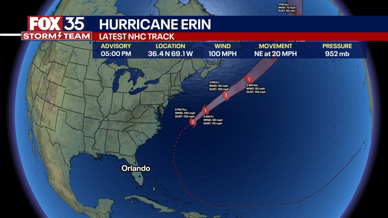
Hurricane Erin live path tracker: Cone, spaghetti models, satellite, forecast

Tropical weather PM update: August 19, 2025
FOX 35 meteorologists Noah Bergren and T.J. Springer give updates on Hurricane Erin, as well as two disturbances being monitored by the National Hurricane Center for potential development in the Atlantic Ocean.
ORLANDO, Fla. - Hurricane Erin was downgraded to a Category 2 storm late Tuesday with maximum sustained winds of 100 mph as it churned northwest, bringing dangerous surf and renewed concerns about beach erosion along Florida’s Atlantic coast.
Erin became the first hurricane of the 2025 Atlantic hurricane season. At one point, it was a Category 5 storm.
The NHC said Hurricane Erin is forecast to pass east of the Bahamas. Then, it will move over the western Atlantic between the U.S. east coast and Bermuda on Wednesday and Thursday.
Erin is a large hurricane with hurricane-force winds extending outward up to 80 miles from the center and tropical-storm-force winds extending outward up to 230 miles.
Hurricane Erin forecast track
Here is the latest forecast track for Hurricane Erin from the National Hurricane Center.
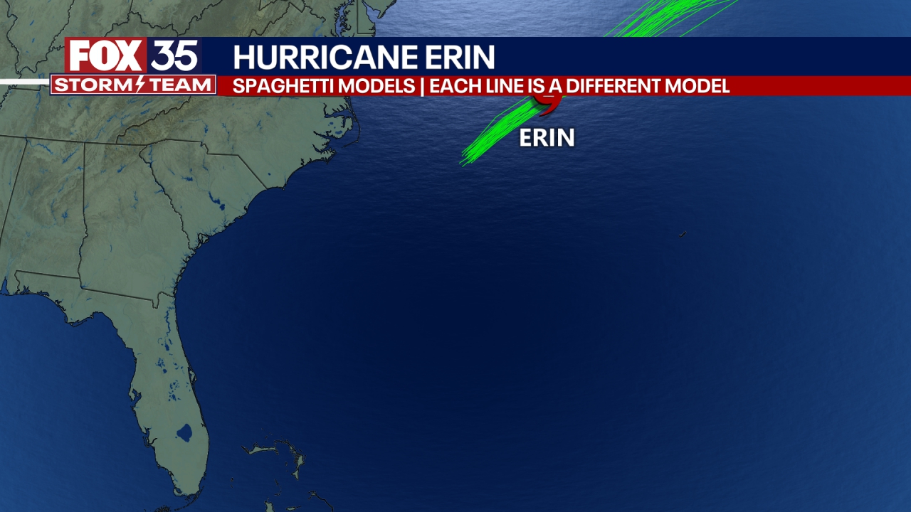
Hurricane Erin spaghetti models
Here are some of the projected computer models of Hurricane Erin's potential path as it treks across the Atlantic Ocean, and away from Florida and the United States.
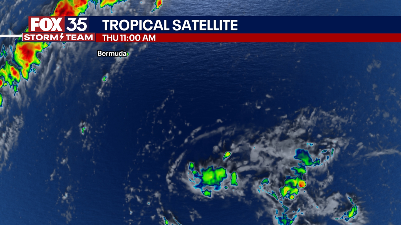
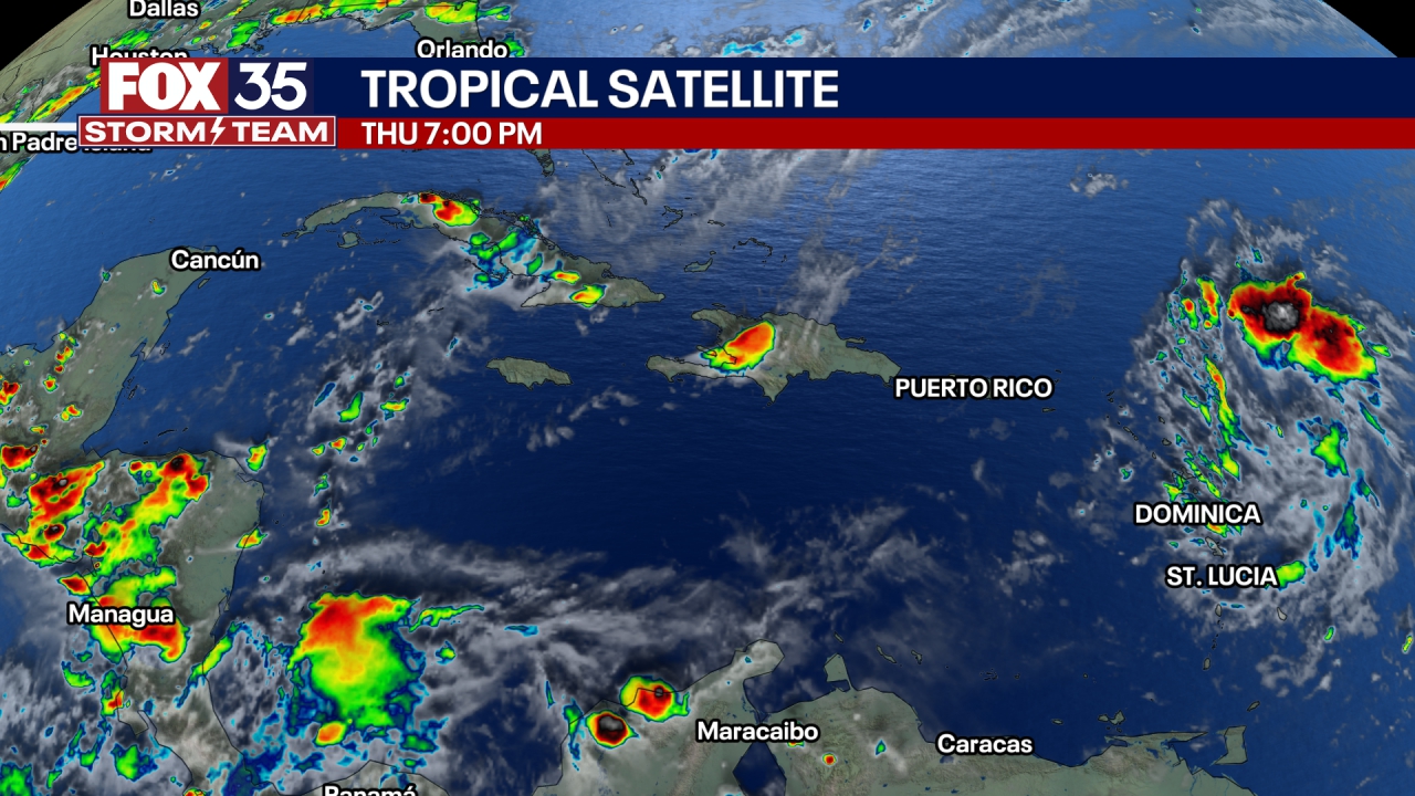
Hurricane Erin satellite images
Here are some live views of Hurricane Erin from satellites in space.