Cold front coming to Central Florida this week: Here's how low temperatures will drop

Weather Forecast: November 17, 2022
FOX 35 Storm Team Chief Meteorologist Jayme King has the forecast.
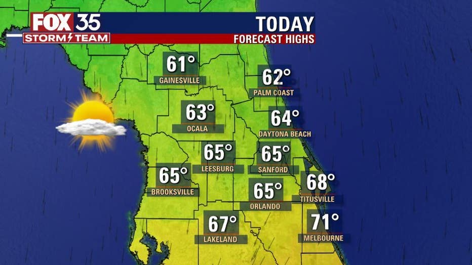
ORLANDO, Fla. - Today's high: 65 degrees
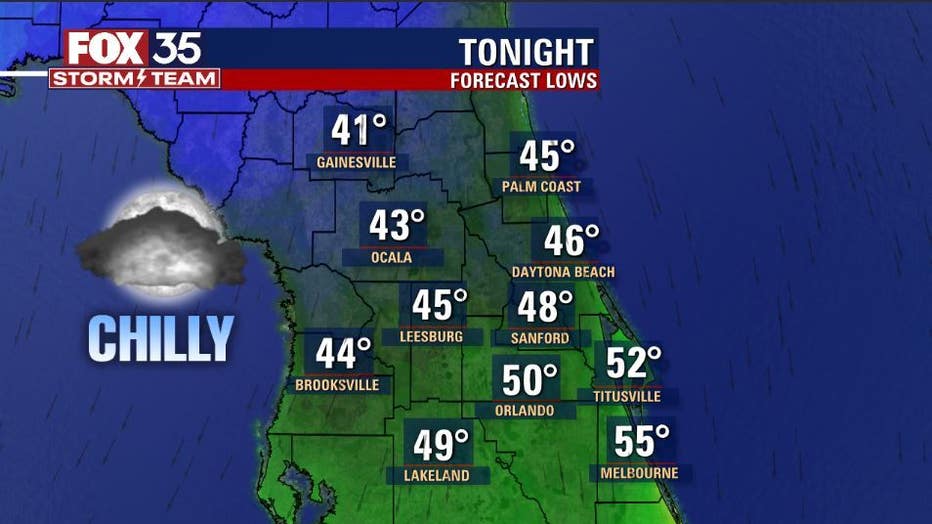
Tonight's low: 50 degrees
Rain: Dry
Main weather concerns:
No weather concerns for the area today. Gusty North winds will create a "long shore current" along the beaches today. A long shore current is a strong flowing current-channel of water that will flow from North to South today. Rip current risk will be a bit elevated as well.
Otherwise, weather locally today looks fantastic. Cooler and drier with pulsing North breezes. Highs will range from the 60s inland and the Northeast coastal counties, closer to 70 along the Brevard County area.
MORE NEWS: Frontier Airlines launches unlimited 'all-you-can-fly' annual pass
BEACHES:
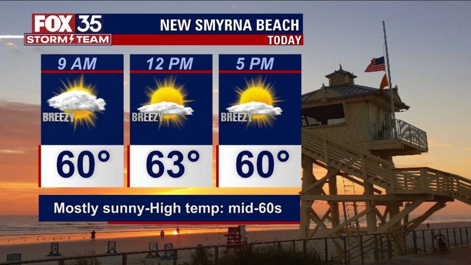
Mostly sunny trend across the beaches today. Gusty North winds keep conditions cool n' breezy. Surf is blown out and in the 2-3' range as a new North wind swell develops by this afternoon. Highs seaside will reside in the 60s to right around 70 over in Brevard County.
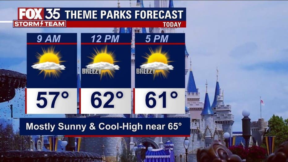
THEME PARKS:
Beautiful day for the theme parks today. Expect mostly sunny skies to phase in, North breezes and highs near 65. Dry all day!
OUTLOOK:
The cooler temps now in place will modestly warm as we head into the weekend and beyond. Highs by the weekend will be in the 70s as Northeast winds warm the local area a bit. Could be a few isolated showers around both Saturday and Sunday. Early next week, moisture in the gulf will spread into Florida with a possible sharp rise in rain chances then....stay tuned!
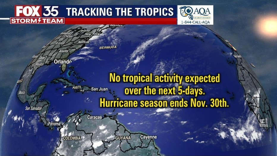
TROPICS:
The tropics are calm with no activity expected within the next five days. The hurricane season continues until November 30th.