

System near Bahamas could develop into our first named storm of hurricane season

System near Bahamas could become first named storm of season
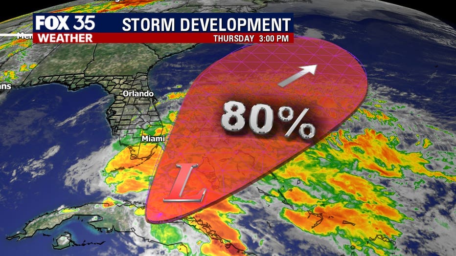
FOX 35 meteorologists continue to monitor a trough of low pressure located over the Straits of Florida that continues to produce disorganized shower activity and gusty winds across the Florida Keys.
ORLANDO, Fla. - FOX 35 meteorologists continue to monitor a trough of low pressure located over the Straits of Florida that continues to produce disorganized shower activity and gusty winds across the Florida Keys, portions of extreme south Florida, and the northwestern Bahamas.
Gradual development of this system is expected, and it will likely become a tropical or subtropical storm by late Friday or Saturday when it is located near the northwestern Bahamas. Later in the weekend and early next week, the system is expected to move generally northeastward over the western Atlantic.
Windy weather across Central Florida is a direct result of the developing system interacting with high pressure located north of the state, local gusts today could get into the 25 to 30 mile per hour range.
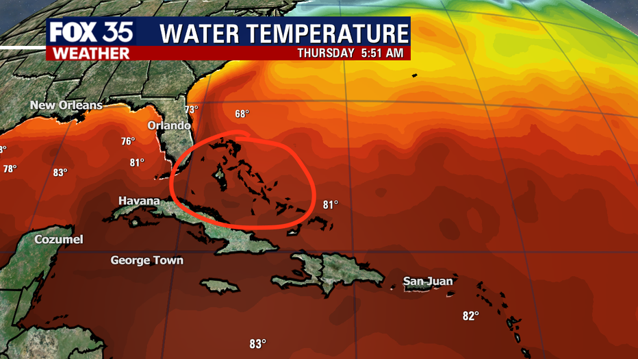
The area around the Central Bahamas will be the spot to watch for tropical development as we head into the weekend.
Waters across the island chain are very warm at 80 degrees plus and atmospheric conditions favorable for a tropical spin up.
If a storm develops, it will be named "Arthur," our first named system of the 2020 Atlantic hurricane season. It will also mark the 5th year in a row that we've seen the tropics active before the official June 1st start date of hurricane season.
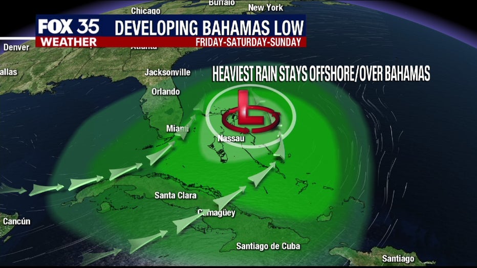
Right now, impacts from this developing system will be rather low for much of Florida. Bulk of the action will play out offshore waters and over the Bahamas.
Far South Florida will see the brunt of the heavy rain on the Florida Peninsula tonight through Friday. Lesser amounts to the north closer to Orlando-metro.
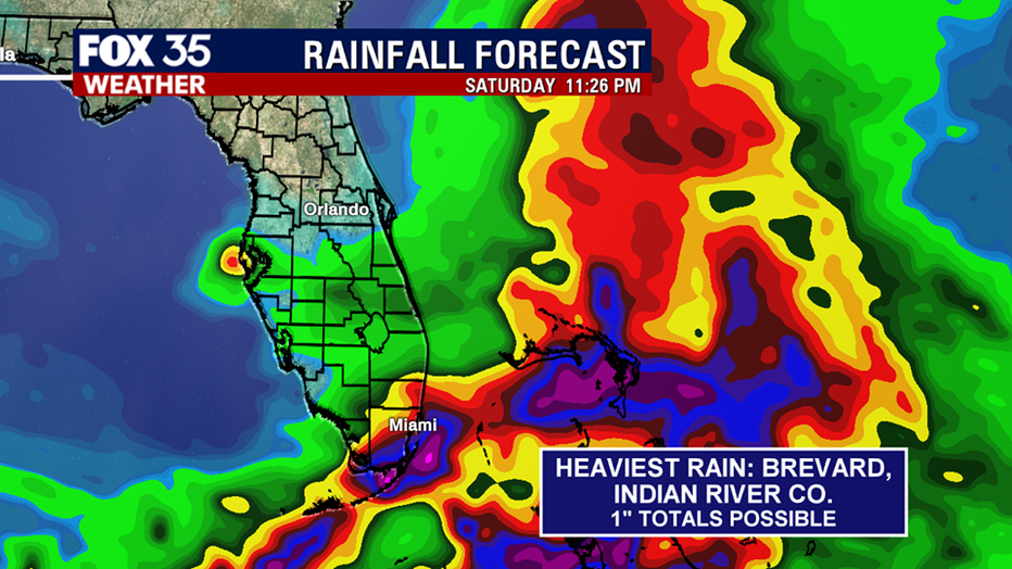
Some forecast modeling is indicating the potential for heavier rain around southern Brevard, Osceola and Indian River counties on Friday afternoon. We'll be watching for this.
Aside from the rain, we anticipate a sharp rise in local surf heights and developing deadly rip currents.
While Saturday still features a few opportunities for rainfall, Sunday will feature dry, warm conditions with some sunshine.
If you have weekend beach plans, please keep these threats in mind and stay safe out there. Heed the advice of our local lifeguards. Rip currents will be worst from 7 a.m. through 12 p.m. both Saturday and Sunday.