

Orlando weather: Wind advisory, dangerous surf to conclude the weekend
Orlando PM Weather: Winds Finally Letting Up
FOX 35 Meteorologist Laurel Blanchard breaks down when the winds will finally calm down and what the start of the week has in store leading up to the Artemis II launch.
ORLANDO, Fla. - Our Sunday begins on a blustery note across Central Florida with spotty showers in the works. A wind advisory is in effect for coastal Brevard and Volusia County until 4:00 p.m. for wind gusts of 30–35 mph.
A high surf advisory is also in effect until 2:00 a.m. Monday for large breaking waves of 6–11 feet for all Central Florida Beaches.
Dangerous and very rough surf is expected today. Local officials are advising beach goers to stay out of the water. A high risk of dangerous rip currents is expected at all of our East Central Florida beaches. Minor sand and dune erosion is possible as well.
Winds will gradually calm throughout the late afternoon, especially after sunset. It will still be breezy, as gusts reach speeds of 20–25 mph.
A 20% chance of a few isolated light to moderate showers will be possible today. Temperatures won't warm up much today. Plan for highs to only reach the low and middle 70s.
Here's what to know
What to Expect:
A few lingering showers are possible overnight. These will remain very isolated and overall light. Temperatures will fall into the low and middle 60s for lows.
What will the weather look like tomorrow?
What to Expect:

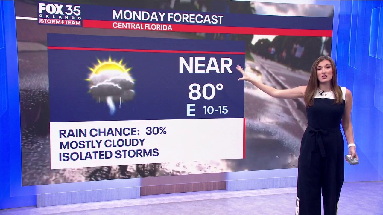
As we move into the new work week, temperatures will be heating back up, with a few chances of rain along the way. For Monday specifically, plan for a 30% chance of scattered afternoon showers and storms.
While it won't be a washout, isolated to scattered showers and storm chances will stick with us just about every day this week.
Looking ahead
What to Expect:

Temperatures will be back to near normal levels to start the work week, with highs in the low 80s for Monday and Tuesday. By Wednesday, we'll climb into the mid 80s with highs before eventually approaching the upper 80s by Friday.
The Source: This story was written by FOX 35 storm team meteorologist Jessica Dobson on March 29, 2026.