

Orlando weather: Strong winds, rip current risk, and scattered showers move in
Orlando PM Weather Forecast: 40MPH wind gusts this evening
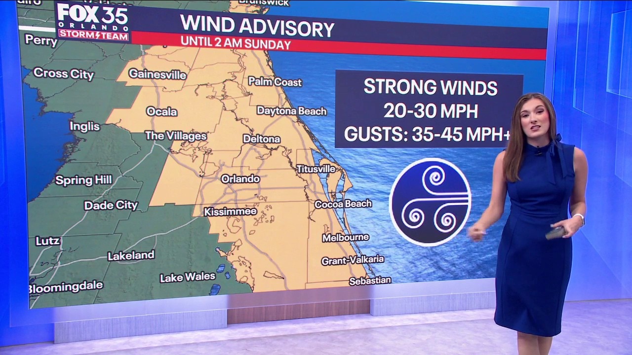
A wind advisory has been issued for the Orlando area, starting Saturday afternoon, March 28. Wind gusts are expected to increase from four to over 40 miles per hour.
ORLANDO, Fla. - Despite the calm and quiet conditions this morning, we're gearing up for a gusty weekend with scattered showers across Central Florida. A cold front will move through the region this afternoon, causing these impacts for the weekend.
Here's what to know
What to Expect:
WIND ADVISORY: In effect until 2am Sunday (will likely be extended) for winds gusting up to 40–45 mph.

Winds will begin to increase during the early afternoon, around 1-2pm, with the strongest gusts happening from 4pm-9pm.
HIGH SURF ADVISORY: In effect 2pm today-2am Monday for large breaking waves up to 7–12 feet.
Dangerous and very rough surf is expected today. Local officials are advising beach goers to stay out of the water. A high risk of dangerous rip currents is expected at all of our East Central Florida beaches. Minor sand and dune erosion is possible as well.

A 30% chance of spotty and scattered showers is expected for this afternoon. Most of these showers will be light overall, but a few steadier showers and downpours can't be ruled out.
Highs today will warm into the low and mid 70s for Flagler and Volusia County. The rest of Central Florida will see highs in the low to middle 80s.
Winds will calm slightly overnight, with gusts up to 20–25 mph. Temperatures will remain mild as lows dip down into the low to middle 60s tomorrow morning. A few showers will stick around throughout the night as well.

What will the weather look like tomorrow?
What to Expect:
We kick off the workweek on a warm but beautiful note with temps warming even more on Monday.
Readings are expected to climb back into the middle 80s with some isolated spots possibly sneaking into the upper 80s.
A few more clouds are on the table, but we'll still see lots of sun. It'll be a touch muggier and milder overnight Monday with lows falling back into the lower to middle 60s.
Looking ahead
What to Expect:
Tomorrow: Strong winds and dangerous surf conditions continue for Sunday as well, with the same hazards still at play. Clouds will stick around tomorrow along with a slightly lower chance of rain at 20%.
Next week: Daily rounds of very isolated afternoon showers and downpours will stick around the majority of the work week. Temperatures will rebound quickly as well, as highs warm back into the low 80s for the start of the work week and will eventually reach the mid to upper 80s by Friday.
The Source: This story was written by FOX 35 storm team meteorologist Jessica Dobson on March 28, 2026.