

Orlando Weather: Hot temperatures to stretch into the weekend

Orlando PM Forecast: April 20, 2024
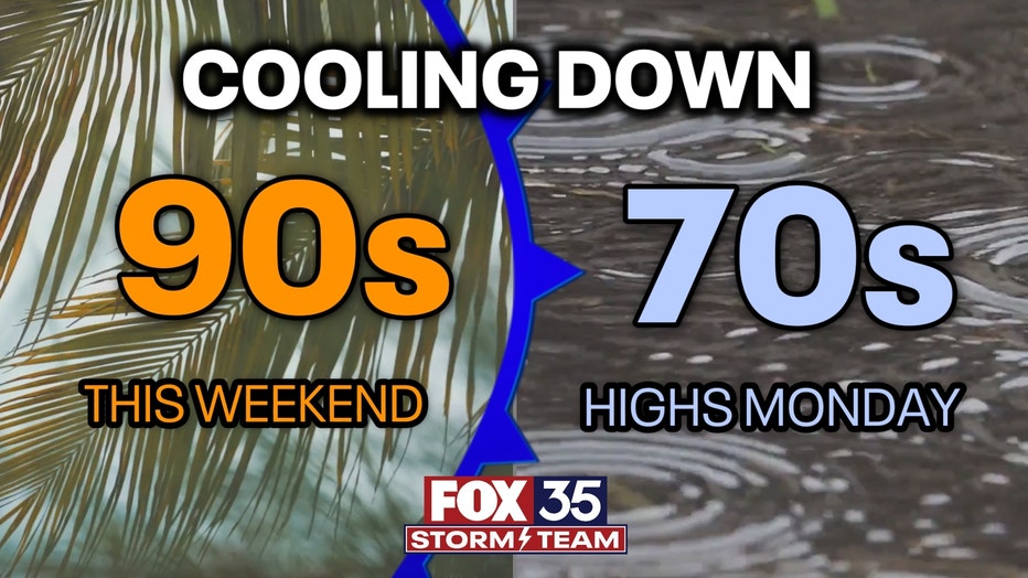
Sunday will be another warm day as a front comes through on Monday bringing some changes
Hot temperatures will be the big story of the weekend across Central Florida.
Another mild night under mostly clear skies. Patchy, dense fog could form in inland areas along and west of I-4 early on Sunday so drive carefully if you are out the door then. Sunday will be our final warm day before a cold front brings us back down early next week.
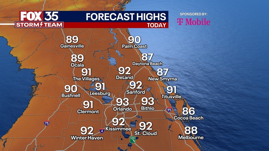
Under partly cloudy skies, highs will reach the upper 80s to near 90 in most places with a breezy SW wind. Rain is unlikely, but an isolated shower can't be ruled out along the coast if the seabreeze is able to push inland.
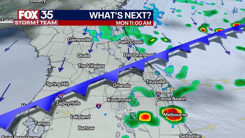
MONDAY: The front is expected to push into North Central Florida in the morning on Monday and bring a chance of scattered showers. A few storms may develop along this front during the peak heating of the day over Central Florida.
For now, a severe risk exists from Lake and Volusia County and points southward. Strong winds and hail would be the main threats. Rain totals looks modest with most under .25". Rain should come to an end by the evening with the front to our south.
Temperatures will be cooler thanks to clouds and rain with highs only into the mid to upper 70s for most. We will return to more seasonable weather the rest of the week as temperatures slowly rise again.