

Orlando weather: Heavy rain, storms move in to conclude the weekend
Orlando AM Weather Forecast: Rain chances on the rise Sunday, holding into the workweek
After a drier Halloween, a disturbance is moving in, bringing more numerous downpours and a few storms. Meteorologist T.J. Springer has the timeline and when more comfy, drier air builds in.
ORANGE COUNTY, Fla. - The weather script flips Sunday as a surge of tropical moisture streams into Central Florida! That persistent easterly breeze off the Atlantic along with an upper-level disturbance swinging in from the west, leads to a damp, dreary Sunday.
SOAKING RAIN AND STORMS TODAY, LINGERING INTO MONDAY
Widespread showers and embedded thunderstorms will continue to push ashore and sweep across the peninsula today into tonight. Rain chances will sit high at 70–80% for most of Central Florida, with the steadiest and heaviest downpours setting up from the Orlando metro down Space Coast.
These fast-moving bands will pack torrential tropical downpours capable of dropping a quick 1 to 3 inches of water, leading to localized street flooding in low-lying and poor-drainage spots. We’ll keep that unsettled, soggy pattern rolling into Monday morning with 60–70% rain chances before drier air gradually starts eating away at the coverage by Tuesday.
RAIN-COOLED CONDITIONS SUNDAY, MUGGINESS HOLDS
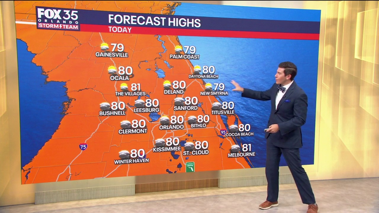
The thick cloud cover and widespread rain will keep afternoon temperatures in check today. Highs will only reach the upper 70s to around 80° across the Orlando metro with coastal communities also holding near 80° under that direct onshore flow.
Even with the cooler daytime numbers, dew points remain elevated in the low 70s, keeping the air humid. Overnight lows tonight won't budge much, bottoming out in the upper 60s to near 70° across the area and our northwest neighborhoods (Marion, Lake, and Sumter counties), while coastal areas hover in the low 70s.
COLD FRONT BRINGS SHOWER CHANCES THURSDAY
After our soggy Sunday and Monday setup winds down, we’ll see rain chances taper some by midweek as the onshore flow relaxes. But don't put the umbrellas away just yet...as eyes shift to Thursday and Thursday night as a cold front approaches.
While this boundary will be weakening as it enters the peninsula, it will tap into leftover moisture to spark another round of a few showers and isolated storms. Behind that front, models continue to show a push of noticeably cooler, drier fall air filtering in just in time for next weekend, and we'll keep tracking those trends closely.
HAZARDOUS SURF, COASTAL FLOODING, AND CHOPPY SEAS
Marine and coastal hazards remain a major concern along the Atlantic coast. A Small Craft Advisory remains in effect through Tuesday morning, with east winds sustained at 20–25 mph driving big waves of 6 to 8 feet nearshore and up to 9 to 11 feet offshore.
A High Surf Advisory is in effect as well through 7 PM Monday. Along area beaches, a High Surf Advisory and Coastal Flood Advisory remain posted through this evening. Breaking waves of 5 to 7 feet, minor beach erosion around high tide, and a HIGH risk of life-threatening rip currents will persist. Swimmers and surfers are strongly urged to stay out of the water.
TRACKING THE TROPICS
The Atlantic basin remains tranquil close to home. The National Hurricane Center expects no tropical cyclone development across the Gulf, Caribbean, or Atlantic over the next 7 days. Pockets of dry air and unfavorable upper-level winds across the deep tropics continue to suppress any organized systems.
There are zero tropical threats to Florida or the U.S. coastline, but the Storm Team will continue to monitor closely.
The Source: This story was written based on information provided by FOX 35 meteorologist T.J. Springer on November 1, 2026.