

Southwest winds push heat, rain, and storms through Central Florida

Weather Report: June 21, 2021
FOX 35 Storm Team Chief Meteorologist Jayme King gives the latest on the weather in Central Florida.
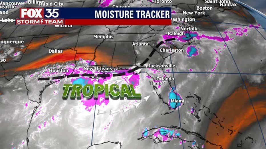
Orlando, FL - Tropical moisture is laden across Central Florida to kick off this new work week ahead.
Tropical Storm Claudette will exit the Carolinas on Monday, heading out into the open Atlantic.
TRACK THE TROPICS: Visit the FOX 35 Storm Team Hurricane Center for the latest tropical weather outlook and more
Behind Claudette, a front will close in on Florida and this feature will bring local winds around to the southwest. Wind flow will help to increase moisture and the rain chances will follow close behind.
Expect hot, steam bath conditions Monday afternoon as highs reach into the lower 90s.

Southwest wind will help push the heat and humidity all the way to the coast this afternoon. Factor in the humidity and you have a heat index – also known an s the "feels like" factor -- around 103 degrees at its peak. Hydration and rests in the A/C are advised if you plan on being outdoor at any point.
WEATHER ALERTS: Download the FOX 35 Storm Team Weather app for live radar, severe weather alerts, and daily forecast reports on your phone
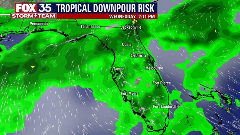
After 2 p.m., skies will begin to trend active as rain chances rise.
Coverage will hang between 60 to 70 percent during the peak of activity that will come by late afternoon and early evening. Storm threats will include very heavy tropical downpours, lightning, and gusty winds. The severe threat looks very low at this time.
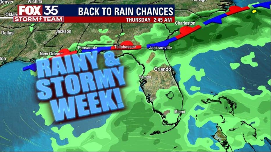
The risk of tropical downpours will remain for much of the week ahead.
Forecast models are painting a rain-soaked outlook through Wednesday. Most of the storms will remain below severe limits with the main issues continuing to be the heavy rain, lightning, and winds.
The FOX 35 Storm Team will track these showers and storms live all week long. Stay tuned!