

Front to bring rain to Central Florida, cooler temperatures to follow after

Weather Report: October 24, 2021
FOX 35 Storm Team Meteorologist Allison Gargaro gives the latest on the weather in Central Florida.
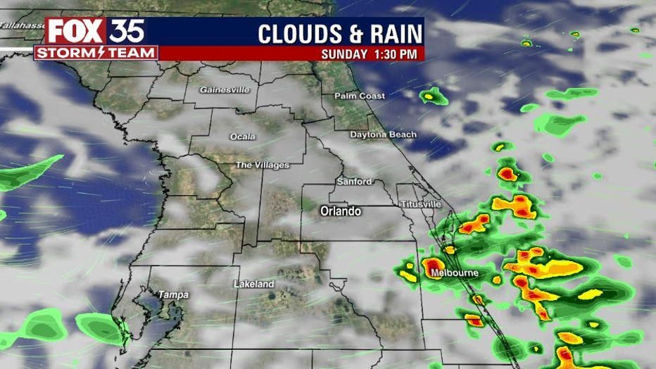
ORLANDO, Fla. - Sunday is off to a cloudy start across the Florida peninsula.
There is a stalled front over South Florida that will slowly move north on Sunday, bringing rain with it. The shower activity will start along coastal Brevard County around 11 a.m., then move north, and across the interior by 4 p.m. and continue into the evening hours.
Brief heavy rain and a few isolated lightning strikes will be likely. These showers will likely linger into the early morning hours on Monday.


WEATHER ALERTS: Download the FOX 35 Storm Team Weather app for live radar, severe weather alerts, and daily forecast reports on your phone
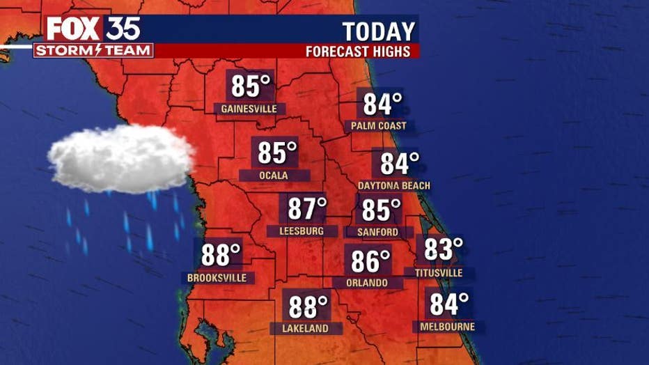
Due to the clouds and rain, afternoon temperatures on Sunday will be a few degrees below what we felt yesterday. The interior will be in the mid to upper-80s, and low to mid-80s along the coast.

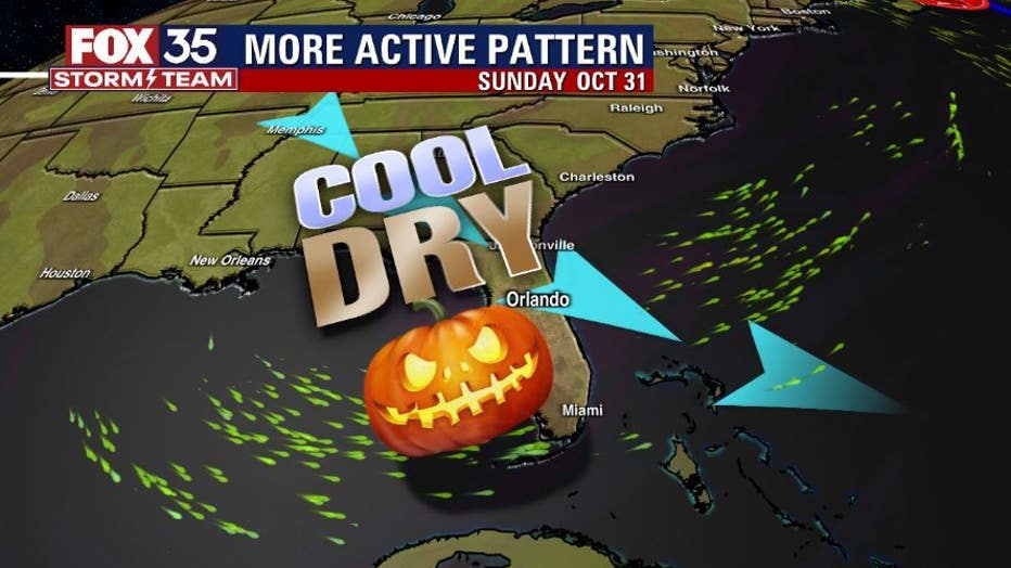
A look ahead, Tuesday and Wednesday will remain dry and warmer, but the weather will change on Thursday. Our next cold front will sweep across Florida on Thursday, causing heavy rain and thunderstorm activity.
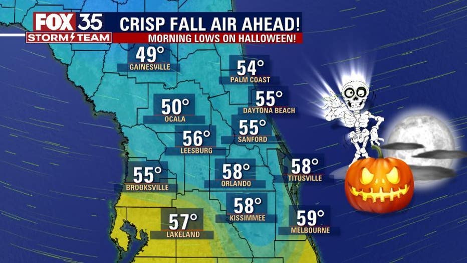
Once the front clears, much drier air and cooler temperatures are expected, just in time for Halloween weekend. Wake-up temperatures on Halloween will be in the 50s across Central Florida.
You can depend and trust the FOX 35 Storm Team to bring you the latest weather updates.
Watch FOX 35 Orlando for the latest Central Florida news.