

Christmas chill looks to target Central Florida!
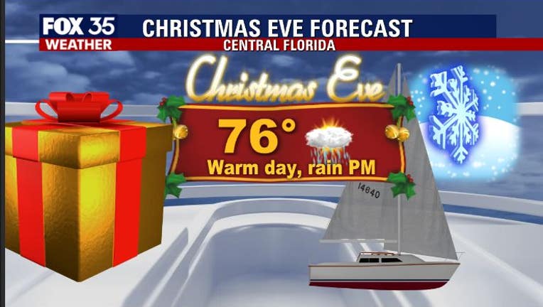
Orlando, FL - Cold weather lovers across Central Florida will absolutely be head over heels with the chilly Holiday outlook! A strong front will approach the area during the day on Thursday, Christmas Eve. The front will turn our winds to the South helping to warm things up and draw in some moisture from the South. This means high temps on Thursday afternoon will soar well into the warm 70s, rain chances will be on the rise for Thursday afternoon. Coverage looks to be in the 60% range or so, a few strong storms could be possible.
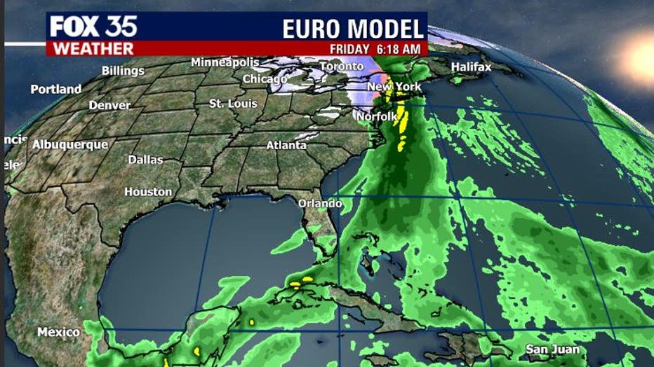
Latest forecast modeling shows the surge of Christmas Eve wet weather wrapping up in the evening, moving well to the South by Christmas morning. As the front moves through Thursday evening, our local temps take a dive. It's during this time that a very chilly airmass moves into Florida from the North.
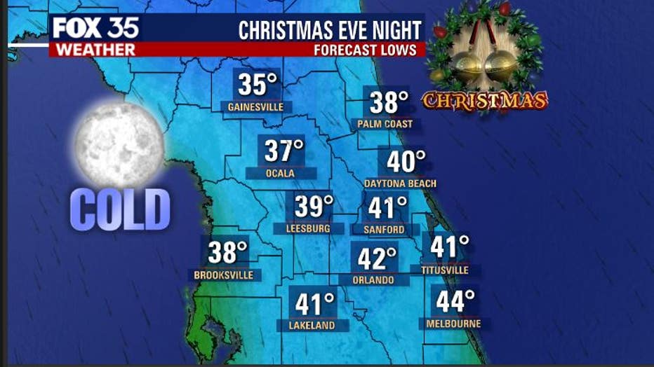
A look at temps late night Christmas Eve into early Christmas morning reveals 30s and 40s areawide. Breezes could be a bit elevated during this time making things feel much cooler overall. Expect clear skies to accompany the chill heading into Christmas morning.
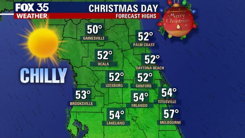
Christmas day temps won't budge a whole lot. Despite full ,bright Central Florida sunshine, we're stuck in the 50s all day long! Looks like the chill sticks around over night Friday and into the Holiday weekend. Keep those jackets and sweaters handy, you're going to need them! Have a safe Holiday and trust FOX 35 Weather for all of your weather needs!