

TIMELINE: Showers continue for Orlando, Central Florida through Thursday evening

Weather Forecast: March 24, 2022
The weather in Orlando and Central Florida will remain wet through the overnight hours with a chance of rain continuing through mid-morning.
ORLANDO, Fla. - The FOX 35 Storm Team continues to monitor showers associated with a cold front that is passing over Florida tonight. Thursday is a FOX 35 Storm Alert Day.
There is a possibility for severe weather this evening though most significant threats have subsided.
Download the FOX 35 Storm Team weather app to receive severe weather alerts sent directly to your phone.
THURSDAY NIGHT
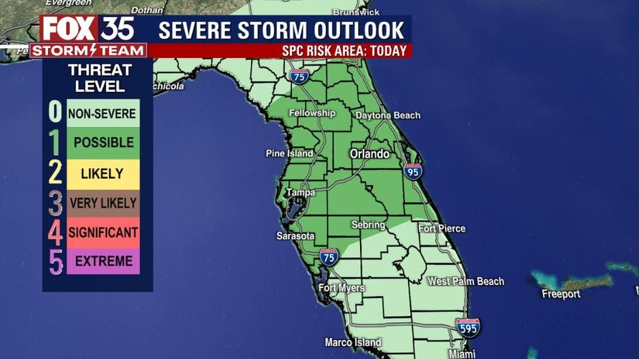
The cold front driving the rain chances is currently located over Central Florida. Areas behind the front will see cooler temperatures. The area still remains in a "LEVEL 1" possible threat for a few strong to locally severe storms.
Isolated, damaging wind gusts, small hail and lightning strikes will remain the primary issues in the stronger storms. The bulk of the action came around noon with tornado warnings issued in Volusia County. Skies remain active into the evening hours with coverage easing up after 5 p.m. Showers will remain possible into the late night hours and much of the rain will be out of the viewing area by early Friday.
DOWNLOAD: FOX 35 NEWS APP | FOX 35 STORM TEAM WEATHER APP
FRIDAY AND THIS WEEKEND
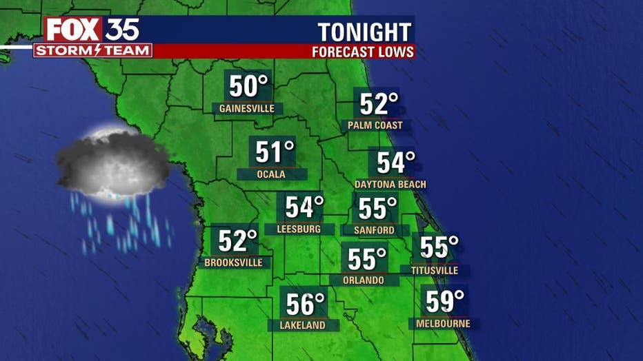
Skies will continue clearing through Friday morning, paving the way into some gorgeous weekend weather and sun filled skies. Lows tonight will fall into the cool 50s as we rise up early Friday morning.
You might want to make those outdoor plans for Saturday and Sunday. Highs will settle in the 70s both days and sunshine out in full force! Enjoy!
Download the FOX 35 Storm Team weather app to receive severe weather alerts sent directly to your phone.
Click here for the latest Central Florida news, Florida stories and local headlines.