

Timeline: More storms moving through Central Florida on Saturday

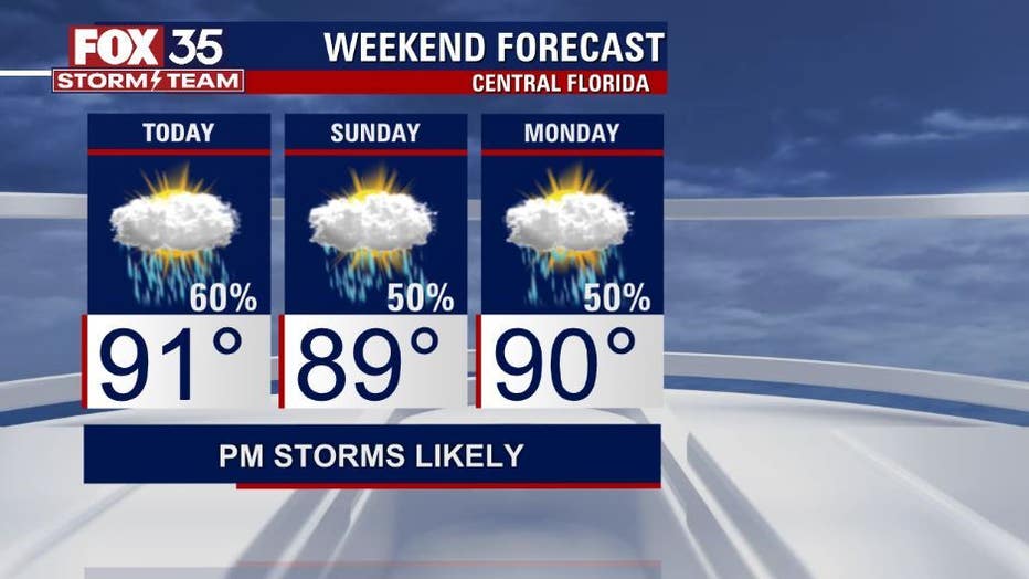
ORLANDO, Fla. - We have made it to the weekend and hot and humid conditions with afternoon/ evening storms will be the story.
We have a nice start to your Saturday with just a few clouds in the sky. There will be an increase in cloud cover through lunchtime, and by the early afternoon and evening hours, sea breeze storms get active.
RELATED: Forecasters increase prediction for number of hurricanes in 2021 season
You can expect storm coverage to be at 60% across our viewing area. Storms will be moving from west to east, bringing the chance for heavy downpours, gusty winds and frequent lightning.
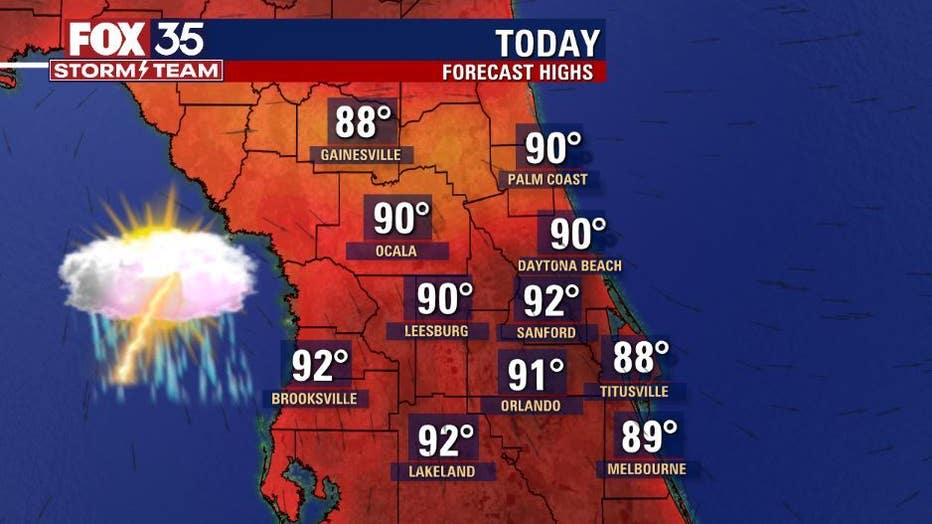
Temperatures will be heating up to the upper-80s along the coast and low-90s across the interior this afternoon.
Sunday will be more of the same, hot and humid, but storms will be moving from east to west. You can expect a 50% chance for afternoon storms, but the collision of the sea breezes will be on the west side of the peninsula.
Make sure you stay hydrated and pack your sunscreen as you head out the door, heat index readings will be in the upper-90s across the region.
Remember to download the FOX 35 Storm Team weather app to track the live radar directly on your phone.
Watch FOX 35 News for the latest weather updates.