Central Florida rain chances drop slightly on Thursday with soaring temperatures

Weather Forecast: July 20, 2022
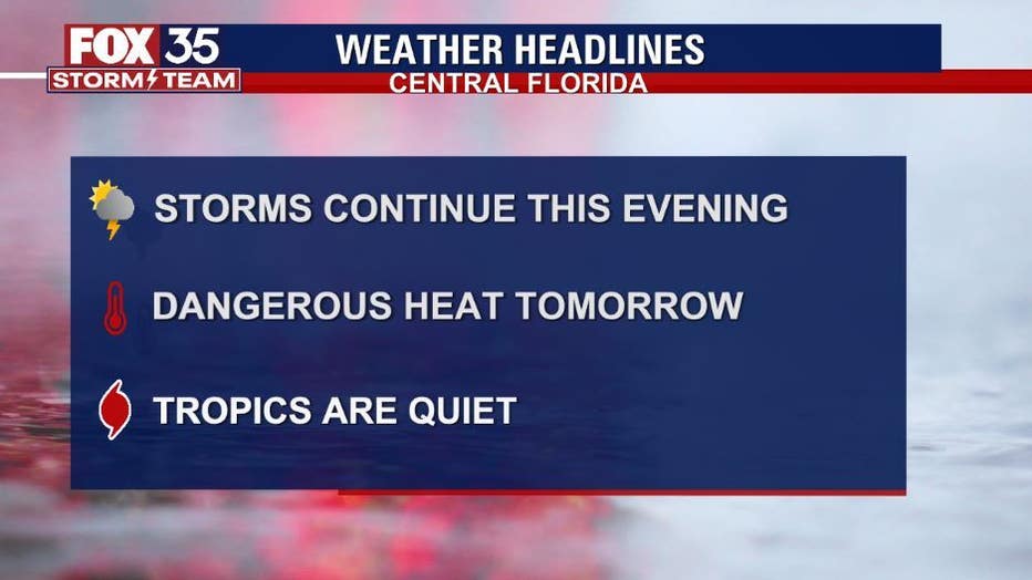
Orlando and Central Florida will enjoy a break from widespread showers as dry air is setting up over the region for the next day but storms are still likely along the eastern portions of our viewing area.
ORLANDO, Fla. - WHAT IS THE WEATHER FORECAST FOR TODAY AROUND ORLANDO?
Tonight’s forecast low: 76 degrees
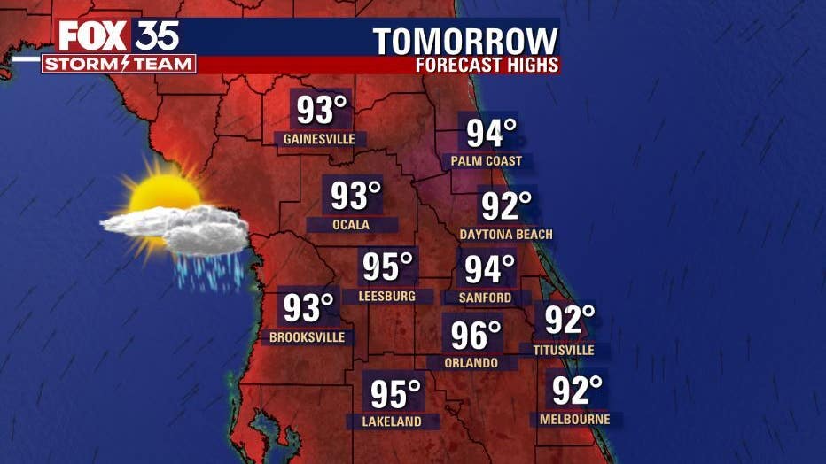
Tomorrow's forecast high: 96 degrees
MAIN WEATHER CONCERNS:
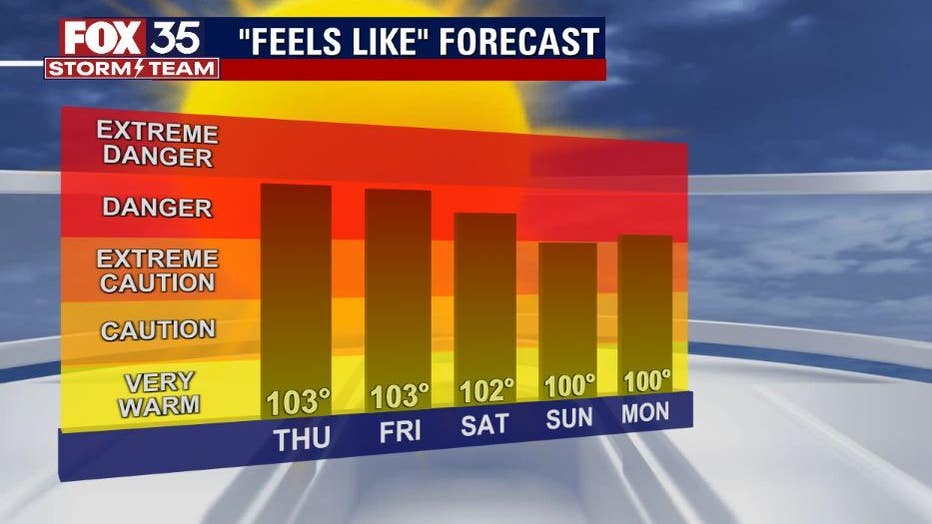
Temperatures will be in the mid to upper-90s across the interior with feels like temperatures soaring to the triple digits. Showers and storms will be at 30% coverage on Thursday afternoon. The west coast sea breeze will be dominating, so shower and storm activity will move east northeast. You can expect frequent lightning, gusty winds up to 40 mph, and heavy rainfall within these storms.
RELATED: 2 people struck by lighting in Florida, both taken to hospitals, officials say
WHAT IS THE WEATHER FORECAST FOR WALT DISNEY WORLD, UNIVERSAL, AND SEAWORLD?
It will be another hot day at the theme parks on Thursday. Afternoon highs will be near 96 degrees with a lot of sunshine. Keep your sunscreen handy. Showers and storms are possible, and the rain will start around 3 pm and will last for a few hours.
WHAT IS THE WEATHER FORECAST FOR THE BEACHES IN CENTRAL FLORIDA?
The shower and storm activity will be moving from west to east across the Florida peninsula, so if you are headed to the Atlantic beaches tomorrow, it will not be until late afternoon when the storms arrive. Lightning will be frequent, so when thunder roars, go indoors. There is a moderate risk of rip currents.
LOOKING AHEAD:
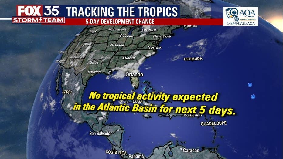
Rain chances will drop to 30% coverage on Thursday and 40% on Friday with temperatures heating up to the widespread mid to upper-90s. Feels like temperatures soar to the triple digits. The tropics remain quiet with no tropical activity expected within the next 5 days. If anything changes the FOX 35 Storm Team will be the first to let you know.