

Rain and storms in the forecast for Central Florida

ORLANDO, Fla. - The warm, steamy, wet weather trend continues for Central Florida on this Tuesday.
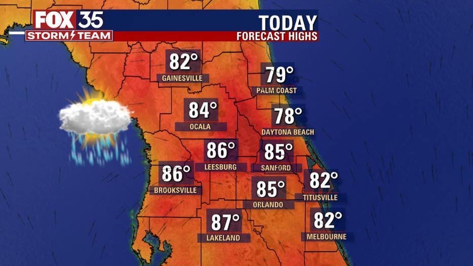
While a few showers will be possible this morning, rain coverage eases enough to allow high temperatures back into the widespread 80s all across the viewing area. Skies will feature a lot of clouds with an uptick in rain coverage after 1 p.m. today.
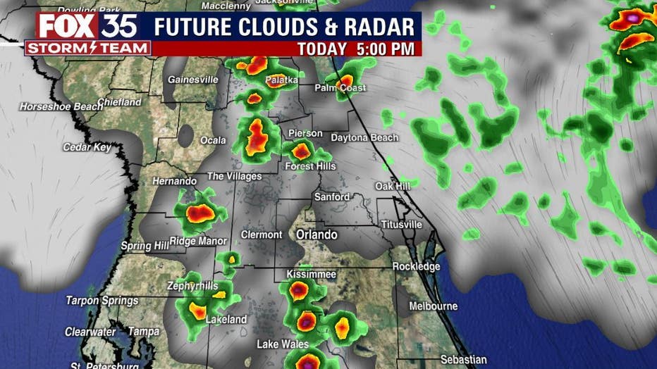
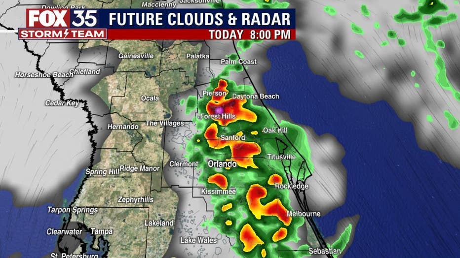
Forecast models show this trend building into the afternoon hours with a peak in coverage coming for the evening hours. The pattern looks strikingly similar to just yesterday. While much of the rain will develop as mainly showers, a few full blown thunderstorms will be possible yet again.
DOWNLOAD: FOX 35 NEWS APP | FOX 35 STORM TEAM WEATHER APP
Stronger storms will produce heavy rainfall, cloud to ground lightning strikes and gusty winds. Rainfall forecasts keep those drops plentiful all the way into late week.
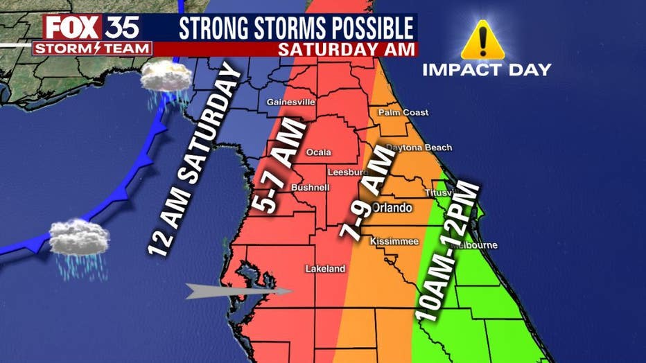
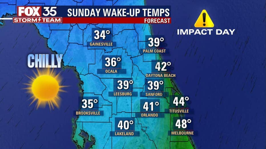
The grand finale comes this weekend and we've declared both Saturday and Sunday FOX 35 WEATHER IMPACT DAYS. A strong cold front will enter the state on Saturday morning and could have a few strong storms in tow. While the arrival times of the storms will likely change, it appears that Saturday morning could be quite active across the viewing area.
As the front sweeps through, the area will receive quite an injection of chilly air. Sunday will be our second FOX 35 WEATHER IMPACT DAY as we wake up to widespread 30s and 40s. Highs Sunday struggle to hit the mid-60s.