

Orlando weather: Temps heating up in Central Florida before storm chances return
ORLANDO, Fla. - Tropical Storm Bertha continued moving west Thursday after making landfall in Louisiana, bringing heavy rain, rough surf and gusty winds to parts of the Texas Gulf Coast.
Forecasters expect the system to weaken into a post-tropical low by Friday as it moves inland over south-central Texas.
Below normal rain chances
Central Florida is expected to remain mostly dry through the end of the workweek as Bertha pulls tropical moisture westward.
Only a 10% of afternoon and evening showers and storms are expected.
High temperatures will climb into the 90s again on Friday, with lower humidity than is typical for this time of year.
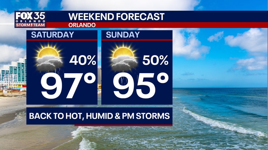
Rain chances will increase over the weekend as moisture returns to the region. Scattered afternoon showers and thunderstorms are expected Saturday and Sunday, with humidity rising and heat index values climbing back into the triple digits. Forecasters expect a more typical summertime pattern of daily afternoon and evening storms to return next week.
The Atlantic sea-breeze will help push any showers that are able to form inland, west of Orlando in Sumter, Lake, and Marion counties.
How hot will it get?:
Since we're drier, this will allow temperatures to heat up even more. Plan for highs to soar into the mid 90s inland and low 90s at the coast.
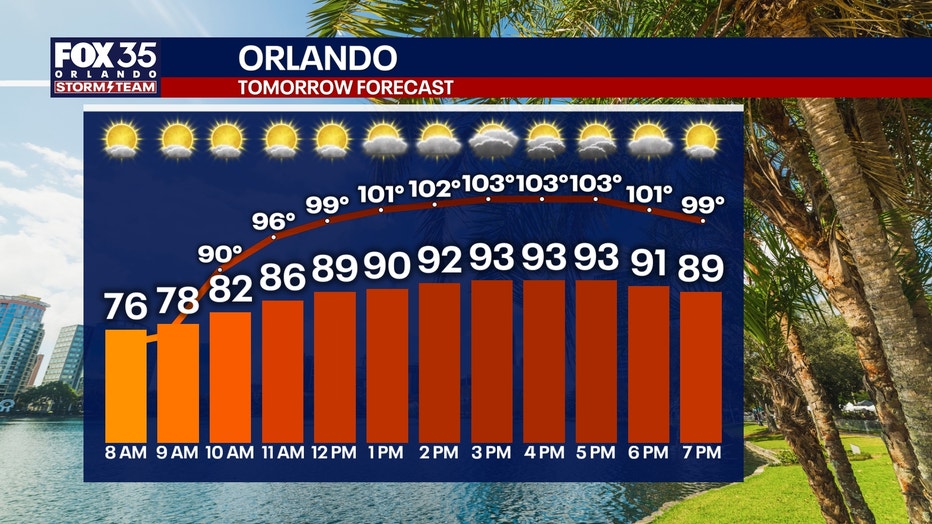
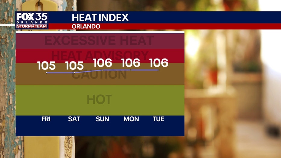
Increasing temperatures and storm chances this weekend
Temperatures will heat up into the mid and upper 90s through the weekend, with the hottest day being Saturday as Orlando reaches a high of 97°.
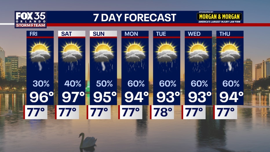
Moisture will steadily build back in for the weekend as well. This will help to bump up our shower and storm chances to a 50% and 60% chance on Saturday and Sunday.
A more typical rainy-season pattern unfolds next week as well, with daily afternoon and evening downpours and storms taking shape.
The Source: The information in this story was provided by the FOX 35 Storm Team.