

Orlando weather: 4-day heatwave to push temperatures into 90s
Orlando PM Weather Forecast: Wind brings low 90-degree temps; incoming storms
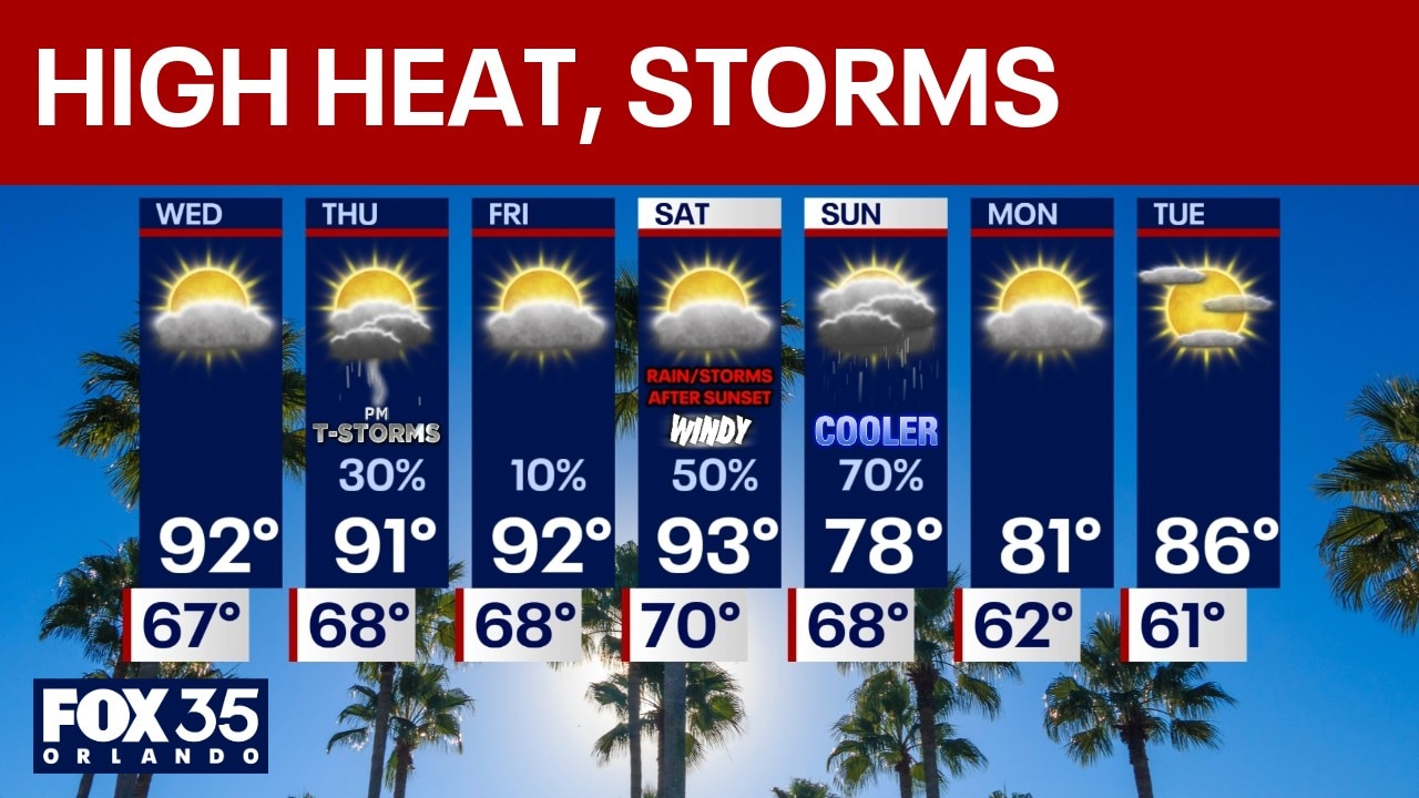
As temperatures rise into the low 90s through Saturday, Central Florida can also expect to experience storms, which will bring a big drop in temperatures.
ORLANDO, Fla. - It is going to feel like a summer heatwave for the next four days as afternoon highs are forecast to be in the 90s for much of Orlando and Central Florida. Our next temperature drop isn't forecast until Sunday, following thunderstorms and rain.
Tonight Forecast
A warm night with temperatures only falling into the 60s and some fog forming late at night into early Wednesday morning.
Wednesday's forecast
Mostly sunny with hotter conditions as winds come around to the SW, everyone gets several degrees hotter. Low 90s inland and upper 80s at the beaches.
Orlando weather forecast for the rest of the week
Partly to mostly sunny through Friday with 90s inland and upper 80s at the East Coast beaches. While above average, these temperatures are not record setting in any locations.
On Thursday, thunderstorm chances increase for those northeast of Orlando. Some of those could be severe. Best chances for rain are those who live in Alachua, Marion, Putnam, St. Johns, Flagler, and Volusia counties.
Friday should be mostly dry and hot.
Saturday, is a WINDY day of weather. SW winds will gust 30-40 MPH all day ahead of an approaching front.
Saturday night into Sunday there will be a front passing by with rain, showers, and storms. The timing the front comes through is still very much uncertain.
Depending on the timing of the front coming by, there may be some strong or severe storms, but that is too far out to know with any clarity for now. It does not look like it will rain all day Sunday, maybe some dry time towards later in the day with much cooler temps.
A gradual rebound next week as sunshine returns.
The Source: This story was written with information from the FOX 35 Storm Team.