

Orlando weather: Storms expected to drench Central Florida this weekend
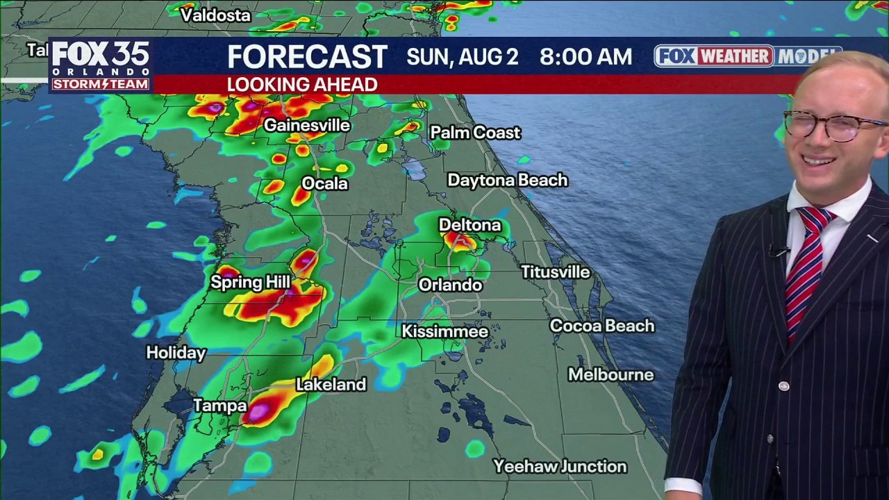
Orlando Weather Forecast: Tracking weekend storms
Some showers and storms Saturday but a lot of them around on Sunday. FOX 35 Storm Team Senior Meteorologist Noah Bergren is tracking the weekend rain timing.
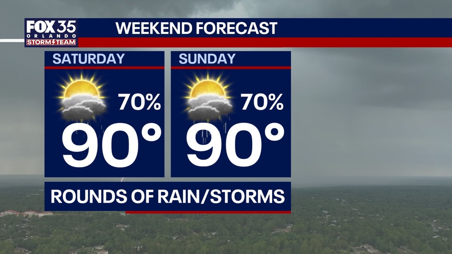
ORLANDO, Fla. - Central Florida is expected to see scattered to widespread afternoon and evening showers and thunderstorms this weekend.
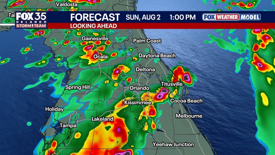
The greatest chance of rain will be on Sunday.
How hot will it get?:
Saturday will bring scattered storms as humidity increases, with afternoon heat index values ranging from 98 to 104 degrees. Most storms are expected to move east and are not forecast to be particularly intense in the Orlando area.
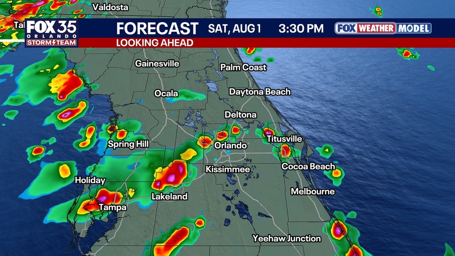
Rounds of heavy rain into the weekend
Rain coverage is expected to increase Sunday, with some storms capable of producing strong wind gusts and small hail. Forecasters said Sunday is likely to be the wetter and cloudier day of the weekend.
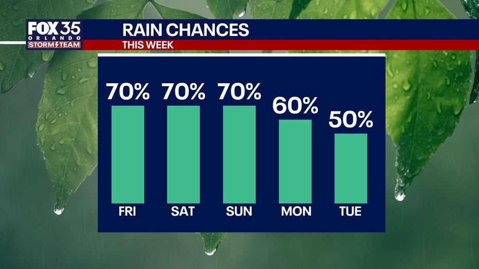
Rain chances are expected to decrease next week as a high-pressure system builds over Florida.
Temperatures are forecast to climb back into the mid-90s by the end of the week, while a shift in wind direction could push most afternoon storms toward the Gulf Coast.
Rainfall totals:
On average, 2 to 4 inches will be possible by the end of the weekend across Central Florida.
A more typical pattern returns next week with daily rounds of sea-breeze-driven afternoon downpours and storms.
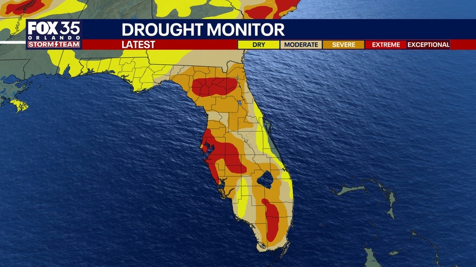
Drought conditions still persist
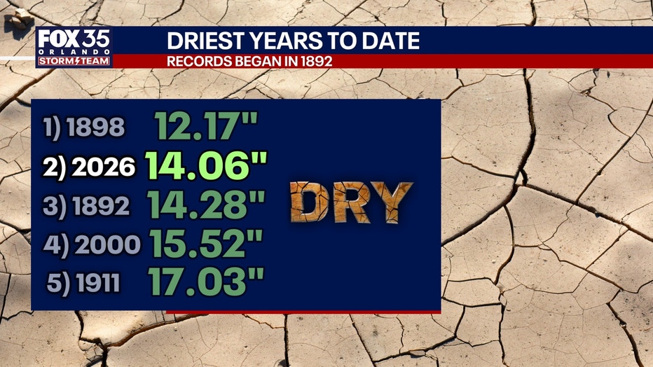
Despite the expected rainfall, Orlando remains well below normal for precipitation this year. The city has recorded a rainfall deficit of about 15 inches in 2026, making it the second-driest year on record to date.
The summer has also been one of the hottest on record in the Orlando area, with temperatures reaching at least 95 degrees on 36 days, ranking as the third-hottest summer recorded so far.
Near normal highs into early next week
Thanks to the rain and clouds rolling in, high temperatures will be lower and closer to normal.
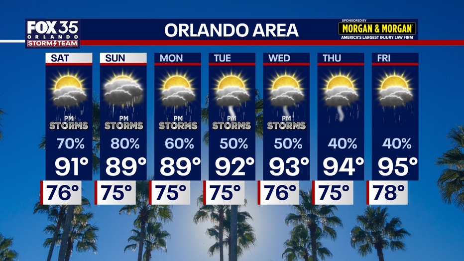
Highs will stay in the low 90s this weekend and into early next week, before highs creep back into the mid 90s.
The Source: The information in this story was provided by the FOX 35 Storm Team.