

Orlando weather: Scattered storms expected again on Tuesday afternoon
Orlando Weather Forecast: Tracking severe storms
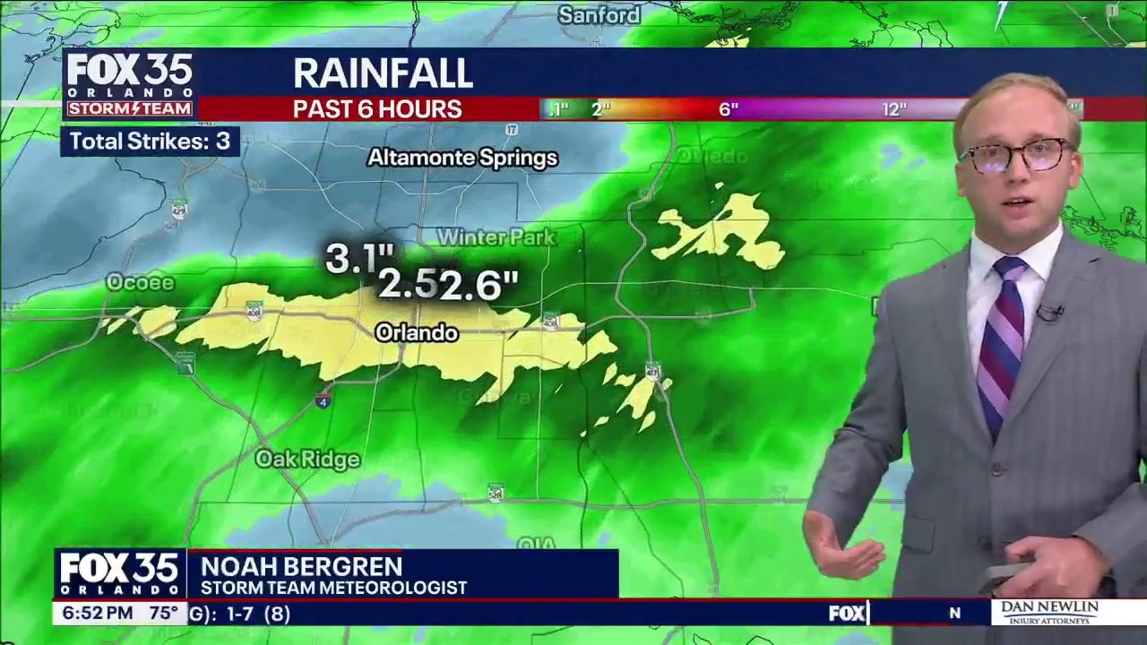
FOX 35 Storm Team Senior Meteorologist Noah Bergren is tracking storms that hit central Florida Monday and a look at Tuesday's storm timing.
ORLANDO, Fla. - Scattered showers and thunderstorms have dissipated.
Another round of storms could produce gusty winds and small hail on Tuesday.
Timeline: When does the rain arrive?
Will will the rain arrive?:
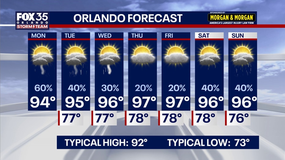
Additional afternoon showers and thunderstorms are expected Tuesday, mainly between 1 p.m. and 7 p.m. A few storms could become briefly strong, but widespread severe weather is not anticipated. High temperatures will reach the low 90s before storms develop.
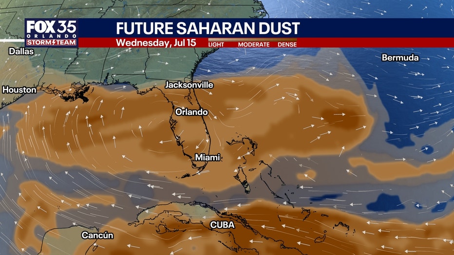
Rain chances will decrease significantly from Wednesday through Friday as Saharan dust moves across the region, creating hazier skies. Forecasters say any storms that develop Tuesday and Wednesday could produce more lightning than usual because of the dust in the atmosphere.
A building high-pressure system will bring another stretch of above-average heat from Wednesday through Friday. Afternoon highs are expected to climb into the upper 90s, with heat index values ranging from 100 to 107 degrees.
Another Saharan dust plume
Another influx of Saharan dust returns this week, helping to bring multiple changes to the forecast this week.
Not only will the dust help bring down our chances of rain by midweek, but it also aids in bringing us vibrant sunrises/sunsets.
The con is the reduced air quality and issues if you deal with respiratory illness or dust allergies. This dust looks to stick around through the end of the week, with some lingering into the weekend.
Another heatwave on the way
As a result of lower chances of rain and storms, temperatures will have more opportunity to heat up.
Afternoon highs will approach the mid and upper 90s for many by Wednesday, Thursday, and Friday of this week.
Once we factor in the humidity, feels-like temperatures could reach a range as high as 103-107°.
The Source: The information is from the FOX 35 Storm Team.