

Orlando weather: Hotter, drier weather midweek before storms return this weekend
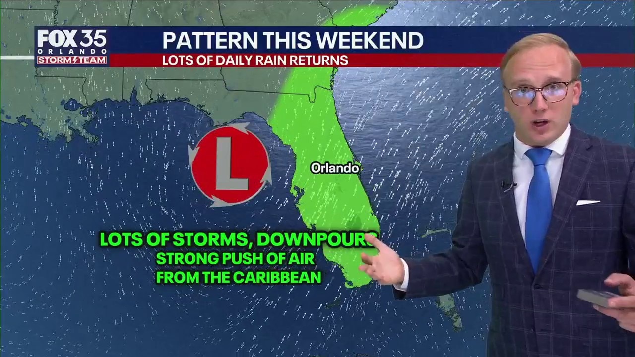
Orlando Weather Forecast: Storms tonight & lots of weekend rains
FOX 35 Storm Team Senior Meteorologist Noah Bergren is tracking showers and storms Tuesday evening, with hotter weather the next few days. This coming weekend, a big jump upwards in the daily rain coverage.
ORLANDO, Fla. - Scattered thunderstorms will continue through the evening across Central Florida before tapering off overnight.
No widespread severe weather expected. Overnight lows will fall into the 70s.
Rain chances drop on Wednesday
How Hot Will It Get?:
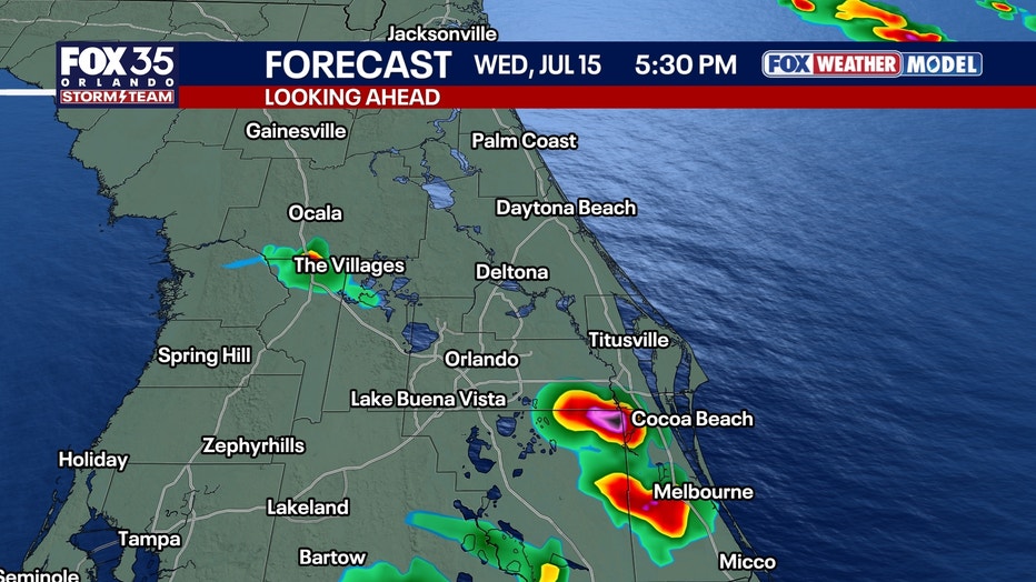
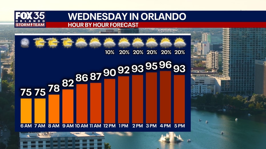
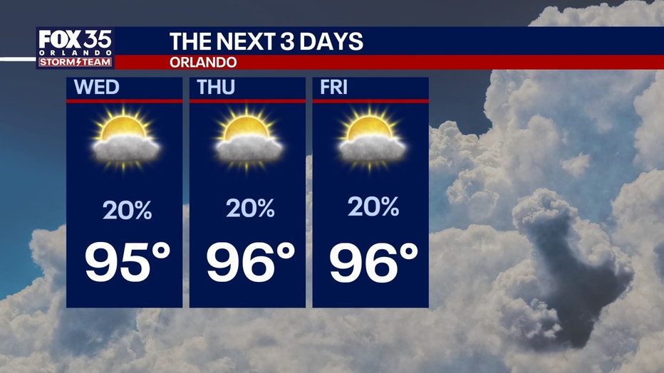
Rain chances will decrease Wednesday and Thursday as drier air moves into the region, allowing temperatures to climb into the mid-90s inland.
CLICK TO DOWNLOAD THE FOX LOCAL APP
While isolated afternoon storms remain possible, coverage is expected to be lower than earlier this week.
Orlando could approach daily record highs, with records of 97 degrees for July 15 and 100 degrees for July 16 and 17.
Rain chances are expected to increase again this weekend as an area of low pressure develops over the eastern Gulf, drawing deep tropical moisture into the Florida Peninsula.
Forecasters expect widespread afternoon showers and thunderstorms Saturday through Monday, with some locations receiving more than 4 inches of rain over the three-day period.
While a tropical system could develop in the Gulf, forecasters say the likelihood remains low and will continue to monitor forecast trends.
Temperatures across Central Florida will reach the low 90s.
Saharan dust filters in
Saharan dust has already started to filter into parts of Central Florida.
This is going to usher in multiple changes to the forecast this week. Not only will the dust help bring down our rain chances by midweek, but it will also aid in bringing us vibrant sunrises/sunsets.
SIGN-UP FOR FOX 35'S BREAKING NEWS, DAILY NEWS NEWSLETTERS
The con is the reduced air quality and issues if you deal with respiratory illness or dust allergies.
This dust looks to stick around through the end of the week, with some lingering into the weekend.
Temperatures heating up
As a result of lower chances of rain and storms, temperatures will have more opportunity to heat up.
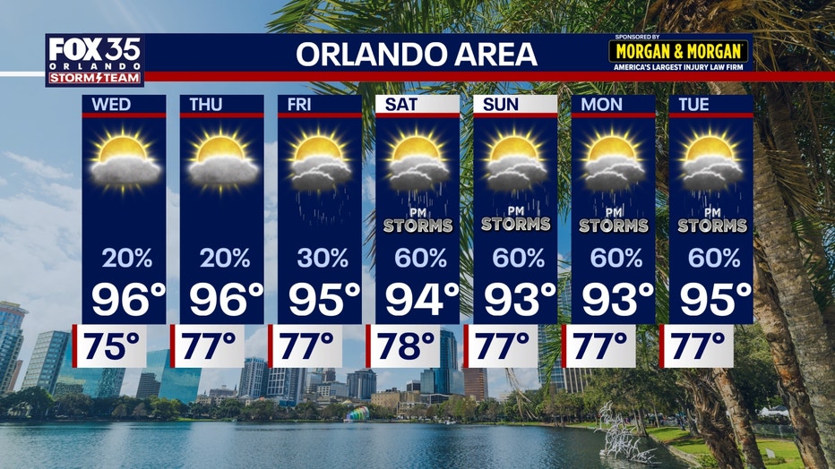
Afternoon highs will approach the mid and upper 90s for many by Wednesday, Thursday, and Friday of this week.
Once we factor in the humidity, the "feels like" temperatures could reach a range as high as 103-107°.
The Source: The information in this story was provided by the FOX Storm Team.