

Orlando rain forecast: Showers, thunderstorms tonight; timeline, main threats

ORLANDO, Fla. - The rainy season continues in Orlando and Central Florida. We're tracking scattered showers and thunderstorms Thursday afternoon and evening, some that could be on the stronger side.
Temperatures stay hot and humid throughout the weekend. Here's the weather forecast for Thursday, Friday, and the upcoming weekend.
Scattered showers and storms this afternoon, evening
Timeline:
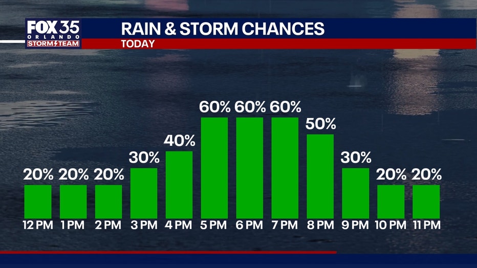
Scattered showers and thunderstorms will increase in the afternoon and evening hours, likely through the Thursday evening commute home.
Timeline: Best rain chances are between 3 p.m. and 10 p.m. Most widespread storms will be between 5 p.m. and 7 p.m. Storms should taper by 9 p.m..
Main storm threats: Gusty winds up to 50 MPH or higher and torrential rain, which could lead to localized flooding or ponding. Remember, turn around, don't drown. Never cross a flooded roadway.
How much rain?
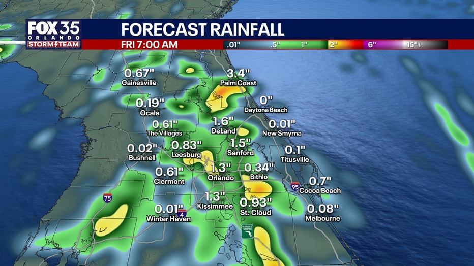
Some areas could see a half inch, but others who see more storms will see 2+" of rain. Some storms could be on the stronger side and will dump a lot of rain over a short period of time. Most of these storms will be over Orlando and east of Orlando.
Weekend forecast: Higher temperatures, lower rain chances
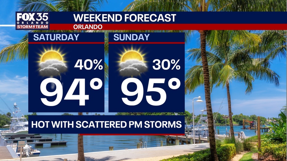
This weekend, high pressure builds, allowing drier air to move in across Central Florida. There will be some scattered showers and thunderstorms through the weekend – higher chances on Sunday, but they will be more isolated.
Temperatures will be in the upper 90s on Saturday and Sunday. Humidity is also high with the heat index – or the "feels like" temperature – in the 100s.
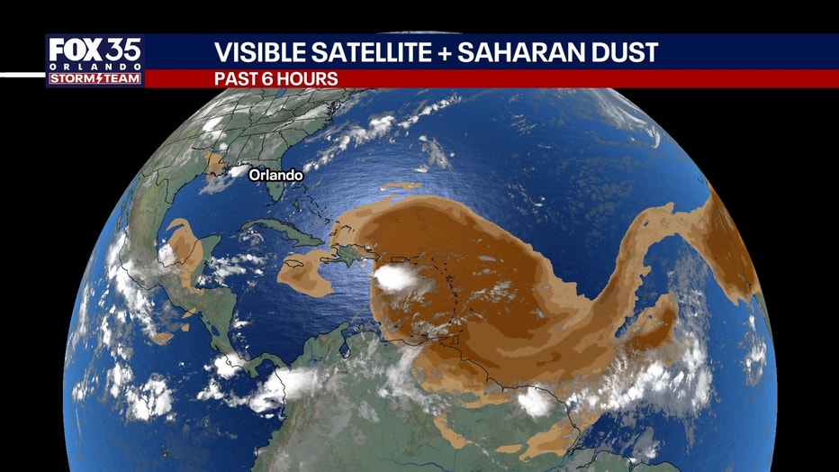
Saharan dust moves in this weekend. Watch for those sunrises, sunsets.
Saharan dust also moves into the Gulf this weekend, bringing drier air. That also means we can expect some stunning sunsets with more of the red hues this weekend.
The Source: The information in this story was provided by the FOX 35 Storm Team.