

Orlando weather: Heat builds across Central Florida as storm chances remain limited
Orlando PM Weather Forecast: Tropical chances in the Gulf, major Orlando heat
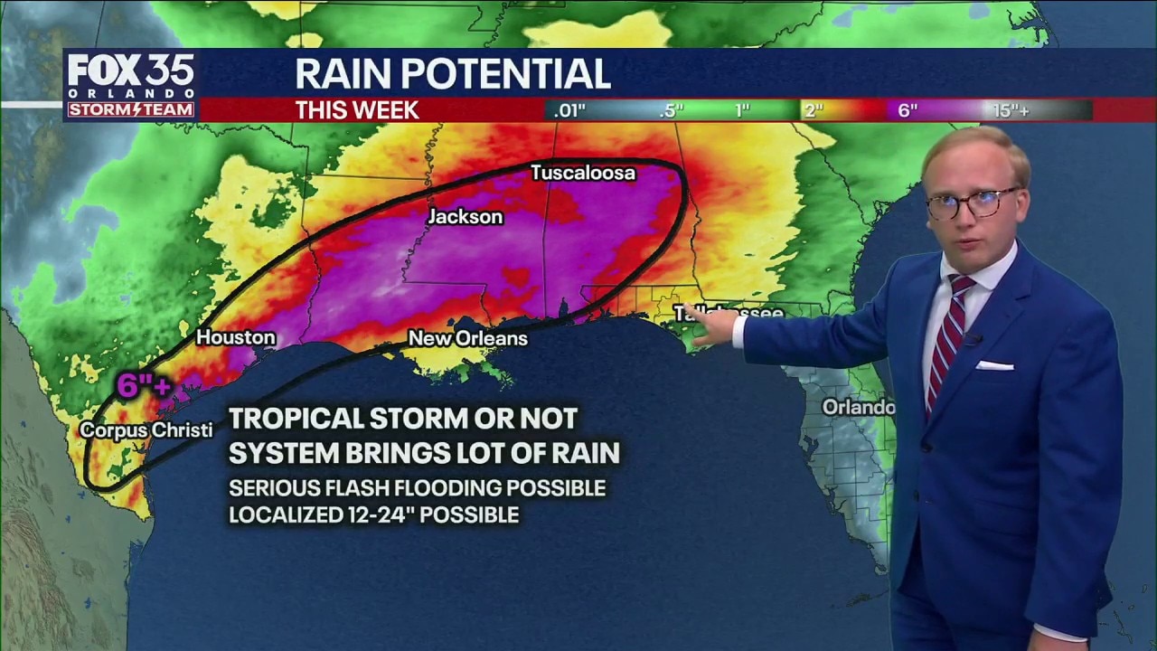
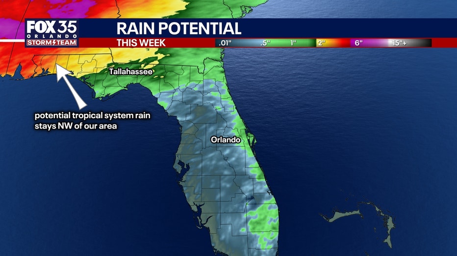
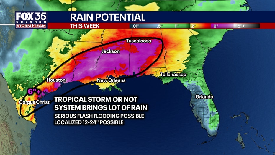
A tropical storm may develop this week in the Gulf, will it impact Florida? FOX 35 Storm Team Senior Meteorologist Noah Bergren is tracking showers and storms the next few days, and when heat index may cross 105 degrees in central Florida.
Scattered showers and thunderstorms moving toward Florida's east coast are expected to diminish by late evening, giving way to a warm, humid and mostly cloudy night.
Tuesday forecast for Orlando
What To Expect:
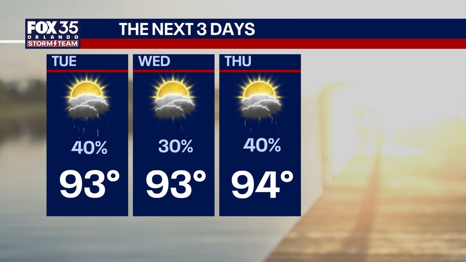
Tuesday will bring a mix of sun and clouds with high temperatures in the low to mid-90s. Heat index values are expected to reach around 100 degrees, while isolated afternoon showers and thunderstorms develop and move eastward, primarily across Brevard, Osceola, Volusia and Flagler counties.
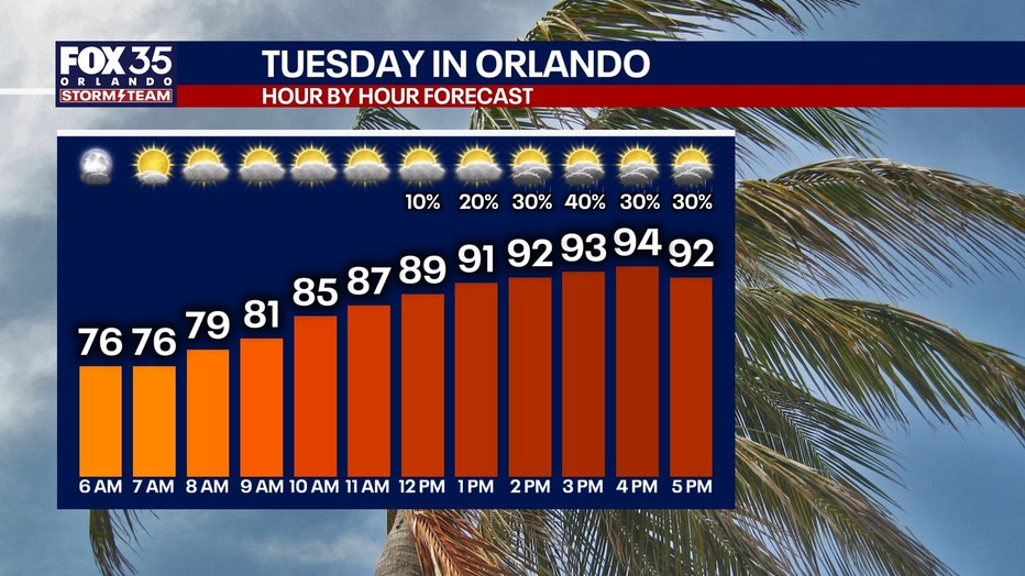
Rain chances will remain relatively low through the workweek, with most activity focused along the east coast. We expect a slight increase in afternoon storm coverage and a modest drop in temperatures heading into the weekend.
Extreme coastal heat index
The hottest weather of the week is expected Wednesday through Friday, when inland temperatures climb into the mid-90s and heat index values peak between 105 and 110 degrees, especially during the afternoon hours.
June 15, 2026 Weather
Looking ahead
Temperatures will soar into the mid 90s, especially by the end of the work week, where a high of 95 degrees is expected Friday in Orlando.
Once we factor in the humidity levels, our heat indices will range from at least 102 to 107 degrees.
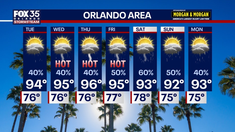
Daily afternoon downpours are likely just about each and every day this week as well. That being said, chances won't be quite as widespread for the first half of the work week. By the end of the week and into the weekend, the sea breeze will move farther inland.
This will give way to higher chances (60%) for Friday and into the weekend.
The Source: Information in this story was gathered from FOX 35's Jessica Dobson.