

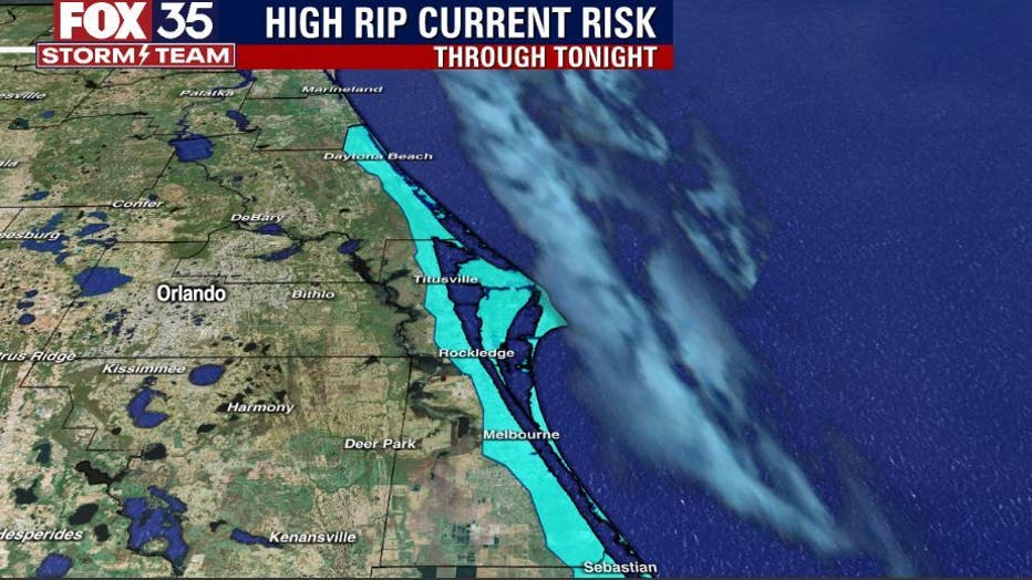
Orlando Weather Forecast: Beautiful beach days this week, but beware of high rip current risk

Weather Forecast: Jan. 17, 2023
Orlando and Central Florida will see gorgeous weather over the next few days with a little patchy fog in the mornings as lows hover in the low 50s. That fog will burn off and highs will reach into the upper 70s. The next rain chance comes on Friday.
LAKE MARY, Fla. - Tonight's low: 52 degrees | Today's high: 73 degrees
Main weather concerns: The weather will be fantastic through Friday. Highs are warmer (70 degrees+) all across the viewing area. Sunshine will be out in full force, breezes light. The next rain chance comes at the start of the weekend.
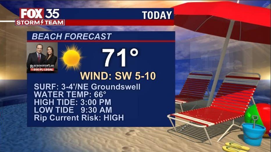
The only concern is the increase in rip current activity at ALL Central Florida beaches. While breezes are super light, a new round of Northeast swell energy has arrived. This wave energy will support dangerous rip current development for much of the day. Surf temps are chilly, generally in the mid-60s for the Northern beaches, closer to 70 degrees South of the Cape. Cooler water temps will keep most out of the water.
On the other hand, wave quality and power is great for surfing, but the FOX 35 STORM TEAM is advising that experienced surfers should only take part.
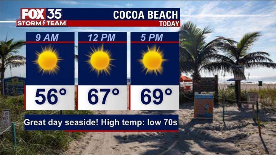
BEACHES: Another nice day at the beaches with highs warming to near 70 at the warmest. Winds will be light, Surf rolls in at 3-4' in Long Period NE groundswell. Rip current risk is high.
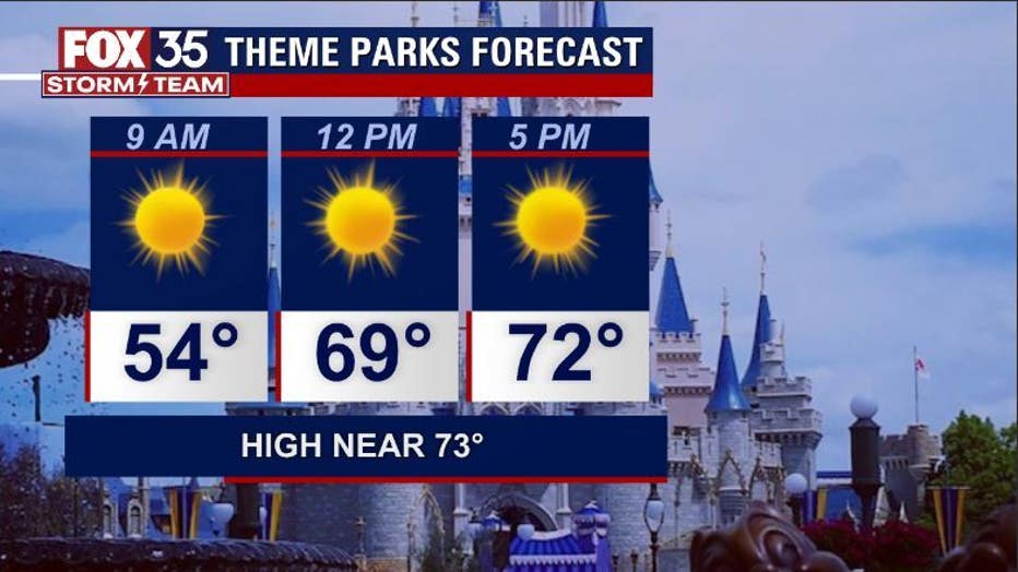
THEME PARKS: Chilly start expected at the attractions, plenty of sun warms things up for the PM with low-mid 70s. Nice day for the attractions.
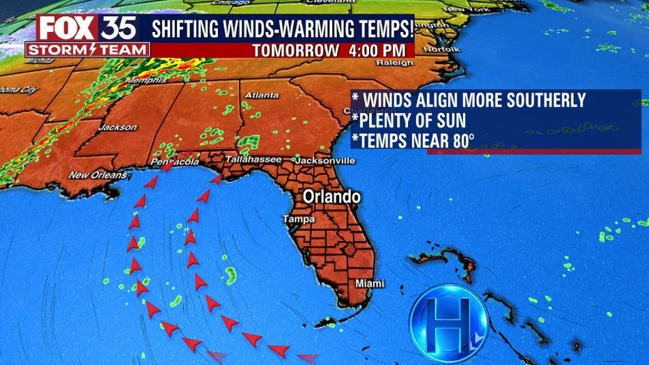
OUTLOOK: We continue our warming ways heading through the remainder of the week. Highs will move into the 80 degree range by Thursday, plenty of sunshine will still be around.
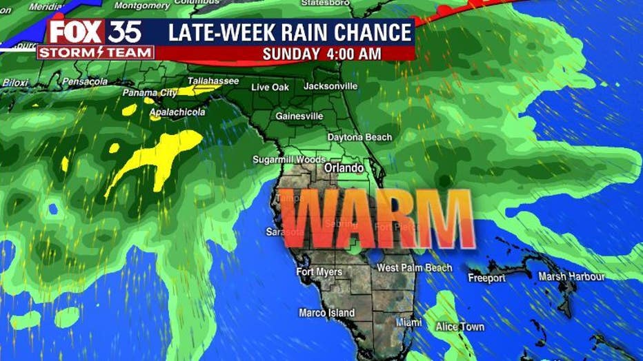
Rain chances increase over the weekend as a series of fronts work through the region.
As of right now, the highest chance for showers and storms looks to reside over Southern Georgia and North Florida-lesser coverage to the South.
This could certainly change so stay with the FOX 35 STORM TEAM for all of your forecast details!