

Orlando weather forecast: Rain chances rise in Central Florida ahead of incoming cold front

Weather Forecast: Oct. 13, 2022
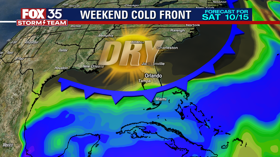
Orlando and Central Florida will see dry air move over the region this weekend. There are still lingering rain chances on Friday. High temperatures will be in the mid-80s.
ORLANDO, Fla. - Tonight's low: 71 degrees | Tomorrow's high: 87 degrees | Rain: 30%
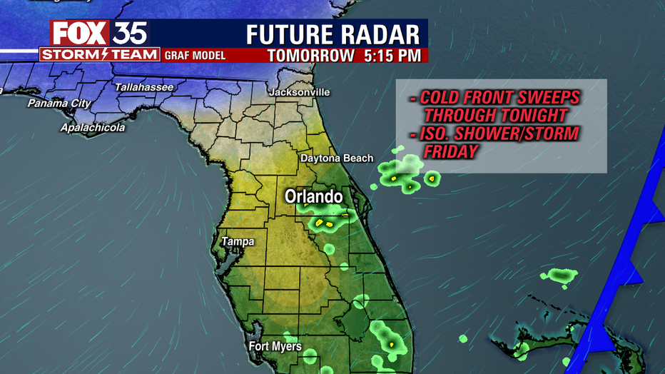
Main weather concerns: A few more showers and storms could linger over Central Florida Thursday evening before moving offshore tonight. The slow cool front will drop south through our area overnight then stall out over South Florida. This may allow for a few isolated showers and storms Friday afternoon and highs to remain in the low 80s near the coast and mid 80s inland. Drier air should move in this weekend.
BEACHES:
Great weather expected along the coast Friday and into the weekend. A stray shower or storm is possible over the Space Coast, but mostly sunny skies should dominate with an onshore wind. Surf remains at 1-2 feet with a moderate risk of rip current.
THEME PARKS:
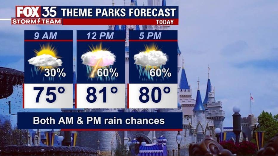
The theme parks could see isolated afternoon showers and storms Friday afternoon. Best time would be the morning if you are hoping to avoid any rain. Highs will top out near 87.
OUTLOOK:
The cool front moves south of us into this weekend which will lead to drier air and a quiet forecast. Humidity will be a step lower, but nothing dramatic with highs still in the mid 80s for most. Early next week another front moves in and that could bring a more significant change to the forecast by midweek.
TROPICS:
Tropical Storm Karl remains pinned in the Southwestern Gulf, very close to Mexico. Karl will stay a tropical storm before a landfall in Mexico late Friday night. Karl stays away from the U.S. Another disturbance is given a low chance of development in the next 5 days off the west coast of Africa, but no signs that would be any threat to us. The FOX 35 Storm Team continues to monitor the tropics for you, remember to depend on us!
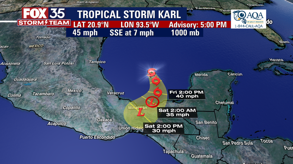
KARL stays away from the U.S. The FOX 35 STORM TEAM is tracking!