

Orlando weather: Hot and humid temperatures with partly-cloudy conditions overnight

Orlando PM Weather Forecast: May 18, 2025
The heat and humidity are the big story as our weekend winds to a close. Meteorologist T.J. Springer lets us know if we'll break any record high temps this weekend and when our next cold front moves in.
ORLANDO, Fla. - The heat and humidity that have raged throughout the day in Central Florida will continue through the night with party-cloudy conditions.
What will the weather look like tonight?
What To Expect:
If you have any outdoor plans this evening, the heat and humidity will be the only things you have to contend with.
We'll see a mix of clouds and sun throughout the rest of the day with partly-cloudy conditions overnight.
Temperatures remain above-normal, and we'll keep the mugginess around.
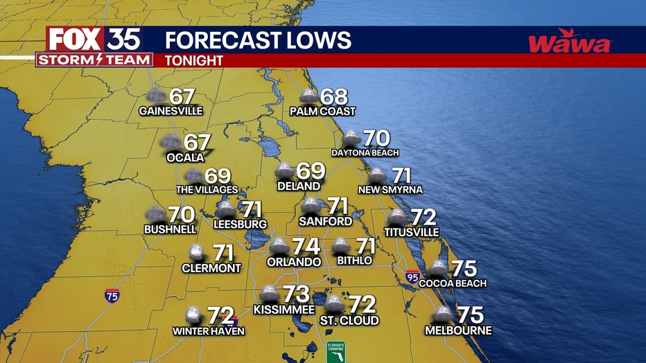
Lows look to only slide back into the lower and middle 70s. Some of our northern neighborhoods look a touch cooler, falling back into the upper 60s.
What will the weather look like tomorrow?
What's next:
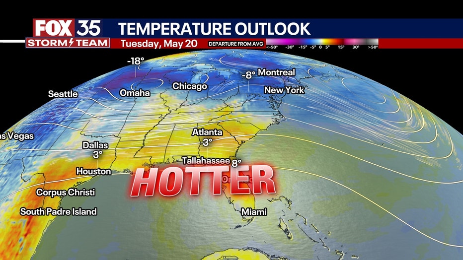
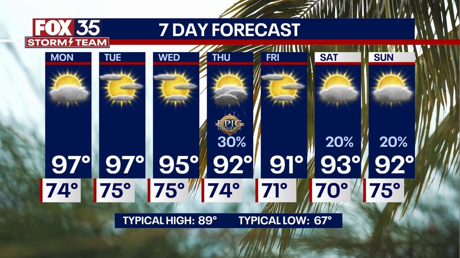
High pressure continues to hold as we progress into the start of the workweek.
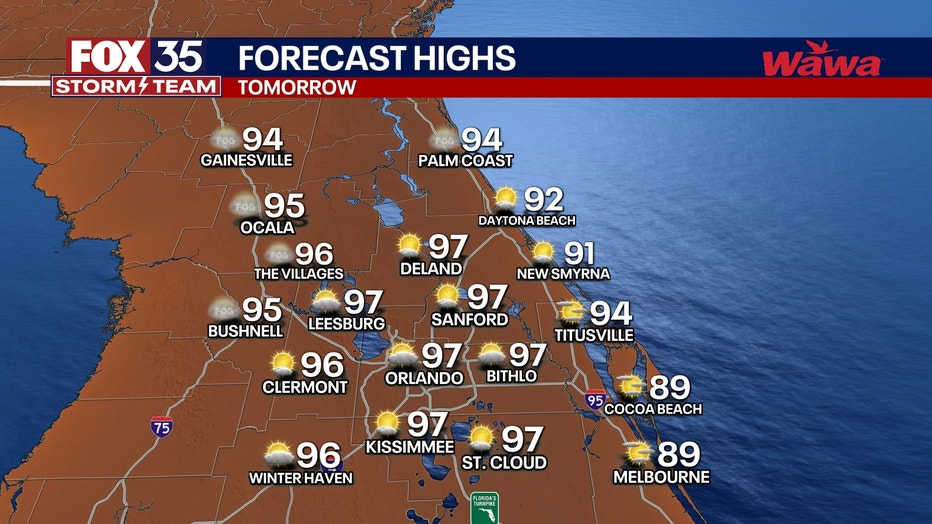
More heat and more humidity take center stage with temperatures surging back into the middle and upper 90s.
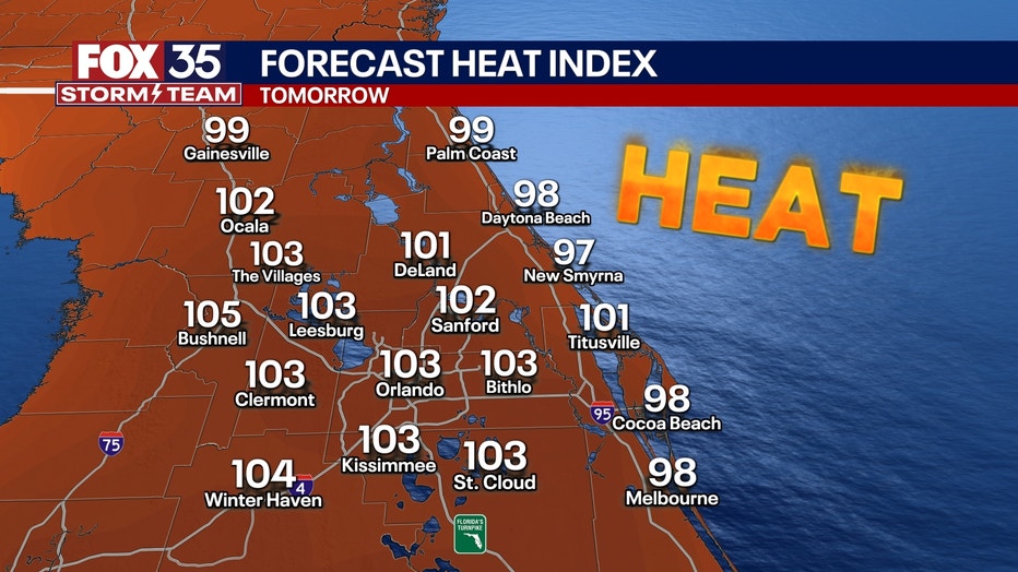
Dew points that will hold up close to 70° make for heat index values in the lower triple digits during the afternoon.
Be sure to stay hydrated and not over exert yourself in the heat of the day.
What will the weather look like the rest of the week?
Dig deeper:
After some drought relief from all the rain last week, the dry conditions prevail as we progress through the upcoming workweek. This will worsen the drought once again.
This, combined with a summer sizzle, will make it feel unbearable at times outdoors.
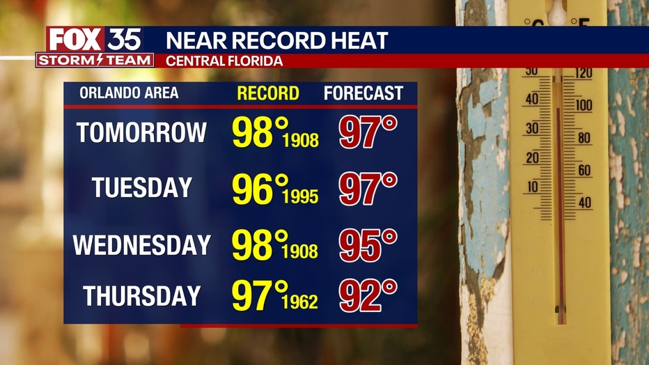
Temperatures stay well above average, climbing back into the upper 90s through Wednesday of next week. The heat is combined with plenty of sunshine, so be sure you remember your sunscreen and hat!
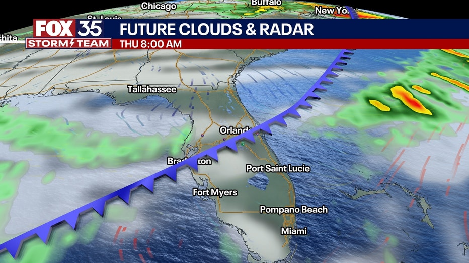
The ridge of high pressure holds strong through midweek, but we then start to see some changes developing by Thursday. This ridge looks to break down as a cold front moves our way. We could see a few showers and thunderstorms as it swings through Central Florida.
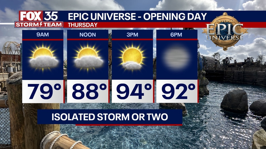
With the heat, comes lots of instability in the atmosphere. With that, some stronger to potentially severe storms could be on the table. This will be something we'll be watching! The dynamics in the atmosphere aren't looking quite as impressive as they did earlier, which could limit the severe weather potential overall.
Behind this system, dew points and temperatures relax, bringing at least a little relief from the sweltering conditions. It won't be a big dip though, with temps hugging the 90° mark, but it'll be closer to seasonable levels.
Onshore flow develops as we progress into next weekend, and with that, the chance of a few sea-breeze-driven showers and storms rises.
FOX 35 Storm Tracker Radar and Live Weather Cameras
Track live when storms move across your area using the FOX 35 Storm Tracker Radar below. You can also watch as heavy rain moves across Central Florida on our Live Weather Cameras' page here.

More radar maps from FOX 35 Storm Tracker Radar
- Brevard County
- Flagler County
- Lake County
- Marion County
- Osceola County
- Orange County
- Polk County
- Seminole County
- Sumter County
- Volusia County
- U.S./National Radar
STAY CONNECTED WITH FOX 35 ORLANDO:
- Download the FOX 35 News app for breaking news alerts, the latest news headlines
- Download the FOX 35 Storm Team Weather app for weather alerts & radar
- Sign up for FOX 35's daily newsletter for the latest morning headlines
- FOX Local: Stream FOX 35 newscasts, FOX 35 News+, Central Florida Eats on your smart TV
The Source: This story was written based on information shared by the FOX 35 Storm Team on May 18, 2025.