

Orlando weather: Saharan Dust lowers rain chances as weekend heat builds

Orlando Weather Forecast PM: June 4th, 2025
FOX 35 Storm Team Meteorologist Noah Bergren is tracking a recap of Wednesday's storms and more rain for Thursday afternoon and evening.
ORLANDO, Fla. - A surge of Saharan Dust is set to sweep across Florida on Thursday, bringing hazy skies, lowering rain chances, and setting the stage for a hotter, more humid weekend across Central Florida.
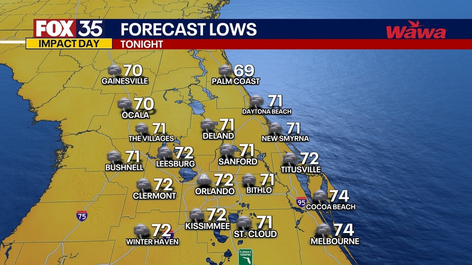
What will the weather look like tonight?
What to expect:
Clouds will linger across Central Florida Wednesday evening, with scattered showers and isolated downpours possible. Temperatures will fall into the low 70s under very humid conditions, though rainfall is not expected to persist all night.
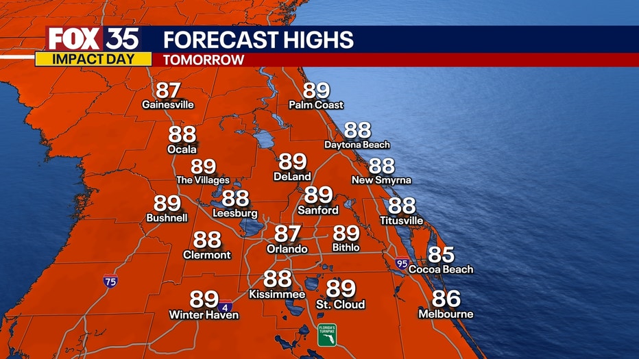
What will the weather look like tomorrow?
What to expect:
A large plume of Saharan Dust is forecast to move over Florida, bringing a hazy appearance to the sky and slightly lowering rain chances. Filtered sunshine is likely throughout the day.
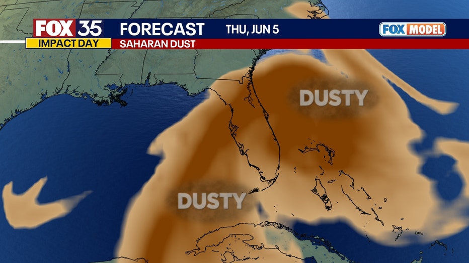
Thunderstorms that do form Thursday afternoon and evening may produce strong wind gusts due to the presence of dust aloft enhancing wind potential.
What will the weather look like this weekend?
Looking ahead:
From Friday through Sunday, rain chances will drop significantly—from midweek levels of 60–80% down to about 30–40%. At the same time, daytime highs will climb back into the 90s.
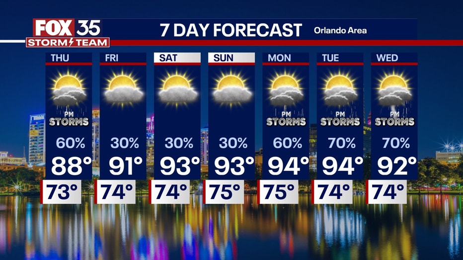
By next week, heat and humidity will intensify, with afternoon heat index values nearing or exceeding 100 degrees before storms develop. A more typical early summer pattern returns starting Monday, featuring daily pop-up thunderstorms during the afternoon and evening hours.
FOX 35 Storm Tracker Radar
Track live when storms move across your area using the FOX 35 Storm Tracker Radar below.

More radar maps from FOX 35 Storm Tracker Radar
- Brevard County
- Flagler County
- Lake County
- Marion County
- Osceola County
- Orange County
- Polk County
- Seminole County
- Sumter County
- Volusia County
- U.S./National Radar
STAY CONNECTED WITH FOX 35 ORLANDO:
- Download the FOX Local app for breaking news alerts, the latest news headlines
- Download the FOX 35 Storm Team Weather app for weather alerts & radar
- Sign up for FOX 35's daily newsletter for the latest morning headlines
- FOX Local: Stream FOX 35 newscasts, FOX 35 News+, Central Florida Eats on your smart TV
The Source: This story was written based on information shared by the FOX 35 Storm Team on June 4, 2025.