

Orlando weather: Drier start to the week, heat returns as Chantal exits

Orlando PM Weather Forecast: July 6, 2025
Meteorologist Laurel Blanchard gets you set up and ready to go for the start of the workweek after the holiday weekend.
What will the weather look like today?
What to Expect:
ORLANDO, Fla. - Hit-and-miss showers and storms for the rest of the evening with mostly cloudy skies. Storms through the rest of the evening will not be as widespread as what we've seen in the past few days.
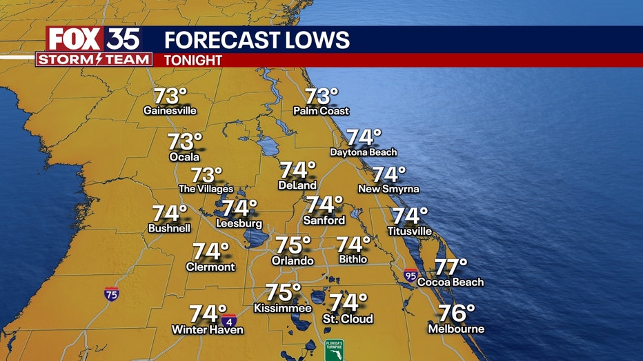
Partly to mostly cloudy skies linger through the overnight. Temperatures will linger in the low to mid 70s.
What will the weather look like this coming week?
What to Expect:
Drier air will start to sink into Florida as NW flow takes over because of Chantal. This will lower our rain chances for the start of the work week. More sunshine is finally back in the forecast after 7 days with more rain than sun.
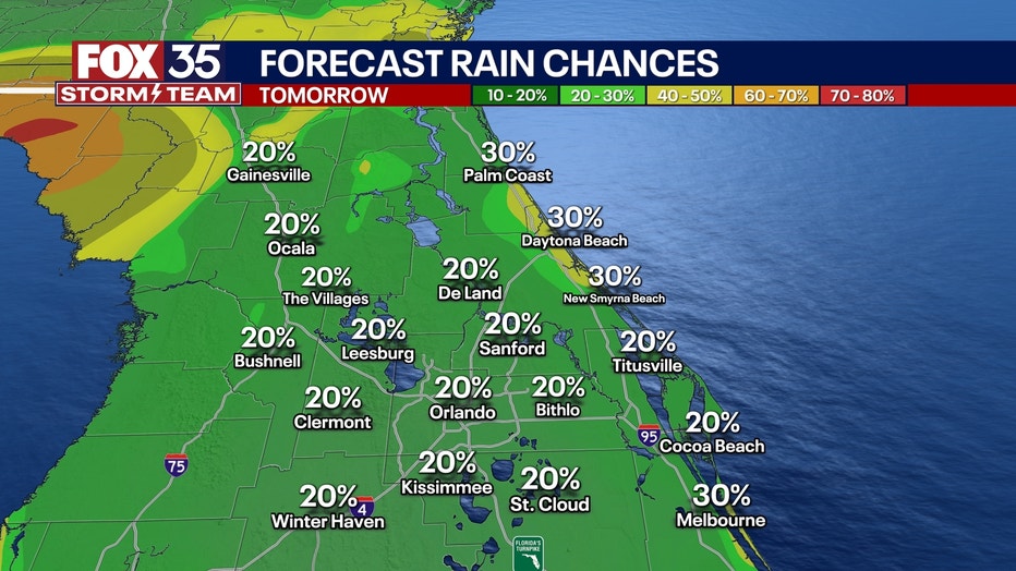
We will still see pop-up storms in the afternoon as the seabreeze storms start to kick back in. If you are outside and hear thunder, get inside immediately. Highs will be in the low 90s degrees with heat indices in the mid 90s. Lows will sit in the low to mid 70s.
Highs start to rebound back into the low 90s as we dry out. High pressure continues to build in jump starts the typical seabreeze pattern again for the workweek. Rain chances pick back up to 60% into next weekend as onshore flow pushes moisture back into Central Florida. Lows linger in the low and mid 70s.
Tracking the tropics
What to Expect:
Chantal officially made landfall this morning around 4 AM in Litchfield Beach, SC. The weakening system is bringing flooding rain, gusty wind, and severe weather to Central NC.
It also could look to bring blustery conditions along with heavy rain up toward the Mid-Atlantic Beaches heading into early next week.
Models suggest that if the weak system pushes back offshore, it could possibly reemerge in the Atlantic and reorganize next week into a depression once again, which is something we'll continue to monitor.
Other than that, no activity is expected for the next 7 days.
FOX 35 Storm Tracker Radar and Live Weather Cameras
Track live when storms move across your area using the FOX 35 Storm Tracker Radar below. You can also watch as heavy rain moves across Central Florida on our Live Weather Cameras' page here.

More radar maps from FOX 35 Storm Tracker Radar
- Brevard County
- Flagler County
- Lake County
- Marion County
- Osceola County
- Orange County
- Polk County
- Seminole County
- Sumter County
- Volusia County
- U.S./National Radar
STAY CONNECTED WITH FOX 35 ORLANDO:
- Download the FOX 35 News app for breaking news alerts, the latest news headlines
- Download the FOX 35 Storm Team Weather app for weather alerts & radar
- Sign up for FOX 35's daily newsletter for the latest morning headlines
- FOX Local: Stream FOX 35 newscasts, FOX 35 News+, Central Florida Eats on your smart TV
The Source: This story was written based on information shared by the FOX 35 Storm Team, FOX Weather and the National Hurricane Center (NHC) on July 7, 2025.