

Orlando weather forecast: Showers return to Central Florida mid-week
Weather Forecast: Oct. 11, 2022
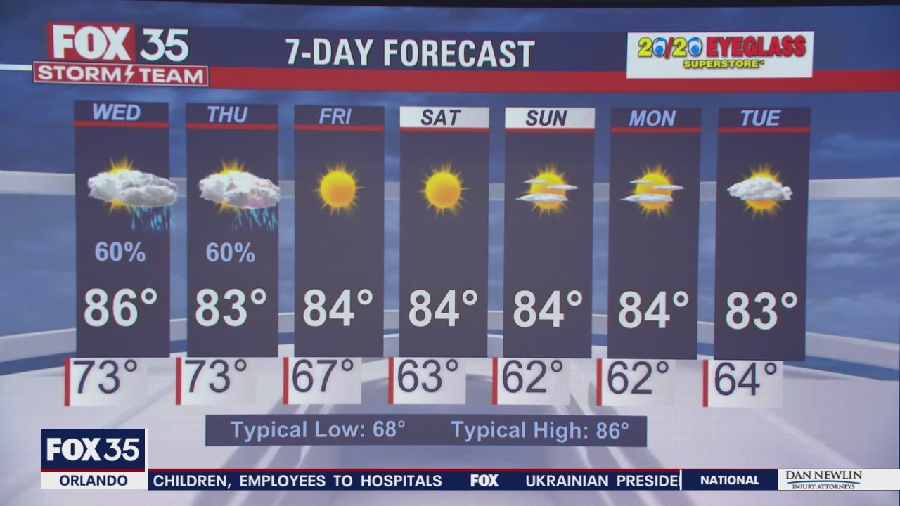
Orlando and Central Florida will see chances for rain increasing over the next days before we arrive a dry and beautiful weekend.
ORLANDO, Fla. - Tonight's low: 73 degrees | Tomorrow's high: 86 degrees | Rain: 60%
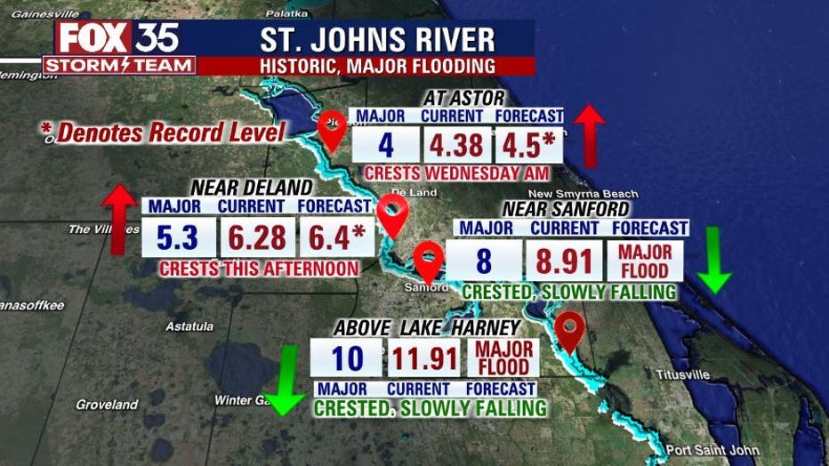
Main weather concerns: Partly cloudy skies are expected today with highs in the mid to upper-80s across the interior and low-80s along the coast. Tropical moisture continues to move into our southern viewing area which could lead to an isolated shower/storm today. Flood issues continue in the middle of the St. Johns River this week above Lake Harney, near DeLand and at Astor. Though a few spots should crest soon and begin the slow decline.
BEACHES:
If you are heading to the beach today, don't forget your hat and sunglasses. There will be partly cloudy skies and a high UV Index. Brevard County could see showers from the mid-morning to early evening hours. Highs will reach the low 80s with overnight lows in the mid-60s. Rip current risk remains moderate. Surf temps are in the upper 70s.
THEME PARKS:
It will be a nice day at the theme parks. Highs in the upper-80s. We start the day with mostly clear skies, but there could be a few showers and an increase in clouds by this afternoon. Don't forget to pack sunscreen and plenty of water.
OUTLOOK:
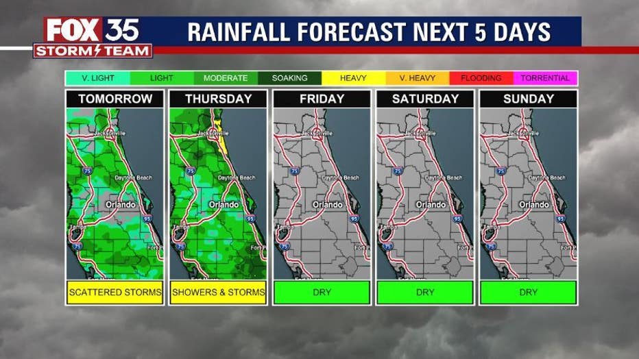
Showers will return midweek with a few storms ahead of a cold front. Once the front pushes south, our skies will dry out, and fall weather returns in time for the weekend.
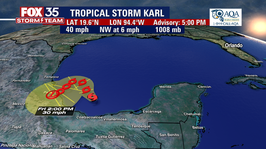
TROPICS:
An area of disorganized showers and thunderstorms over the Bay of Campeche is likely to move into the southwestern Gulf of Mexico later this morning. This could become a tropical depression within the next day or so.
The FOX 35 Storm Team will continue to monitor conditions and keep you updated. Depend on us this hurricane season.