Orlando weather: Freeze warnings, wind chill advisories issued ahead of temperature drop

Orlando Weather Forecast: Jan. 16, 2024
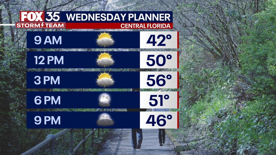
Bundle up on Wednesday morning because temperatures will continue to plunge into the overnight hours.
ORLANDO, Fla. - This evening, a strong cold front will move through Central Florida. Behind it, temperatures will fall quickly thanks to a brisk wind funneling cold air from the north. Because of this, we have declared Wednesday a FOX 35 Weather Impact Day.
Lows are expected to fall well into the 30s north of Interstate 4 and low to mid-40s to the south. Winds will make it feel like it is in the 20s and 30s north of I-4.
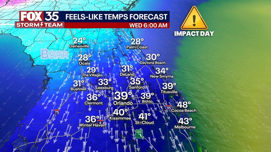
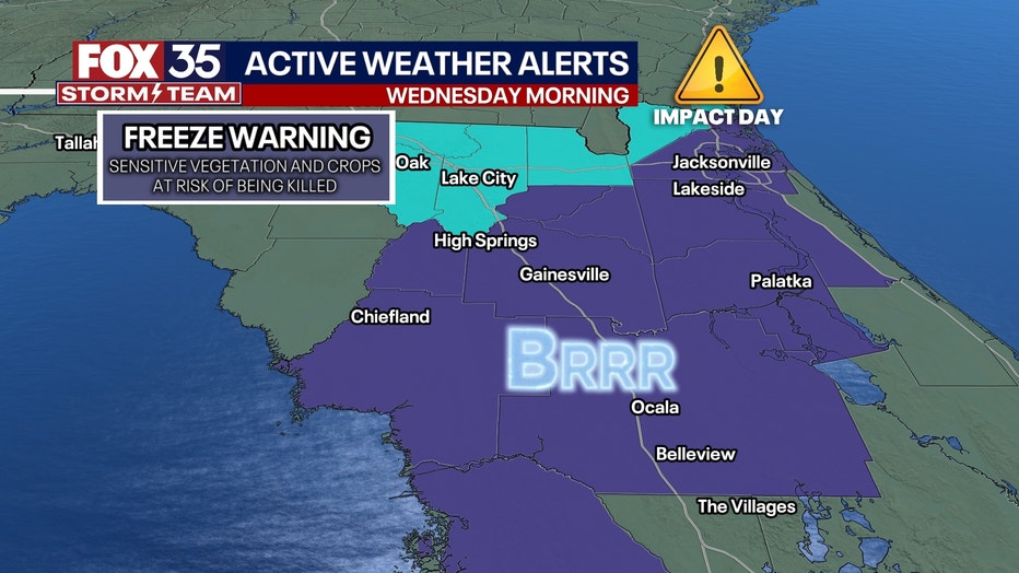
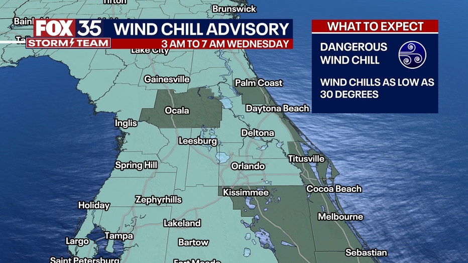
As a result, Wind Chill Advisories will be in effect from 3 a.m. to 7 a.m. on Wednesday morning, including most of the Orlando metropolitan area. Sub-freezing temps are also expected from Marion County northward, where Freeze Warnings are in effect overnight. It's a good policy to bring in any sensitive plants and outdoor pets and be very careful if you choose to warm yourself with a space heater.
RELATED: How to prevent pipes from freezing in cold weather
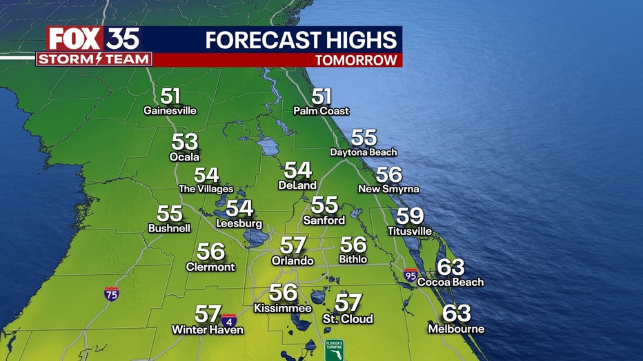
WEDNESDAY: We won't warm up too much tomorrow, thanks to the cold air in place and the north wind. Highs will only manage to get into the 50s in most areas aside from areas near the Space Coast. No rain is expected.
Behind the front, colder air will funnel in. Freeze warnings are in effect for the northern counties late tonight through Wednesday morning. Lows here will fall to 32 degrees or colder for at least two hours.
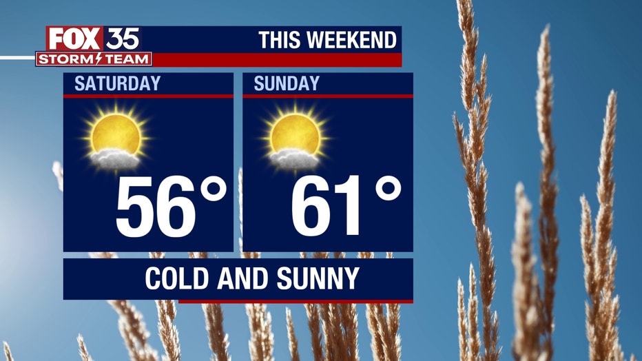
OUTLOOK: After a brief cool down, roller coaster weather returns with highs back in the 70s Thursday and Friday ahead of another strong front. Rain chances could return from Thursday night into Friday, but nothing super impactful is expected. Behind that front, another shot of cold air arrives this weekend, bringing highs back into the 50s and 60s with lows in the 30s and 40s again on both mornings. We should remain dry throughout the weekend, but you'll need a jacket for anything outdoors.