

National Hurricane Center tracking rare wintertime disturbance over North Atlantic Ocean

National Hurricane Center tracking rare wintertime disturbance
The National Hurricane Center (NHC) is tracking a rare wintertime disturbance brewing in the North Atlantic Ocean.
LAKE MARY, Fla. - The National Hurricane Center (NHC) is tracking a rare wintertime disturbance brewing in the North Atlantic Ocean.
Forecast models show Invest 90L is not expected to become an organized system, but it was producing storm-force winds of nearly 60 mph on Monday afternoon. The term "invest" is a naming convention used by the NHC to identify areas meteorologists are investigating for possible tropical development. Could this be the first tropical system of the 2023 hurricane season?
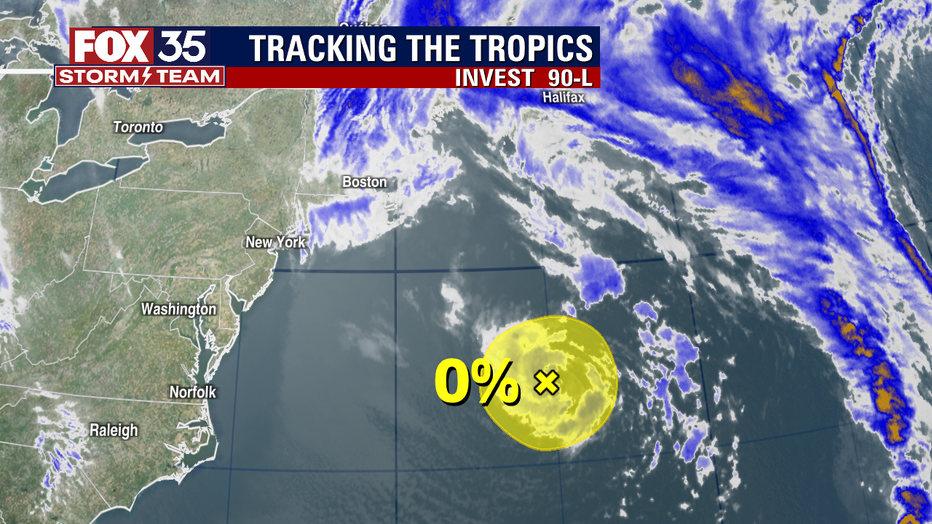
Invest 90L, January 16, 2023.
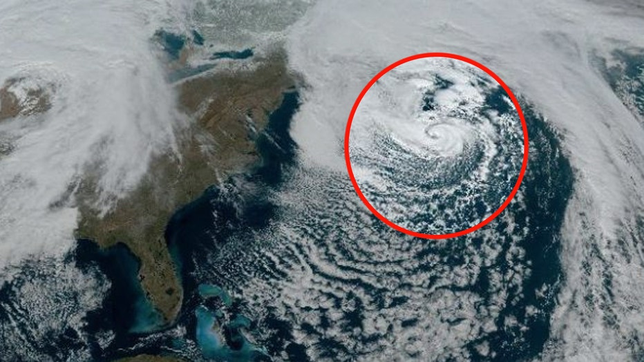
"From satellite imagery, this thing looks like a hurricane. It's got an eyewall feature to it, it's got thunderstorms in the center, and it's got a concentric, buzzsaw-like shape. To the untrained eye, this looks like a tropical system, and it's way out of season," said FOX 35 Meteorologist Brooks Garner.
Out-of-season tropical, or more often the case, subtropical storms are not unheard of, but they are uncommon.
"A tropical system forming this far north and during the middle of the winter would be very difficult if not impossible, due to the high wind shear environment and extremely cold air in the vicinity of the circulation," Garner explained. "Mid-latitude, non-tropical low-pressure systems often form and can produce storm-force winds, but they develop in a baroclinic environment, where it feeds off of the clash cold and warm air."
While it is unlikely that the low will transition to a subtropical or tropical cyclone, it can still have an impact on shipping lanes and shipping interests, Garner added.
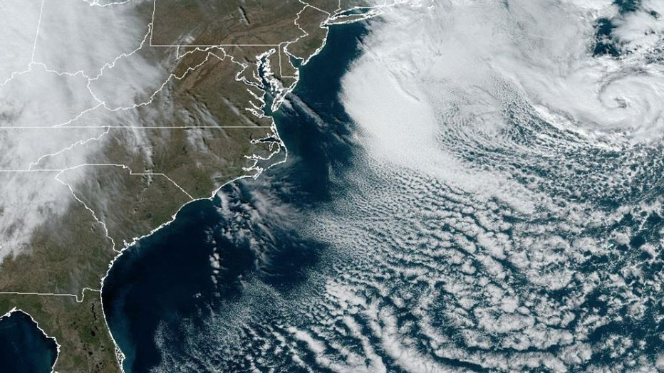
The low is expected to move northeastward on Monday and northward in the overnight hours, bringing the system over much colder waters and across Atlantic Canada by early Tuesday.
"True tropical system requires a homogenous, barotropic environment feeding off of only warm water with no cold air. The only reason this system in the North Atlantic is catching any heat energy is due to its proximity over the Gulf Stream, of which the cyclone will depart over the next few hours."
While the Atlantic hurricane season runs from May to November, tropical systems have historically developed every month of the year.
January hurricanes are exceedingly rare, with only three on record. The last hurricane to develop during the first month of the year was Hurricane Alex in 2016. Hurricane Alice in 1954 originally developed at the end of December of the previous year but was still spinning into early January. The first January hurricane on record happened during the first six days of 1938. That storm was not named.
As we have reported before, a few different varieties of low-pressure systems can cause trouble in the tropics, from traditional tropical storms to subtropical storms, to even extratropical storms, but what are the differences?
What is a tropical storm?
For a low-pressure system to become tropical, it has to develop a warm core. That means its main source of energy comes from the latent heat of condensation. Warm, moist air over the warm ocean rises, water vapor condenses into droplets, and heat is released. As the newly warmed air continues to rise (think hot air balloon) it pulls in more humid air up from the surface of the water.
This is why meteorologists look at sea surface temperatures. Generally, the sea needs to be near 80 degrees or above and that warm water needs to be about 150 feet deep. Once the storm system becomes better organized and has maximum sustained winds of between 39 and 73 mph, it is designated a tropical storm. It is then given a name. The wind field of tropical storms is usually more compact than an extratropical cyclone.
What is a subtropical storm?
As a tropical storm moves into cooler water, it will begin to transition to a cold-core system. It's during this transition that a tropical storm can become subtropical. A subtropical storm has characteristics of both tropical and extratropical cyclones. Most of its energy is derived from the clash of warm and cold air, but the cyclone does not have fronts and is cold-core in the upper levels of the atmosphere.
Like tropical systems, a subtropical storm has a well-defined center and a closed circulation. However, the area of maximum winds within the circulation is farther away from the center and there is less symmetry, according to the NWS.
What is an extratropical cyclone?
An extratropical cyclone is the type of low-pressure system that most of us are used to seeing on the weather map with fronts attached to them. This type of storm is a cold-core low, meaning its primary energy source is the contrast of cold and warm air. This happens because warm air is less dense than cold air. As cold air, behind the front, pushes into the warm air, the warm air is forced up and out of the way. This lift often creates clouds and precipitation.
FOX Weather created a quick buzzword sheet with definitions of meteorological terms you may hear during hurricane season. You can find it here.
FOX Weather contributed to this story.